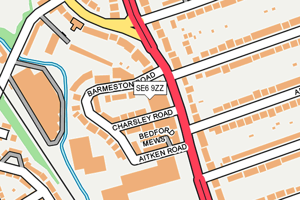
SE6 9ZZ is located in the Catford South electoral ward, within the London borough of Lewisham and the English Parliamentary constituency of Lewisham East. The Sub Integrated Care Board (ICB) Location is NHS South East London ICB - 72Q and the police force is Metropolitan Police. This postcode has been in use since March 2016.


GetTheData
Source: OS OpenMap – Local (Ordnance Survey)
Source: OS VectorMap District (Ordnance Survey)
Licence: Open Government Licence (requires attribution)
| Easting | 537721 |
| Northing | 172900 |
| Latitude | 51.438362 |
| Longitude | -0.019944 |
GetTheData
Source: Open Postcode Geo
Licence: Open Government Licence
| Country | England |
| Postcode District | SE6 |
| ➜ SE6 open data dashboard ➜ See where SE6 is on a map | |
GetTheData
Source: Land Registry Price Paid Data
Licence: Open Government Licence
Elevation or altitude of SE6 9ZZ as distance above sea level:
| Metres | Feet | |
|---|---|---|
| Elevation | 20m | 66ft |
Elevation is measured from the approximate centre of the postcode, to the nearest point on an OS contour line from OS Terrain 50, which has contour spacing of ten vertical metres.
➜ How high above sea level am I? Find the elevation of your current position using your device's GPS.
GetTheData
Source: Open Postcode Elevation
Licence: Open Government Licence
| Ward | Catford South |
| Constituency | Lewisham East |
GetTheData
Source: ONS Postcode Database
Licence: Open Government Licence
| June 2022 | Other theft | On or near Barmeston Road | 50m |
| June 2022 | Criminal damage and arson | On or near Barmeston Road | 50m |
| June 2022 | Criminal damage and arson | On or near Barmeston Road | 50m |
| ➜ Get more crime data in our Crime section | |||
GetTheData
Source: data.police.uk
Licence: Open Government Licence
| Inchmery Road (Bromley Road) | Bellingham | 49m |
| Inchmery Road | Bellingham | 102m |
| Newquay Road (Bromley Road) | Bellingham | 172m |
| Newquay Road (Bromley Road) | Bellingham | 226m |
| Bargery Road | Catford | 248m |
| Bellingham Station | 0.6km |
| Catford Bridge Station | 0.8km |
| Catford Station | 0.8km |
GetTheData
Source: NaPTAN
Licence: Open Government Licence
GetTheData
Source: ONS Postcode Database
Licence: Open Government Licence


➜ Get more ratings from the Food Standards Agency
GetTheData
Source: Food Standards Agency
Licence: FSA terms & conditions
| Last Collection | |||
|---|---|---|---|
| Location | Mon-Fri | Sat | Distance |
| Post Office | 17:30 | 12:00 | 49m |
| Bromley Road | 17:30 | 12:00 | 162m |
| 56 Fordmill Road | 17:30 | 12:00 | 363m |
GetTheData
Source: Dracos
Licence: Creative Commons Attribution-ShareAlike
| Facility | Distance |
|---|---|
| The Gym Group (London Catford) Bromley Road Retail Park, Bromley Road , London Health and Fitness Gym | 267m |
| St Dunstans Jubilee Ground Catford Road, London Health and Fitness Gym, Grass Pitches, Squash Courts, Studio, Artificial Grass Pitch | 657m |
| Bellingham Leisure & Lifestyle Centre Randlesdown Road, London Health and Fitness Gym, Grass Pitches, Studio, Artificial Grass Pitch | 679m |
GetTheData
Source: Active Places
Licence: Open Government Licence
| School | Phase of Education | Distance |
|---|---|---|
| Rushey Green Primary School Culverley Road, Catford, London, SE6 2LA | Primary | 509m |
| Holy Cross Catholic Primary School Culverley Road, Catford, London, SE6 2LD | Primary | 545m |
| Athelney Primary School Athelney Street, London, SE6 3LD | Primary | 553m |
GetTheData
Source: Edubase
Licence: Open Government Licence
| Risk of SE6 9ZZ flooding from rivers and sea | Low |
| ➜ SE6 9ZZ flood map | |
GetTheData
Source: Open Flood Risk by Postcode
Licence: Open Government Licence
The below table lists the International Territorial Level (ITL) codes (formerly Nomenclature of Territorial Units for Statistics (NUTS) codes) and Local Administrative Units (LAU) codes for SE6 9ZZ:
| ITL 1 Code | Name |
|---|---|
| TLI | London |
| ITL 2 Code | Name |
| TLI4 | Inner London - East |
| ITL 3 Code | Name |
| TLI44 | Lewisham and Southwark |
| LAU 1 Code | Name |
| E09000023 | Lewisham |
GetTheData
Source: ONS Postcode Directory
Licence: Open Government Licence
The below table lists the Census Output Area (OA), Lower Layer Super Output Area (LSOA), and Middle Layer Super Output Area (MSOA) for SE6 9ZZ:
| Code | Name | |
|---|---|---|
| OA | E00016265 | |
| LSOA | E01003221 | Lewisham 025C |
| MSOA | E02000677 | Lewisham 025 |
GetTheData
Source: ONS Postcode Directory
Licence: Open Government Licence
| SE6 2UN | Bromley Road | 56m |
| SE6 3BE | Charsley Road | 68m |
| SE6 3DX | Bedford Mews | 72m |
| SE6 3BJ | Barmeston Road | 74m |
| SE6 2UR | Bromley Road | 80m |
| SE6 2UF | Bromley Road | 87m |
| SE6 3BG | Aitken Road | 94m |
| SE6 2NF | Inchmery Road | 114m |
| SE6 3BH | Barmeston Road | 134m |
| SE6 2NJ | Sambruck Mews | 137m |
GetTheData
Source: Open Postcode Geo; Land Registry Price Paid Data
Licence: Open Government Licence