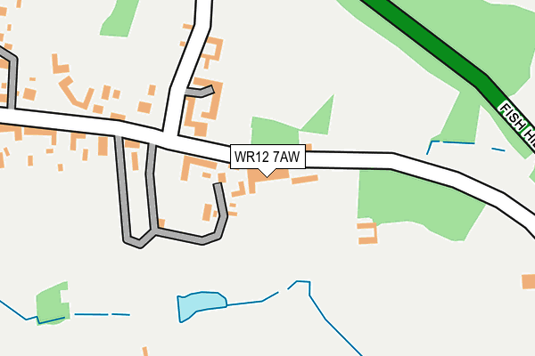
WR12 7AW is located in the Broadway, Sedgeberrow & Childswickham electoral ward, within the local authority district of Wychavon and the English Parliamentary constituency of Mid Worcestershire. The Sub Integrated Care Board (ICB) Location is NHS Herefordshire and Worcestershire ICB - 18C and the police force is West Mercia. This postcode has been in use since January 1980.


GetTheData
Source: OS OpenMap – Local (Ordnance Survey)
Source: OS VectorMap District (Ordnance Survey)
Licence: Open Government Licence (requires attribution)
| Easting | 410595 |
| Northing | 237519 |
| Latitude | 52.035976 |
| Longitude | -1.846960 |
GetTheData
Source: Open Postcode Geo
Licence: Open Government Licence
| Country | England |
| Postcode District | WR12 |
| ➜ WR12 open data dashboard ➜ See where WR12 is on a map ➜ Where is Broadway? | |
GetTheData
Source: Land Registry Price Paid Data
Licence: Open Government Licence
Elevation or altitude of WR12 7AW as distance above sea level:
| Metres | Feet | |
|---|---|---|
| Elevation | 120m | 394ft |
Elevation is measured from the approximate centre of the postcode, to the nearest point on an OS contour line from OS Terrain 50, which has contour spacing of ten vertical metres.
➜ How high above sea level am I? Find the elevation of your current position using your device's GPS.
GetTheData
Source: Open Postcode Elevation
Licence: Open Government Licence
| Ward | Broadway, Sedgeberrow & Childswickham |
| Constituency | Mid Worcestershire |
GetTheData
Source: ONS Postcode Database
Licence: Open Government Licence
| June 2022 | Anti-social behaviour | On or near High Street | 437m |
| April 2022 | Burglary | On or near High Street | 437m |
| April 2022 | Anti-social behaviour | On or near High Street | 437m |
| ➜ Get more crime data in our Crime section | |||
GetTheData
Source: data.police.uk
Licence: Open Government Licence
| St Mary's Rc Primary (High Street) | Broadway | 616m |
| Colletts Fields (Leamington Road) | Broadway | 640m |
| Colletts Fields (Leamington Road) | Broadway | 656m |
| Clock (High Street) | Broadway | 718m |
| Wells Gardens (Leamington Road) | Broadway | 723m |
GetTheData
Source: NaPTAN
Licence: Open Government Licence
GetTheData
Source: ONS Postcode Database
Licence: Open Government Licence


➜ Get more ratings from the Food Standards Agency
GetTheData
Source: Food Standards Agency
Licence: FSA terms & conditions
| Last Collection | |||
|---|---|---|---|
| Location | Mon-Fri | Sat | Distance |
| Upper High Street | 17:15 | 09:00 | 141m |
| High Street | 17:15 | 11:15 | 542m |
| Bibsworth Avenue | 17:15 | 11:00 | 618m |
GetTheData
Source: Dracos
Licence: Creative Commons Attribution-ShareAlike
| Facility | Distance |
|---|---|
| Broadway Activity Park High Street, Broadway Grass Pitches | 686m |
| St Marys Catholic Primary School Leamington Road, Broadway Grass Pitches | 723m |
| Broadway First School Lime Tree Avenue, Broadway Grass Pitches | 759m |
GetTheData
Source: Active Places
Licence: Open Government Licence
| School | Phase of Education | Distance |
|---|---|---|
| St Mary's Catholic Primary School Leamington Road, Broadway, WR12 7DZ | Primary | 696m |
| Broadway First School Lime Tree Avenue, Broadway, WR12 7BD | Primary | 772m |
| Cotswold Spa Hospital School Station Road, Broadway, WR12 7DE | Not applicable | 1.6km |
GetTheData
Source: Edubase
Licence: Open Government Licence
The below table lists the International Territorial Level (ITL) codes (formerly Nomenclature of Territorial Units for Statistics (NUTS) codes) and Local Administrative Units (LAU) codes for WR12 7AW:
| ITL 1 Code | Name |
|---|---|
| TLG | West Midlands (England) |
| ITL 2 Code | Name |
| TLG1 | Herefordshire, Worcestershire and Warwickshire |
| ITL 3 Code | Name |
| TLG12 | Worcestershire CC |
| LAU 1 Code | Name |
| E07000238 | Wychavon |
GetTheData
Source: ONS Postcode Directory
Licence: Open Government Licence
The below table lists the Census Output Area (OA), Lower Layer Super Output Area (LSOA), and Middle Layer Super Output Area (MSOA) for WR12 7AW:
| Code | Name | |
|---|---|---|
| OA | E00164999 | |
| LSOA | E01032353 | Wychavon 018C |
| MSOA | E02006765 | Wychavon 018 |
GetTheData
Source: ONS Postcode Directory
Licence: Open Government Licence
| WR12 7LW | Bibsworth Lane | 133m |
| WR12 7LN | Bibsworth Lane | 238m |
| WR12 7AG | High Street | 334m |
| WR12 7AL | High Street | 353m |
| WR12 7BL | Kingsdale Court | 391m |
| WR12 7AU | Salubrious | 400m |
| WR12 7LL | Fish Hill | 416m |
| WR12 7AJ | High Street | 430m |
| WR12 7AY | Bredon View | 449m |
| WR12 7AX | Colletts Gardens | 478m |
GetTheData
Source: Open Postcode Geo; Land Registry Price Paid Data
Licence: Open Government Licence