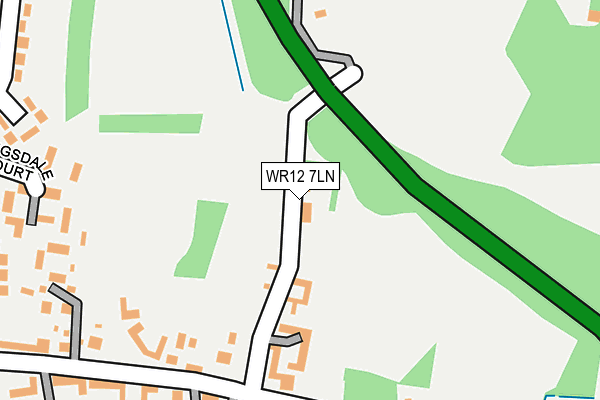
WR12 7LN lies on Bibsworth Lane in Broadway. WR12 7LN is located in the Broadway, Sedgeberrow & Childswickham electoral ward, within the local authority district of Wychavon and the English Parliamentary constituency of Mid Worcestershire. The Sub Integrated Care Board (ICB) Location is NHS Herefordshire and Worcestershire ICB - 18C and the police force is West Mercia. This postcode has been in use since January 1980.


GetTheData
Source: OS OpenMap – Local (Ordnance Survey)
Source: OS VectorMap District (Ordnance Survey)
Licence: Open Government Licence (requires attribution)
| Easting | 410536 |
| Northing | 237750 |
| Latitude | 52.038065 |
| Longitude | -1.847803 |
GetTheData
Source: Open Postcode Geo
Licence: Open Government Licence
| Street | Bibsworth Lane |
| Town/City | Broadway |
| Country | England |
| Postcode District | WR12 |
➜ See where WR12 is on a map ➜ Where is Broadway? | |
GetTheData
Source: Land Registry Price Paid Data
Licence: Open Government Licence
Elevation or altitude of WR12 7LN as distance above sea level:
| Metres | Feet | |
|---|---|---|
| Elevation | 110m | 361ft |
Elevation is measured from the approximate centre of the postcode, to the nearest point on an OS contour line from OS Terrain 50, which has contour spacing of ten vertical metres.
➜ How high above sea level am I? Find the elevation of your current position using your device's GPS.
GetTheData
Source: Open Postcode Elevation
Licence: Open Government Licence
| Ward | Broadway, Sedgeberrow & Childswickham |
| Constituency | Mid Worcestershire |
GetTheData
Source: ONS Postcode Database
Licence: Open Government Licence
4, BIBSWORTH LANE, BROADWAY, WR12 7LN 2007 5 JAN £320,000 |
GetTheData
Source: HM Land Registry Price Paid Data
Licence: Contains HM Land Registry data © Crown copyright and database right 2025. This data is licensed under the Open Government Licence v3.0.
| Wells Gardens (Leamington Road) | Broadway | 570m |
| Colletts Fields (Leamington Road) | Broadway | 572m |
| Broadway First School (Limetree Avenue) | Broadway | 586m |
| Wells Gardens (Leamington Road) | Broadway | 588m |
| Colletts Fields (Leamington Road) | Broadway | 588m |
GetTheData
Source: NaPTAN
Licence: Open Government Licence
| Percentage of properties with Next Generation Access | 100.0% |
| Percentage of properties with Superfast Broadband | 100.0% |
| Percentage of properties with Ultrafast Broadband | 0.0% |
| Percentage of properties with Full Fibre Broadband | 0.0% |
Superfast Broadband is between 30Mbps and 300Mbps
Ultrafast Broadband is > 300Mbps
| Percentage of properties unable to receive 2Mbps | 0.0% |
| Percentage of properties unable to receive 5Mbps | 0.0% |
| Percentage of properties unable to receive 10Mbps | 0.0% |
| Percentage of properties unable to receive 30Mbps | 0.0% |
GetTheData
Source: Ofcom
Licence: Ofcom Terms of Use (requires attribution)
GetTheData
Source: ONS Postcode Database
Licence: Open Government Licence


➜ Get more ratings from the Food Standards Agency
GetTheData
Source: Food Standards Agency
Licence: FSA terms & conditions
| Last Collection | |||
|---|---|---|---|
| Location | Mon-Fri | Sat | Distance |
| Upper High Street | 17:15 | 09:00 | 188m |
| Bibsworth Avenue | 17:15 | 11:00 | 453m |
| High Street | 17:15 | 11:15 | 516m |
GetTheData
Source: Dracos
Licence: Creative Commons Attribution-ShareAlike
The below table lists the International Territorial Level (ITL) codes (formerly Nomenclature of Territorial Units for Statistics (NUTS) codes) and Local Administrative Units (LAU) codes for WR12 7LN:
| ITL 1 Code | Name |
|---|---|
| TLG | West Midlands (England) |
| ITL 2 Code | Name |
| TLG1 | Herefordshire, Worcestershire and Warwickshire |
| ITL 3 Code | Name |
| TLG12 | Worcestershire CC |
| LAU 1 Code | Name |
| E07000238 | Wychavon |
GetTheData
Source: ONS Postcode Directory
Licence: Open Government Licence
The below table lists the Census Output Area (OA), Lower Layer Super Output Area (LSOA), and Middle Layer Super Output Area (MSOA) for WR12 7LN:
| Code | Name | |
|---|---|---|
| OA | E00164999 | |
| LSOA | E01032353 | Wychavon 018C |
| MSOA | E02006765 | Wychavon 018 |
GetTheData
Source: ONS Postcode Directory
Licence: Open Government Licence
| WR12 7LW | Bibsworth Lane | 123m |
| WR12 7BL | Kingsdale Court | 266m |
| WR12 7AY | Bredon View | 279m |
| WR12 7AG | High Street | 294m |
| WR12 7AU | Salubrious | 306m |
| WR12 7BQ | Bibsworth Avenue | 329m |
| WR12 7AL | High Street | 349m |
| WR12 7AX | Colletts Gardens | 357m |
| WR12 7AJ | High Street | 385m |
| WR12 7BH | Bibsworth Avenue | 387m |
GetTheData
Source: Open Postcode Geo; Land Registry Price Paid Data
Licence: Open Government Licence