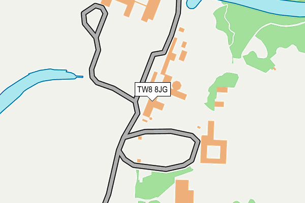
TW8 8JG is located in the Syon & Brentford Lock electoral ward, within the London borough of Hounslow and the English Parliamentary constituency of Brentford and Isleworth. The Sub Integrated Care Board (ICB) Location is NHS North West London ICB - W2U3Z and the police force is Metropolitan Police. This postcode has been in use since January 1980.


GetTheData
Source: OS OpenMap – Local (Ordnance Survey)
Source: OS VectorMap District (Ordnance Survey)
Licence: Open Government Licence (requires attribution)
| Easting | 517307 |
| Northing | 176663 |
| Latitude | 51.476774 |
| Longitude | -0.312230 |
GetTheData
Source: Open Postcode Geo
Licence: Open Government Licence
| Country | England |
| Postcode District | TW8 |
| ➜ TW8 open data dashboard ➜ See where TW8 is on a map ➜ Where is London? | |
GetTheData
Source: Land Registry Price Paid Data
Licence: Open Government Licence
Elevation or altitude of TW8 8JG as distance above sea level:
| Metres | Feet | |
|---|---|---|
| Elevation | 10m | 33ft |
Elevation is measured from the approximate centre of the postcode, to the nearest point on an OS contour line from OS Terrain 50, which has contour spacing of ten vertical metres.
➜ How high above sea level am I? Find the elevation of your current position using your device's GPS.
GetTheData
Source: Open Postcode Elevation
Licence: Open Government Licence
| Ward | Syon & Brentford Lock |
| Constituency | Brentford And Isleworth |
GetTheData
Source: ONS Postcode Database
Licence: Open Government Licence
| June 2022 | Vehicle crime | On or near Pedestrian Subway | 125m |
| June 2022 | Violence and sexual offences | On or near Pedestrian Subway | 125m |
| June 2022 | Vehicle crime | On or near Pedestrian Subway | 125m |
| ➜ Get more crime data in our Crime section | |||
GetTheData
Source: data.police.uk
Licence: Open Government Licence
| Beech Avenue (London Road) | Brentford End | 544m |
| Syon Lane London Road (London Road) | Brentford End | 556m |
| Brent Lea (London Road) | Brentford End | 566m |
| Syon Lane London Road | Brentford End | 597m |
| Brent Lea (London Road) | Brentford End | 627m |
| Richmond Underground Station | Richmond | 1,686m |
| Syon Lane Station | 1km |
| Brentford Station | 1.2km |
| Richmond (London) Station | 1.7km |
GetTheData
Source: NaPTAN
Licence: Open Government Licence
GetTheData
Source: ONS Postcode Database
Licence: Open Government Licence


➜ Get more ratings from the Food Standards Agency
GetTheData
Source: Food Standards Agency
Licence: FSA terms & conditions
| Last Collection | |||
|---|---|---|---|
| Location | Mon-Fri | Sat | Distance |
| 50 London Road | 18:30 | 11:15 | 563m |
| Augustus Close | 18:30 | 11:30 | 665m |
| Brentford Bridge And | 18:30 | 11:15 | 685m |
GetTheData
Source: Dracos
Licence: Creative Commons Attribution-ShareAlike
| Facility | Distance |
|---|---|
| Kallima Spa (London Syon Park) London Road, Brentford Health and Fitness Gym, Swimming Pool | 422m |
| Syon Park School (Closed) Twickenham Road, Isleworth Grass Pitches | 748m |
| The Green School London Road, Isleworth Grass Pitches, Sports Hall | 919m |
GetTheData
Source: Active Places
Licence: Open Government Licence
| School | Phase of Education | Distance |
|---|---|---|
| The Green School for Boys Twickenham Road, Isleworth, TW7 6AU | Secondary | 768m |
| The Green School for Girls Busch Corner, London Road, Isleworth, TW7 5BB | Secondary | 919m |
| St Paul's CofE Primary School St Paul's Road, Brentford, TW8 0PN | Primary | 1km |
GetTheData
Source: Edubase
Licence: Open Government Licence
| Risk of TW8 8JG flooding from rivers and sea | Very Low |
| ➜ TW8 8JG flood map | |
GetTheData
Source: Open Flood Risk by Postcode
Licence: Open Government Licence
The below table lists the International Territorial Level (ITL) codes (formerly Nomenclature of Territorial Units for Statistics (NUTS) codes) and Local Administrative Units (LAU) codes for TW8 8JG:
| ITL 1 Code | Name |
|---|---|
| TLI | London |
| ITL 2 Code | Name |
| TLI7 | Outer London - West and North West |
| ITL 3 Code | Name |
| TLI75 | Hounslow and Richmond upon Thames |
| LAU 1 Code | Name |
| E09000018 | Hounslow |
GetTheData
Source: ONS Postcode Directory
Licence: Open Government Licence
The below table lists the Census Output Area (OA), Lower Layer Super Output Area (LSOA), and Middle Layer Super Output Area (MSOA) for TW8 8JG:
| Code | Name | |
|---|---|---|
| OA | E00013336 | |
| LSOA | E01002686 | Hounslow 006E |
| MSOA | E02000531 | Hounslow 006 |
GetTheData
Source: ONS Postcode Directory
Licence: Open Government Licence
| TW8 8JE | Brent Lea | 409m |
| TW8 8JS | London Road | 506m |
| TW8 8JD | Brent Lea | 511m |
| TW8 8HY | Brent Lea | 522m |
| TW8 8HE | The Ham | 527m |
| TW8 8JJ | London Road | 562m |
| TW8 8JL | London Road | 571m |
| TW8 8JH | London Road | 583m |
| TW8 8HW | The Ham | 592m |
| TW8 8JB | London Road | 606m |
GetTheData
Source: Open Postcode Geo; Land Registry Price Paid Data
Licence: Open Government Licence