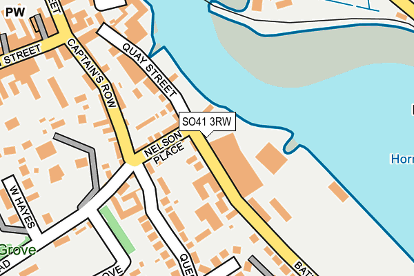
SO41 3RW is located in the Lymington electoral ward, within the local authority district of New Forest and the English Parliamentary constituency of New Forest West. The Sub Integrated Care Board (ICB) Location is NHS Hampshire and Isle of Wight ICB - D9Y0V and the police force is Hampshire. This postcode has been in use since December 1994.


GetTheData
Source: OS OpenMap – Local (Ordnance Survey)
Source: OS VectorMap District (Ordnance Survey)
Licence: Open Government Licence (requires attribution)
| Easting | 432867 |
| Northing | 95460 |
| Latitude | 50.757810 |
| Longitude | -1.535406 |
GetTheData
Source: Open Postcode Geo
Licence: Open Government Licence
| Country | England |
| Postcode District | SO41 |
➜ See where SO41 is on a map ➜ Where is Lymington? | |
GetTheData
Source: Land Registry Price Paid Data
Licence: Open Government Licence
Elevation or altitude of SO41 3RW as distance above sea level:
| Metres | Feet | |
|---|---|---|
| Elevation | 10m | 33ft |
Elevation is measured from the approximate centre of the postcode, to the nearest point on an OS contour line from OS Terrain 50, which has contour spacing of ten vertical metres.
➜ How high above sea level am I? Find the elevation of your current position using your device's GPS.
GetTheData
Source: Open Postcode Elevation
Licence: Open Government Licence
| Ward | Lymington |
| Constituency | New Forest West |
GetTheData
Source: ONS Postcode Database
Licence: Open Government Licence
| Station Street (Gosport Street) | Lymington | 333m |
| Station Street (Gosport Street) | Lymington | 338m |
| Town Railway Station (Forecourt) | Lymington | 355m |
| Waggon And Horses (Undershore Road) | Walhampton | 376m |
| Waggon And Horses (Undershore Road) | Walhampton | 384m |
| Lymington Town Station | 0.4km |
| Lymington Pier Station | 0.4km |
GetTheData
Source: NaPTAN
Licence: Open Government Licence
| Percentage of properties with Next Generation Access | 100.0% |
| Percentage of properties with Superfast Broadband | 100.0% |
| Percentage of properties with Ultrafast Broadband | 0.0% |
| Percentage of properties with Full Fibre Broadband | 0.0% |
Superfast Broadband is between 30Mbps and 300Mbps
Ultrafast Broadband is > 300Mbps
| Percentage of properties unable to receive 2Mbps | 0.0% |
| Percentage of properties unable to receive 5Mbps | 0.0% |
| Percentage of properties unable to receive 10Mbps | 0.0% |
| Percentage of properties unable to receive 30Mbps | 0.0% |
GetTheData
Source: Ofcom
Licence: Ofcom Terms of Use (requires attribution)
GetTheData
Source: ONS Postcode Database
Licence: Open Government Licence


➜ Get more ratings from the Food Standards Agency
GetTheData
Source: Food Standards Agency
Licence: FSA terms & conditions
| Last Collection | |||
|---|---|---|---|
| Location | Mon-Fri | Sat | Distance |
| Town Quay | 17:00 | 11:30 | 105m |
| High Street (East) | 17:15 | 11:45 | 268m |
| Railway Station | 17:00 | 11:30 | 353m |
GetTheData
Source: Dracos
Licence: Creative Commons Attribution-ShareAlike
| Risk of SO41 3RW flooding from rivers and sea | High |
| ➜ SO41 3RW flood map | |
GetTheData
Source: Open Flood Risk by Postcode
Licence: Open Government Licence
The below table lists the International Territorial Level (ITL) codes (formerly Nomenclature of Territorial Units for Statistics (NUTS) codes) and Local Administrative Units (LAU) codes for SO41 3RW:
| ITL 1 Code | Name |
|---|---|
| TLJ | South East (England) |
| ITL 2 Code | Name |
| TLJ3 | Hampshire and Isle of Wight |
| ITL 3 Code | Name |
| TLJ36 | Central Hampshire |
| LAU 1 Code | Name |
| E07000091 | New Forest |
GetTheData
Source: ONS Postcode Directory
Licence: Open Government Licence
The below table lists the Census Output Area (OA), Lower Layer Super Output Area (LSOA), and Middle Layer Super Output Area (MSOA) for SO41 3RW:
| Code | Name | |
|---|---|---|
| OA | E00117096 | |
| LSOA | E01023042 | New Forest 017D |
| MSOA | E02004795 | New Forest 017 |
GetTheData
Source: ONS Postcode Directory
Licence: Open Government Licence
| SO41 3AX | Quay Road | 65m |
| SO41 3RT | Nelson Place | 66m |
| SO41 3RU | Bath Road | 85m |
| SO41 3AT | Quay Road | 117m |
| SO41 3RY | Queen Katherine Road | 123m |
| SO41 9RS | Wellington Place | 140m |
| SO41 9RP | Captains Row | 155m |
| SO41 3ET | Quay Road | 156m |
| SO41 9RQ | Captains Row | 165m |
| SO41 9RR | Captains Row | 180m |
GetTheData
Source: Open Postcode Geo; Land Registry Price Paid Data
Licence: Open Government Licence