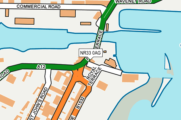
NR33 0AG lies on Royal Plain in Lowestoft. NR33 0AG is located in the Kirkley & Pakefield electoral ward, within the local authority district of East Suffolk and the English Parliamentary constituency of Waveney. The Sub Integrated Care Board (ICB) Location is NHS Norfolk and Waveney ICB - 26A and the police force is Suffolk. This postcode has been in use since January 1980.


GetTheData
Source: OS OpenMap – Local (Ordnance Survey)
Source: OS VectorMap District (Ordnance Survey)
Licence: Open Government Licence (requires attribution)
| Easting | 654727 |
| Northing | 292633 |
| Latitude | 52.472140 |
| Longitude | 1.749218 |
GetTheData
Source: Open Postcode Geo
Licence: Open Government Licence
| Street | Royal Plain |
| Town/City | Lowestoft |
| Country | England |
| Postcode District | NR33 |
| ➜ NR33 open data dashboard ➜ See where NR33 is on a map ➜ Where is Lowestoft? | |
GetTheData
Source: Land Registry Price Paid Data
Licence: Open Government Licence
Elevation or altitude of NR33 0AG as distance above sea level:
| Metres | Feet | |
|---|---|---|
| Elevation | 10m | 33ft |
Elevation is measured from the approximate centre of the postcode, to the nearest point on an OS contour line from OS Terrain 50, which has contour spacing of ten vertical metres.
➜ How high above sea level am I? Find the elevation of your current position using your device's GPS.
GetTheData
Source: Open Postcode Elevation
Licence: Open Government Licence
| Ward | Kirkley & Pakefield |
| Constituency | Waveney |
GetTheData
Source: ONS Postcode Database
Licence: Open Government Licence
THE BRIDGE HOUSE, ROYAL PLAIN, LOWESTOFT, NR33 0AG 2000 29 SEP £210,000 |
GetTheData
Source: HM Land Registry Price Paid Data
Licence: Contains HM Land Registry data © Crown copyright and database right 2024. This data is licensed under the Open Government Licence v3.0.
| January 2024 | Violence and sexual offences | On or near Parking Area | 195m |
| January 2024 | Violence and sexual offences | On or near Parking Area | 195m |
| January 2024 | Violence and sexual offences | On or near Parking Area | 195m |
| ➜ Get more crime data in our Crime section | |||
GetTheData
Source: data.police.uk
Licence: Open Government Licence
| East Point Pavilion | Lowestoft | 72m |
| Jewsons (Belvedere Road) | Lowestoft | 156m |
| Railway Station | Lowestoft | 267m |
| Railway Station | Lowestoft | 280m |
| Mill Road (London Road South) | Lowestoft | 307m |
| Lowestoft Station | 0.3km |
| Oulton Broad North Station | 2.4km |
| Oulton Broad South Station | 2.8km |
GetTheData
Source: NaPTAN
Licence: Open Government Licence
GetTheData
Source: ONS Postcode Database
Licence: Open Government Licence


➜ Get more ratings from the Food Standards Agency
GetTheData
Source: Food Standards Agency
Licence: FSA terms & conditions
| Last Collection | |||
|---|---|---|---|
| Location | Mon-Fri | Sat | Distance |
| Lowestoft Rly Station | 17:30 | 12:00 | 276m |
| Mill Road | 17:30 | 12:00 | 327m |
| 51 London Road Post Office | 17:30 | 12:30 | 363m |
GetTheData
Source: Dracos
Licence: Creative Commons Attribution-ShareAlike
| Facility | Distance |
|---|---|
| Lowestoft Town Fc Love Road, Lowestoft Grass Pitches | 902m |
| Kirkley Middle School (Closed) Southwell Road, Lowestoft Sports Hall, Grass Pitches | 930m |
| Red Oak Primary School Southwell Road, Lowestoft Grass Pitches, Sports Hall | 930m |
GetTheData
Source: Active Places
Licence: Open Government Licence
| School | Phase of Education | Distance |
|---|---|---|
| Ness Point School 32/34 Gordon Road, Lowestoft, NR32 1NL | Not applicable | 608m |
| Roman Hill Primary School Avondale Road, Lowestoft, NR32 2NX | Primary | 909m |
| Red Oak Primary School Southwell Road, Lowestoft, NR33 0RZ | Primary | 930m |
GetTheData
Source: Edubase
Licence: Open Government Licence
| Risk of NR33 0AG flooding from rivers and sea | Low |
| ➜ NR33 0AG flood map | |
GetTheData
Source: Open Flood Risk by Postcode
Licence: Open Government Licence
The below table lists the International Territorial Level (ITL) codes (formerly Nomenclature of Territorial Units for Statistics (NUTS) codes) and Local Administrative Units (LAU) codes for NR33 0AG:
| ITL 1 Code | Name |
|---|---|
| TLH | East |
| ITL 2 Code | Name |
| TLH1 | East Anglia |
| ITL 3 Code | Name |
| TLH14 | Suffolk CC |
| LAU 1 Code | Name |
| E07000244 | East Suffolk |
GetTheData
Source: ONS Postcode Directory
Licence: Open Government Licence
The below table lists the Census Output Area (OA), Lower Layer Super Output Area (LSOA), and Middle Layer Super Output Area (MSOA) for NR33 0AG:
| Code | Name | |
|---|---|---|
| OA | E00154317 | |
| LSOA | E01030258 | Waveney 007D |
| MSOA | E02006308 | Waveney 007 |
GetTheData
Source: ONS Postcode Directory
Licence: Open Government Licence
| NR33 0AH | Royal Terrace | 29m |
| NR33 0AB | Pier Terrace | 31m |
| NR33 0QL | Marine Parade | 174m |
| NR32 1BA | Station Square | 201m |
| NR32 2TD | Commercial Road | 202m |
| NR33 0AS | London Road South | 205m |
| NR33 0PH | St Johns Road | 244m |
| NR33 0PN | Turners Cottages | 261m |
| NR33 0PL | Simmetts Cottages | 274m |
| NR32 1BT | Waveney Road | 278m |
GetTheData
Source: Open Postcode Geo; Land Registry Price Paid Data
Licence: Open Government Licence