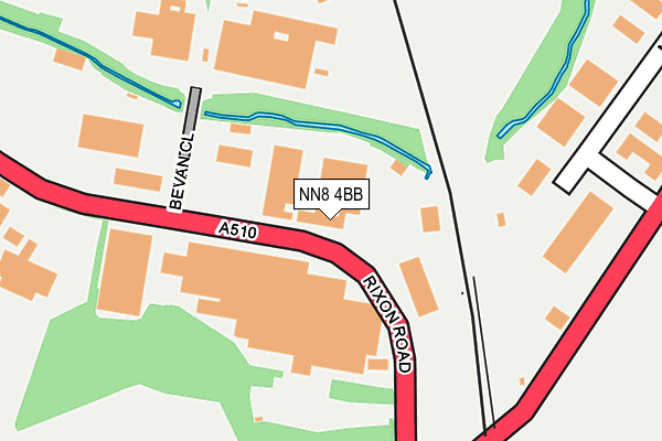
NN8 4BB is located in the Finedon electoral ward, within the unitary authority of North Northamptonshire and the English Parliamentary constituency of Wellingborough. The Sub Integrated Care Board (ICB) Location is NHS Northamptonshire ICB - 78H and the police force is Northamptonshire. This postcode has been in use since January 1980.


GetTheData
Source: OS OpenMap – Local (Ordnance Survey)
Source: OS VectorMap District (Ordnance Survey)
Licence: Open Government Licence (requires attribution)
| Easting | 490299 |
| Northing | 269413 |
| Latitude | 52.315407 |
| Longitude | -0.676759 |
GetTheData
Source: Open Postcode Geo
Licence: Open Government Licence
| Country | England |
| Postcode District | NN8 |
| ➜ NN8 open data dashboard ➜ See where NN8 is on a map ➜ Where is Wellingborough? | |
GetTheData
Source: Land Registry Price Paid Data
Licence: Open Government Licence
Elevation or altitude of NN8 4BB as distance above sea level:
| Metres | Feet | |
|---|---|---|
| Elevation | 50m | 164ft |
Elevation is measured from the approximate centre of the postcode, to the nearest point on an OS contour line from OS Terrain 50, which has contour spacing of ten vertical metres.
➜ How high above sea level am I? Find the elevation of your current position using your device's GPS.
GetTheData
Source: Open Postcode Elevation
Licence: Open Government Licence
| Ward | Finedon |
| Constituency | Wellingborough |
GetTheData
Source: ONS Postcode Database
Licence: Open Government Licence
| June 2022 | Other theft | On or near Bevan Close | 148m |
| June 2022 | Drugs | On or near Hillside Road | 414m |
| May 2022 | Other theft | On or near Petrol Station | 266m |
| ➜ Get more crime data in our Crime section | |||
GetTheData
Source: data.police.uk
Licence: Open Government Licence
| Bushboard Parker (Rixon Road) | Wellingborough | 88m |
| Bevan Close (Rixon Road) | Wellingborough | 99m |
| Bevan Close (Rixon Road) | Wellingborough | 167m |
| The Locomotive Ph (Finedon Road) | Wellingborough | 306m |
| The Locomotive Ph (Finedon Road) | Wellingborough | 316m |
| Wellingborough Station | 1.3km |
GetTheData
Source: NaPTAN
Licence: Open Government Licence
GetTheData
Source: ONS Postcode Database
Licence: Open Government Licence


➜ Get more ratings from the Food Standards Agency
GetTheData
Source: Food Standards Agency
Licence: FSA terms & conditions
| Last Collection | |||
|---|---|---|---|
| Location | Mon-Fri | Sat | Distance |
| Royal Mail Wellingborough | 18:30 | 11:00 | 1,448m |
| Park Cres | 17:15 | 11:00 | 1,559m |
| Eastfield Road | 17:00 | 11:00 | 1,583m |
GetTheData
Source: Dracos
Licence: Creative Commons Attribution-ShareAlike
| Facility | Distance |
|---|---|
| Diana's Health And Fitness Finedon Road, Wellingborough Swimming Pool, Health and Fitness Gym, Studio, Squash Courts | 261m |
| Trojan Gym (Closed) Trojan Centre, Finedon Road Industrial Estate, Wellingborough Health and Fitness Gym | 809m |
| Oakway Academy Oakway, Wellingborough Grass Pitches, Sports Hall | 1.1km |
GetTheData
Source: Active Places
Licence: Open Government Licence
| School | Phase of Education | Distance |
|---|---|---|
| Rowan Gate Primary School -Two Sites and Two Satellites Rowan Gate Primary School, Finedon Road, Wellingborough, NN8 4NS | Not applicable | 899m |
| Highfield Nursery School Finedon Road, Wellingborough, NN8 4AB | Nursery | 965m |
| Victoria Primary Academy Finedon Road, Wellingborough, NN8 4NT | Primary | 980m |
GetTheData
Source: Edubase
Licence: Open Government Licence
| Risk of NN8 4BB flooding from rivers and sea | Medium |
| ➜ NN8 4BB flood map | |
GetTheData
Source: Open Flood Risk by Postcode
Licence: Open Government Licence
The below table lists the International Territorial Level (ITL) codes (formerly Nomenclature of Territorial Units for Statistics (NUTS) codes) and Local Administrative Units (LAU) codes for NN8 4BB:
| ITL 1 Code | Name |
|---|---|
| TLF | East Midlands (England) |
| ITL 2 Code | Name |
| TLF2 | Leicestershire, Rutland and Northamptonshire |
| ITL 3 Code | Name |
| TLF25 | North Northamptonshire |
| LAU 1 Code | Name |
| E07000156 | Wellingborough |
GetTheData
Source: ONS Postcode Directory
Licence: Open Government Licence
The below table lists the Census Output Area (OA), Lower Layer Super Output Area (LSOA), and Middle Layer Super Output Area (MSOA) for NN8 4BB:
| Code | Name | |
|---|---|---|
| OA | E00139048 | |
| LSOA | E01027330 | Wellingborough 002A |
| MSOA | E02005693 | Wellingborough 002 |
GetTheData
Source: ONS Postcode Directory
Licence: Open Government Licence
| NN8 4BL | Bevan Close | 140m |
| NN8 4AL | Finedon Road | 352m |
| NN8 4EY | Links Road | 387m |
| NN8 4AN | Hillside Road | 396m |
| NN8 4AW | Hillside Road | 424m |
| NN8 4AH | Finedon Road | 449m |
| NN8 4AP | Finedon Road | 481m |
| NN8 4AQ | Finedon Road | 576m |
| NN8 4BY | Swallow Close | 587m |
| NN8 4AX | Nest Lane | 615m |
GetTheData
Source: Open Postcode Geo; Land Registry Price Paid Data
Licence: Open Government Licence