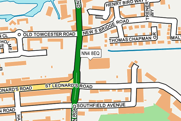
NN4 8EQ is located in the Delapre and Rushmere electoral ward, within the unitary authority of West Northamptonshire and the English Parliamentary constituency of Northampton South. The Sub Integrated Care Board (ICB) Location is NHS Northamptonshire ICB - 78H and the police force is Northamptonshire. This postcode has been in use since December 1999.


GetTheData
Source: OS OpenMap – Local (Ordnance Survey)
Source: OS VectorMap District (Ordnance Survey)
Licence: Open Government Licence (requires attribution)
| Easting | 475514 |
| Northing | 259524 |
| Latitude | 52.228749 |
| Longitude | -0.895814 |
GetTheData
Source: Open Postcode Geo
Licence: Open Government Licence
| Country | England |
| Postcode District | NN4 |
| ➜ NN4 open data dashboard ➜ See where NN4 is on a map ➜ Where is Northampton? | |
GetTheData
Source: Land Registry Price Paid Data
Licence: Open Government Licence
Elevation or altitude of NN4 8EQ as distance above sea level:
| Metres | Feet | |
|---|---|---|
| Elevation | 60m | 197ft |
Elevation is measured from the approximate centre of the postcode, to the nearest point on an OS contour line from OS Terrain 50, which has contour spacing of ten vertical metres.
➜ How high above sea level am I? Find the elevation of your current position using your device's GPS.
GetTheData
Source: Open Postcode Elevation
Licence: Open Government Licence
| Ward | Delapre And Rushmere |
| Constituency | Northampton South |
GetTheData
Source: ONS Postcode Database
Licence: Open Government Licence
| January 2024 | Violence and sexual offences | On or near Haines Road | 323m |
| January 2024 | Violence and sexual offences | On or near Haines Road | 323m |
| December 2023 | Violence and sexual offences | On or near Haines Road | 323m |
| ➜ Get more crime data in our Crime section | |||
GetTheData
Source: data.police.uk
Licence: Open Government Licence
| Old Towcester Road (Cotton End) | Far Cotton | 77m |
| London Road (St Leonards Road) | Far Cotton | 129m |
| Southfield Avenue (London Road) | Far Cotton | 131m |
| Old Towcester Road (Cotton End) | Far Cotton | 155m |
| London Road (St Leonards Road) | Far Cotton | 222m |
| Northampton Station | 1.2km |
GetTheData
Source: NaPTAN
Licence: Open Government Licence
GetTheData
Source: ONS Postcode Database
Licence: Open Government Licence


➜ Get more ratings from the Food Standards Agency
GetTheData
Source: Food Standards Agency
Licence: FSA terms & conditions
| Last Collection | |||
|---|---|---|---|
| Location | Mon-Fri | Sat | Distance |
| Haines Road | 17:30 | 12:15 | 301m |
| London Road | 17:30 | 12:15 | 357m |
| Bridge St | 17:30 | 11:30 | 699m |
GetTheData
Source: Dracos
Licence: Creative Commons Attribution-ShareAlike
| Facility | Distance |
|---|---|
| Playing Fields (Closed) London Road, Northampton Grass Pitches | 247m |
| University Of Northampton (Waterside Campus) University Drive, Northampton Outdoor Tennis Courts, Artificial Grass Pitch, Sports Hall | 426m |
| Delapre Abbey (Closed) Delapre Park, London Road, Northampton Grass Pitches | 550m |
GetTheData
Source: Active Places
Licence: Open Government Licence
| School | Phase of Education | Distance |
|---|---|---|
| Hospital and Outreach Education Delapre Learning Centre, Alton St, Off Main Rd, Far Cotton, Northampton, NN4 8EN | Not applicable | 827m |
| Queen Eleanor Primary Academy Queen Eleanor Road, Northampton, NN4 8NN | Primary | 842m |
| Delapre Primary School Rothersthorpe Road, Far Cotton, Northampton, NN4 8JA | Primary | 965m |
GetTheData
Source: Edubase
Licence: Open Government Licence
| Risk of NN4 8EQ flooding from rivers and sea | Very Low |
| ➜ NN4 8EQ flood map | |
GetTheData
Source: Open Flood Risk by Postcode
Licence: Open Government Licence
The below table lists the International Territorial Level (ITL) codes (formerly Nomenclature of Territorial Units for Statistics (NUTS) codes) and Local Administrative Units (LAU) codes for NN4 8EQ:
| ITL 1 Code | Name |
|---|---|
| TLF | East Midlands (England) |
| ITL 2 Code | Name |
| TLF2 | Leicestershire, Rutland and Northamptonshire |
| ITL 3 Code | Name |
| TLF24 | West Northamptonshire |
| LAU 1 Code | Name |
| E07000154 | Northampton |
GetTheData
Source: ONS Postcode Directory
Licence: Open Government Licence
The below table lists the Census Output Area (OA), Lower Layer Super Output Area (LSOA), and Middle Layer Super Output Area (MSOA) for NN4 8EQ:
| Code | Name | |
|---|---|---|
| OA | E00169267 | |
| LSOA | E01032981 | Northampton 028F |
| MSOA | E02005677 | Northampton 028 |
GetTheData
Source: ONS Postcode Directory
Licence: Open Government Licence
| NN4 8RP | New South Bridge Road | 132m |
| NN4 8AF | Claughton Road | 138m |
| NN4 8DE | Ransome Road | 139m |
| NN4 8AQ | Southfield Avenue | 144m |
| NN4 8DL | St Leonards Road | 151m |
| NN4 8GB | Henry Bird Way | 164m |
| NN4 8RQ | Thomas Chapman Grove | 169m |
| NN4 8AH | London Road | 175m |
| NN4 8GD | Henry Bird Way | 176m |
| NN4 8DP | St Leonards Road | 180m |
GetTheData
Source: Open Postcode Geo; Land Registry Price Paid Data
Licence: Open Government Licence