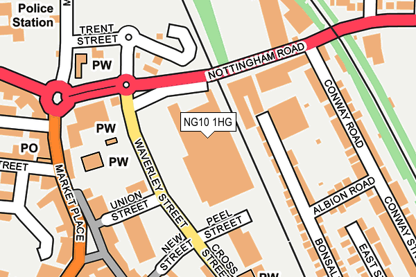
NG10 1HG is located in the Long Eaton Central electoral ward, within the local authority district of Erewash and the English Parliamentary constituency of Erewash. The Sub Integrated Care Board (ICB) Location is NHS Derby and Derbyshire ICB - 15M and the police force is Derbyshire. This postcode has been in use since May 2005.


GetTheData
Source: OS OpenMap – Local (Ordnance Survey)
Source: OS VectorMap District (Ordnance Survey)
Licence: Open Government Licence (requires attribution)
| Easting | 449298 |
| Northing | 333667 |
| Latitude | 52.898213 |
| Longitude | -1.268598 |
GetTheData
Source: Open Postcode Geo
Licence: Open Government Licence
| Country | England |
| Postcode District | NG10 |
| ➜ NG10 open data dashboard ➜ See where NG10 is on a map ➜ Where is Long Eaton? | |
GetTheData
Source: Land Registry Price Paid Data
Licence: Open Government Licence
Elevation or altitude of NG10 1HG as distance above sea level:
| Metres | Feet | |
|---|---|---|
| Elevation | 30m | 98ft |
Elevation is measured from the approximate centre of the postcode, to the nearest point on an OS contour line from OS Terrain 50, which has contour spacing of ten vertical metres.
➜ How high above sea level am I? Find the elevation of your current position using your device's GPS.
GetTheData
Source: Open Postcode Elevation
Licence: Open Government Licence
| Ward | Long Eaton Central |
| Constituency | Erewash |
GetTheData
Source: ONS Postcode Database
Licence: Open Government Licence
| January 2024 | Burglary | On or near Parking Area | 225m |
| January 2024 | Criminal damage and arson | On or near Parking Area | 225m |
| January 2024 | Shoplifting | On or near Parking Area | 225m |
| ➜ Get more crime data in our Crime section | |||
GetTheData
Source: data.police.uk
Licence: Open Government Licence
| New Street (Waverley Street) | Long Eaton | 23m |
| New Street (Waverley Street) | Long Eaton | 28m |
| Union Street (Waverley Street) | Long Eaton | 114m |
| Market Place | Long Eaton | 177m |
| Green (Nottingham Road) | Long Eaton | 208m |
| Long Eaton Station | 1.9km |
| Attenborough Station | 2.7km |
| East Midlands Parkway Station | 4km |
GetTheData
Source: NaPTAN
Licence: Open Government Licence
GetTheData
Source: ONS Postcode Database
Licence: Open Government Licence


➜ Get more ratings from the Food Standards Agency
GetTheData
Source: Food Standards Agency
Licence: FSA terms & conditions
| Last Collection | |||
|---|---|---|---|
| Location | Mon-Fri | Sat | Distance |
| Market Place | 17:30 | 12:00 | 176m |
| High Street | 17:30 | 12:00 | 196m |
| Long Eaton Delvery Office | 18:30 | 239m | |
GetTheData
Source: Dracos
Licence: Creative Commons Attribution-ShareAlike
| Facility | Distance |
|---|---|
| Active Nation Gym (Long Eaton) (Closed) High Street, Long Eaton, Nottingham Health and Fitness Gym, Studio | 183m |
| Intrim Health Studio (Closed) Beaconsfield Street, Long Eaton, Nottingham Health and Fitness Gym, Studio | 271m |
| The Clifford Health Club & Spa Regent Street, Long Eaton Health and Fitness Gym, Studio, Swimming Pool | 324m |
GetTheData
Source: Active Places
Licence: Open Government Licence
| School | Phase of Education | Distance |
|---|---|---|
| Grange Primary School Station Road, Long Eaton, Nottingham, NG10 2DU | Primary | 641m |
| Brooklands Primary School 44 St. Johns Street, Long Eaton, St Johns Street, Nottingham, NG10 1BW | Primary | 733m |
| St Laurence CofE Primary School Collingwood Road, Long Eaton, Nottingham, NG10 1DR | Primary | 895m |
GetTheData
Source: Edubase
Licence: Open Government Licence
| Risk of NG10 1HG flooding from rivers and sea | Very Low |
| ➜ NG10 1HG flood map | |
GetTheData
Source: Open Flood Risk by Postcode
Licence: Open Government Licence
The below table lists the International Territorial Level (ITL) codes (formerly Nomenclature of Territorial Units for Statistics (NUTS) codes) and Local Administrative Units (LAU) codes for NG10 1HG:
| ITL 1 Code | Name |
|---|---|
| TLF | East Midlands (England) |
| ITL 2 Code | Name |
| TLF1 | Derbyshire and Nottinghamshire |
| ITL 3 Code | Name |
| TLF13 | South and West Derbyshire |
| LAU 1 Code | Name |
| E07000036 | Erewash |
GetTheData
Source: ONS Postcode Directory
Licence: Open Government Licence
The below table lists the Census Output Area (OA), Lower Layer Super Output Area (LSOA), and Middle Layer Super Output Area (MSOA) for NG10 1HG:
| Code | Name | |
|---|---|---|
| OA | E00099573 | |
| LSOA | E01019682 | Erewash 012D |
| MSOA | E02004089 | Erewash 012 |
GetTheData
Source: ONS Postcode Directory
Licence: Open Government Licence
| NG10 1HH | Union Street | 117m |
| NG10 1LP | High Street | 128m |
| NG10 1LS | Market Place | 130m |
| NG10 2AL | Bonsall Street | 145m |
| NG10 1GH | High Street | 176m |
| NG10 1HZ | High Street | 179m |
| NG10 1HP | Nottingham Road | 181m |
| NG10 1JL | Market Place | 182m |
| NG10 1JE | Tamworth Road | 208m |
| NG10 2AH | Bonsall Street | 211m |
GetTheData
Source: Open Postcode Geo; Land Registry Price Paid Data
Licence: Open Government Licence