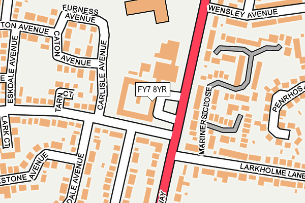
FY7 8YR is located in the Rossall electoral ward, within the local authority district of Wyre and the English Parliamentary constituency of Lancaster and Fleetwood. The Sub Integrated Care Board (ICB) Location is NHS Lancashire and South Cumbria ICB - 02M and the police force is Lancashire. This postcode has been in use since June 1997.


GetTheData
Source: OS OpenMap – Local (Ordnance Survey)
Source: OS VectorMap District (Ordnance Survey)
Licence: Open Government Licence (requires attribution)
| Easting | 331965 |
| Northing | 446217 |
| Latitude | 53.907624 |
| Longitude | -3.037098 |
GetTheData
Source: Open Postcode Geo
Licence: Open Government Licence
| Country | England |
| Postcode District | FY7 |
| ➜ FY7 open data dashboard ➜ See where FY7 is on a map ➜ Where is Fleetwood? | |
GetTheData
Source: Land Registry Price Paid Data
Licence: Open Government Licence
Elevation or altitude of FY7 8YR as distance above sea level:
| Metres | Feet | |
|---|---|---|
| Elevation | 10m | 33ft |
Elevation is measured from the approximate centre of the postcode, to the nearest point on an OS contour line from OS Terrain 50, which has contour spacing of ten vertical metres.
➜ How high above sea level am I? Find the elevation of your current position using your device's GPS.
GetTheData
Source: Open Postcode Elevation
Licence: Open Government Licence
| Ward | Rossall |
| Constituency | Lancaster And Fleetwood |
GetTheData
Source: ONS Postcode Database
Licence: Open Government Licence
| January 2024 | Anti-social behaviour | On or near Mariners Close | 169m |
| January 2024 | Vehicle crime | On or near Homestead Way | 440m |
| January 2024 | Other theft | On or near Homestead Way | 440m |
| ➜ Get more crime data in our Crime section | |||
GetTheData
Source: data.police.uk
Licence: Open Government Licence
| Larkholme Parade (Broadway) | Larkholme | 55m |
| Larkholme Lane (Broadway) | Larkholme | 94m |
| Melbourne Avenue (Broadway) | Larkholme | 326m |
| Flakefleet Avenue (Fleetwood Road) | Broadwater | 348m |
| Northway Shops (Northway) | Larkholme | 352m |
| Broadwater (Blackpool Tramway) (The Crescent) | Broadwater | 523m |
| Heathfield Road (Blackpool Tramway) (Heathfield Road) | Broadwater | 695m |
| Rossall Square (Blackpool Tramway) (A587 Broadway) | Rossall Beach | 782m |
| Lindel Road (Blackpool Tramway) (Lindel Road) | Freeport | 1,107m |
| Rossall School (Blackpool Tramway) (A587 Broadway) | Rossall Beach | 1,213m |
GetTheData
Source: NaPTAN
Licence: Open Government Licence
GetTheData
Source: ONS Postcode Database
Licence: Open Government Licence


➜ Get more ratings from the Food Standards Agency
GetTheData
Source: Food Standards Agency
Licence: FSA terms & conditions
| Last Collection | |||
|---|---|---|---|
| Location | Mon-Fri | Sat | Distance |
| Flakefleet | 16:45 | 12:15 | 385m |
| Larkholme Avenue | 16:45 | 11:30 | 394m |
| Ullswater Avenue | 16:30 | 12:15 | 448m |
GetTheData
Source: Dracos
Licence: Creative Commons Attribution-ShareAlike
| Facility | Distance |
|---|---|
| Fleetwood High School Broadway, Fleetwood Sports Hall, Health and Fitness Gym, Artificial Grass Pitch, Grass Pitches, Studio | 232m |
| Fleetwood Rugby Club Melbourne Avenue, Fleetwood Health and Fitness Gym, Grass Pitches, Artificial Grass Pitch | 318m |
| Fleetwood Cricket Club Fleetwood Road, Broadwater, Fleetwood Grass Pitches, Squash Courts | 413m |
GetTheData
Source: Active Places
Licence: Open Government Licence
| School | Phase of Education | Distance |
|---|---|---|
| Cardinal Allen Catholic High School, Fleetwood Melbourne Avenue, Fleetwood, FY7 8AY | Secondary | 432m |
| Fleetwood Flakefleet Primary School Northfleet Avenue, Fleetwood, FY7 7ND | Primary | 481m |
| Fleetwood High School Broadway, Fleetwood High School, FLEETWOOD, FY7 8HE | Secondary | 487m |
GetTheData
Source: Edubase
Licence: Open Government Licence
| Risk of FY7 8YR flooding from rivers and sea | Very Low |
| ➜ FY7 8YR flood map | |
GetTheData
Source: Open Flood Risk by Postcode
Licence: Open Government Licence
The below table lists the International Territorial Level (ITL) codes (formerly Nomenclature of Territorial Units for Statistics (NUTS) codes) and Local Administrative Units (LAU) codes for FY7 8YR:
| ITL 1 Code | Name |
|---|---|
| TLD | North West (England) |
| ITL 2 Code | Name |
| TLD4 | Lancashire |
| ITL 3 Code | Name |
| TLD44 | Lancaster and Wyre |
| LAU 1 Code | Name |
| E07000128 | Wyre |
GetTheData
Source: ONS Postcode Directory
Licence: Open Government Licence
The below table lists the Census Output Area (OA), Lower Layer Super Output Area (LSOA), and Middle Layer Super Output Area (MSOA) for FY7 8YR:
| Code | Name | |
|---|---|---|
| OA | E00129883 | |
| LSOA | E01025591 | Wyre 003B |
| MSOA | E02005321 | Wyre 003 |
GetTheData
Source: ONS Postcode Directory
Licence: Open Government Licence
| FY7 8LJ | Larkholme Parade | 92m |
| FY7 8LP | Carlisle Avenue | 133m |
| FY7 7BF | Mariners Close | 134m |
| FY7 8LW | Tarn Court | 170m |
| FY7 7BR | Mariners Close | 174m |
| FY7 8LS | Caton Avenue | 198m |
| FY7 8AU | Larkholme Lane | 237m |
| FY7 8LN | Larkholme Parade | 242m |
| FY7 8NW | Patterdale Avenue | 259m |
| FY7 8AR | Penrhos Avenue | 267m |
GetTheData
Source: Open Postcode Geo; Land Registry Price Paid Data
Licence: Open Government Licence