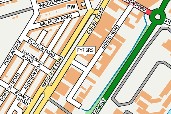
FY7 6RS is located in the Mount electoral ward, within the local authority district of Wyre and the English Parliamentary constituency of Lancaster and Fleetwood. The Sub Integrated Care Board (ICB) Location is NHS Lancashire and South Cumbria ICB - 02M and the police force is Lancashire. This postcode has been in use since May 2002.


GetTheData
Source: OS OpenMap – Local (Ordnance Survey)
Source: OS VectorMap District (Ordnance Survey)
Licence: Open Government Licence (requires attribution)
| Easting | 333235 |
| Northing | 447352 |
| Latitude | 53.917989 |
| Longitude | -3.018018 |
GetTheData
Source: Open Postcode Geo
Licence: Open Government Licence
| Country | England |
| Postcode District | FY7 |
| ➜ FY7 open data dashboard ➜ See where FY7 is on a map ➜ Where is Fleetwood? | |
GetTheData
Source: Land Registry Price Paid Data
Licence: Open Government Licence
Elevation or altitude of FY7 6RS as distance above sea level:
| Metres | Feet | |
|---|---|---|
| Elevation | 10m | 33ft |
Elevation is measured from the approximate centre of the postcode, to the nearest point on an OS contour line from OS Terrain 50, which has contour spacing of ten vertical metres.
➜ How high above sea level am I? Find the elevation of your current position using your device's GPS.
GetTheData
Source: Open Postcode Elevation
Licence: Open Government Licence
| Ward | Mount |
| Constituency | Lancaster And Fleetwood |
GetTheData
Source: ONS Postcode Database
Licence: Open Government Licence
| January 2024 | Violence and sexual offences | On or near Gordon Road | 288m |
| December 2023 | Criminal damage and arson | On or near Gordon Road | 288m |
| December 2023 | Violence and sexual offences | On or near Gordon Road | 288m |
| ➜ Get more crime data in our Crime section | |||
GetTheData
Source: data.police.uk
Licence: Open Government Licence
| Copse Road | Fleetwood | 41m |
| Fisherman's Walk (Radcliffe Road) | Fleetwood | 164m |
| Elm Street | Fleetwood | 195m |
| Freeport Village | Freeport | 223m |
| Station Road | Fleetwood | 240m |
| Fisherman's Walk (Blackpool Tramway) (Ash Street) | Freeport | 193m |
| Stanley Road (Blackpool Tramway) (Stanley Road) | Freeport | 232m |
| Lindel Road (Blackpool Tramway) (Lindel Road) | Freeport | 611m |
| London Street (Blackpool Tramway) (London Street) | Freeport | 678m |
| Victoria Street (Blackpool Tramway) (Victoria Street) | Fleetwood | 987m |
GetTheData
Source: NaPTAN
Licence: Open Government Licence
GetTheData
Source: ONS Postcode Database
Licence: Open Government Licence


➜ Get more ratings from the Food Standards Agency
GetTheData
Source: Food Standards Agency
Licence: FSA terms & conditions
| Last Collection | |||
|---|---|---|---|
| Location | Mon-Fri | Sat | Distance |
| Radcliffe Road | 17:00 | 12:45 | 90m |
| Fleetwood Freeport | 17:00 | 11:30 | 228m |
| Fleetwood Post Office | 18:15 | 13:00 | 287m |
GetTheData
Source: Dracos
Licence: Creative Commons Attribution-ShareAlike
| Facility | Distance |
|---|---|
| Elite Muscle And Fitness Fleetwood (Closed) Copse Road, Fleetwood Health and Fitness Gym | 62m |
| Fleetwood Memorial Park Warrenhurst Road, Fleetwood Grass Pitches, Outdoor Tennis Courts | 361m |
| Fleetwood Town (Highbury Stadium) Park Avenue, Fleetwood Grass Pitches | 475m |
GetTheData
Source: Active Places
Licence: Open Government Licence
| School | Phase of Education | Distance |
|---|---|---|
| Fleetwood Chaucer Community Primary School Chaucer Road, Fleetwood, FY7 6QN | Primary | 535m |
| St Mary's Catholic Primary School, Fleetwood London Street, Fleetwood, FY7 6EU | Primary | 767m |
| Shakespeare Primary School Manor Road, Fleetwood, FY7 7LL | Primary | 861m |
GetTheData
Source: Edubase
Licence: Open Government Licence
| Risk of FY7 6RS flooding from rivers and sea | Low |
| ➜ FY7 6RS flood map | |
GetTheData
Source: Open Flood Risk by Postcode
Licence: Open Government Licence
The below table lists the International Territorial Level (ITL) codes (formerly Nomenclature of Territorial Units for Statistics (NUTS) codes) and Local Administrative Units (LAU) codes for FY7 6RS:
| ITL 1 Code | Name |
|---|---|
| TLD | North West (England) |
| ITL 2 Code | Name |
| TLD4 | Lancashire |
| ITL 3 Code | Name |
| TLD44 | Lancaster and Wyre |
| LAU 1 Code | Name |
| E07000128 | Wyre |
GetTheData
Source: ONS Postcode Directory
Licence: Open Government Licence
The below table lists the Census Output Area (OA), Lower Layer Super Output Area (LSOA), and Middle Layer Super Output Area (MSOA) for FY7 6RS:
| Code | Name | |
|---|---|---|
| OA | E00129780 | |
| LSOA | E01025574 | Wyre 001B |
| MSOA | E02005319 | Wyre 001 |
GetTheData
Source: ONS Postcode Directory
Licence: Open Government Licence
| FY7 6SJ | Radcliffe Road | 96m |
| FY7 6UH | Addison Road | 112m |
| FY7 6SH | Radcliffe Road | 119m |
| FY7 6UA | Addison Road | 157m |
| FY7 6TY | Deepdale Road | 161m |
| FY7 6ST | Lofthouse Way | 163m |
| FY7 6TR | Belmont Road | 180m |
| FY7 6TZ | Clifton Road | 185m |
| FY7 6UD | Nansen Road | 195m |
| FY7 6SQ | Radcliffe Road | 198m |
GetTheData
Source: Open Postcode Geo; Land Registry Price Paid Data
Licence: Open Government Licence