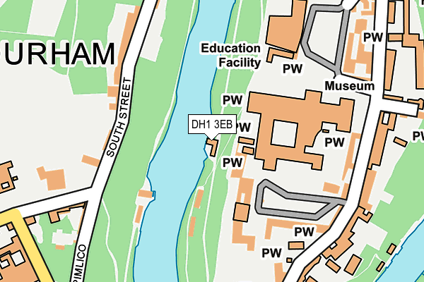
DH1 3EB is located in the Elvet and Gilesgate electoral ward, within the unitary authority of County Durham and the English Parliamentary constituency of City of Durham. The Sub Integrated Care Board (ICB) Location is NHS North East and North Cumbria ICB - 84H and the police force is Durham. This postcode has been in use since January 1980.


GetTheData
Source: OS OpenMap – Local (Ordnance Survey)
Source: OS VectorMap District (Ordnance Survey)
Licence: Open Government Licence (requires attribution)
| Easting | 427221 |
| Northing | 542102 |
| Latitude | 54.773114 |
| Longitude | -1.578391 |
GetTheData
Source: Open Postcode Geo
Licence: Open Government Licence
| Country | England |
| Postcode District | DH1 |
| ➜ DH1 open data dashboard ➜ See where DH1 is on a map ➜ Where is Durham? | |
GetTheData
Source: Land Registry Price Paid Data
Licence: Open Government Licence
Elevation or altitude of DH1 3EB as distance above sea level:
| Metres | Feet | |
|---|---|---|
| Elevation | 40m | 131ft |
Elevation is measured from the approximate centre of the postcode, to the nearest point on an OS contour line from OS Terrain 50, which has contour spacing of ten vertical metres.
➜ How high above sea level am I? Find the elevation of your current position using your device's GPS.
GetTheData
Source: Open Postcode Elevation
Licence: Open Government Licence
| Ward | Elvet And Gilesgate |
| Constituency | City Of Durham |
GetTheData
Source: ONS Postcode Database
Licence: Open Government Licence
| January 2024 | Anti-social behaviour | On or near Crossgate | 370m |
| January 2024 | Anti-social behaviour | On or near Parking Area | 405m |
| January 2024 | Anti-social behaviour | On or near Parking Area | 405m |
| ➜ Get more crime data in our Crime section | |||
GetTheData
Source: data.police.uk
Licence: Open Government Licence
| Cathedral Priors Walk Entrance (Priors Walk) | Durham | 135m |
| Cathedral (Palace Green) | Durham | 211m |
| Durham School (Margery Lane) | Durham | 293m |
| Durham School (Margery Lane) | Durham | 304m |
| Margery Lane | Durham | 389m |
| Durham Station | 0.7km |
GetTheData
Source: NaPTAN
Licence: Open Government Licence
| Percentage of properties with Next Generation Access | 100.0% |
| Percentage of properties with Superfast Broadband | 100.0% |
| Percentage of properties with Ultrafast Broadband | 0.0% |
| Percentage of properties with Full Fibre Broadband | 0.0% |
Superfast Broadband is between 30Mbps and 300Mbps
Ultrafast Broadband is > 300Mbps
| Percentage of properties unable to receive 2Mbps | 0.0% |
| Percentage of properties unable to receive 5Mbps | 0.0% |
| Percentage of properties unable to receive 10Mbps | 0.0% |
| Percentage of properties unable to receive 30Mbps | 0.0% |
GetTheData
Source: Ofcom
Licence: Ofcom Terms of Use (requires attribution)
GetTheData
Source: ONS Postcode Database
Licence: Open Government Licence


➜ Get more ratings from the Food Standards Agency
GetTheData
Source: Food Standards Agency
Licence: FSA terms & conditions
| Last Collection | |||
|---|---|---|---|
| Location | Mon-Fri | Sat | Distance |
| South Street | 17:15 | 12:00 | 136m |
| South Bailey | 17:30 | 12:00 | 212m |
| Palace Green | 17:30 | 11:30 | 257m |
GetTheData
Source: Dracos
Licence: Creative Commons Attribution-ShareAlike
| Facility | Distance |
|---|---|
| The Chorister School The College, Durham Sports Hall | 125m |
| Durham School Durham Sports Hall, Swimming Pool, Artificial Grass Pitch, Grass Pitches, Squash Courts, Health and Fitness Gym | 318m |
| Result Fitness Gym The Riverwalk, Durham Health and Fitness Gym, Studio | 397m |
GetTheData
Source: Active Places
Licence: Open Government Licence
| School | Phase of Education | Distance |
|---|---|---|
| Durham Cathedral Schools Foundation Durham Cathedral Schools Foundation, Quarryheads Lane, Durham, DH1 4SZ | Not applicable | 318m |
| St Oswald's Church of England Aided Primary and Nursery School Church Street, Durham, DH1 3DQ | Primary | 474m |
| St Margaret's Church of England Primary School Crossgate Peth, Durham, DH1 4QB | Primary | 571m |
GetTheData
Source: Edubase
Licence: Open Government Licence
| Risk of DH1 3EB flooding from rivers and sea | Medium |
| ➜ DH1 3EB flood map | |
GetTheData
Source: Open Flood Risk by Postcode
Licence: Open Government Licence
The below table lists the International Territorial Level (ITL) codes (formerly Nomenclature of Territorial Units for Statistics (NUTS) codes) and Local Administrative Units (LAU) codes for DH1 3EB:
| ITL 1 Code | Name |
|---|---|
| TLC | North East (England) |
| ITL 2 Code | Name |
| TLC1 | Tees Valley and Durham |
| ITL 3 Code | Name |
| TLC14 | Durham |
| LAU 1 Code | Name |
| E06000047 | County Durham |
GetTheData
Source: ONS Postcode Directory
Licence: Open Government Licence
The below table lists the Census Output Area (OA), Lower Layer Super Output Area (LSOA), and Middle Layer Super Output Area (MSOA) for DH1 3EB:
| Code | Name | |
|---|---|---|
| OA | E00171794 | |
| LSOA | E01033164 | County Durham 030D |
| MSOA | E02004314 | County Durham 030 |
GetTheData
Source: ONS Postcode Directory
Licence: Open Government Licence
| DH1 4QP | South Street | 180m |
| DH1 4QW | Pimlico | 218m |
| DH1 3EE | South Bailey | 224m |
| DH1 4QX | Dunelm Court | 258m |
| DH1 3ET | North Bailey | 275m |
| DH1 4DB | St Helens Well | 289m |
| DH1 3ER | Bow Lane | 301m |
| DH1 4QT | Margery Lane | 341m |
| DH1 4PS | Crossgate | 356m |
| DH1 4PR | Crossgate | 367m |
GetTheData
Source: Open Postcode Geo; Land Registry Price Paid Data
Licence: Open Government Licence