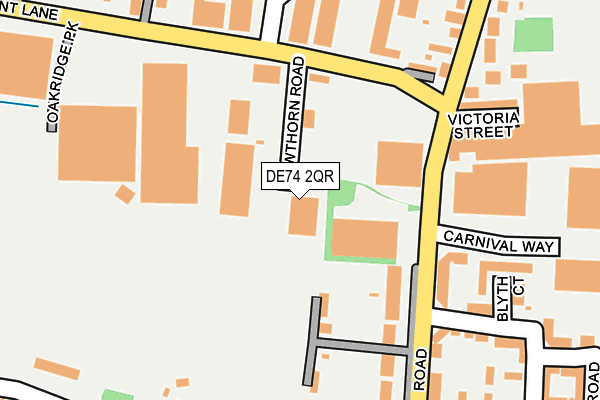
DE74 2QR is located in the Castle Donington Central electoral ward, within the local authority district of North West Leicestershire and the English Parliamentary constituency of North West Leicestershire. The Sub Integrated Care Board (ICB) Location is NHS Leicester, Leicestershire and Rutland ICB - 04V and the police force is Leicestershire. This postcode has been in use since June 1996.


GetTheData
Source: OS OpenMap – Local (Ordnance Survey)
Source: OS VectorMap District (Ordnance Survey)
Licence: Open Government Licence (requires attribution)
| Easting | 444625 |
| Northing | 328018 |
| Latitude | 52.847842 |
| Longitude | -1.338830 |
GetTheData
Source: Open Postcode Geo
Licence: Open Government Licence
| Country | England |
| Postcode District | DE74 |
| ➜ DE74 open data dashboard ➜ See where DE74 is on a map ➜ Where is Castle Donington? | |
GetTheData
Source: Land Registry Price Paid Data
Licence: Open Government Licence
Elevation or altitude of DE74 2QR as distance above sea level:
| Metres | Feet | |
|---|---|---|
| Elevation | 40m | 131ft |
Elevation is measured from the approximate centre of the postcode, to the nearest point on an OS contour line from OS Terrain 50, which has contour spacing of ten vertical metres.
➜ How high above sea level am I? Find the elevation of your current position using your device's GPS.
GetTheData
Source: Open Postcode Elevation
Licence: Open Government Licence
| Ward | Castle Donington Central |
| Constituency | North West Leicestershire |
GetTheData
Source: ONS Postcode Database
Licence: Open Government Licence
| June 2022 | Public order | On or near Derbyshire Drive | 357m |
| May 2022 | Violence and sexual offences | On or near Glover Road | 338m |
| May 2022 | Violence and sexual offences | On or near Glover Road | 338m |
| ➜ Get more crime data in our Crime section | |||
GetTheData
Source: data.police.uk
Licence: Open Government Licence
| Trent Lane (Station Road) | Castle Donington | 129m |
| Willow Road (Trent Lane) | Castle Donington | 177m |
| Willow Road (Trent Lane) | Castle Donington | 183m |
| Newbold Drive (Station Road) | Castle Donington | 222m |
| The Lamb (Station Road) | Castle Donington | 226m |
| Long Eaton Station | 5.4km |
GetTheData
Source: NaPTAN
Licence: Open Government Licence
GetTheData
Source: ONS Postcode Database
Licence: Open Government Licence


➜ Get more ratings from the Food Standards Agency
GetTheData
Source: Food Standards Agency
Licence: FSA terms & conditions
| Last Collection | |||
|---|---|---|---|
| Location | Mon-Fri | Sat | Distance |
| Trent Lane, Castle Donington | 18:30 | 137m | |
| Trent Lane | 17:30 | 10:30 | 138m |
| Bondgate | 17:30 | 10:30 | 414m |
GetTheData
Source: Dracos
Licence: Creative Commons Attribution-ShareAlike
| Facility | Distance |
|---|---|
| Spital Park The Spittal, Castle Donington Grass Pitches | 296m |
| Orchard Community Primary School Grange Drive, Castle Donington, Derby Grass Pitches | 617m |
| Moira Dale Sports Ground Moira Dale, Castle Donington Grass Pitches | 899m |
GetTheData
Source: Active Places
Licence: Open Government Licence
| School | Phase of Education | Distance |
|---|---|---|
| Orchard Community Primary School Grange Drive, Castle Donington, Derby, DE74 2QU | Primary | 624m |
| St Edward's Church of England Primary School Dovecote, Castle Donington, Derby, DE74 2LH | Primary | 814m |
| Castle Donington College Mount Pleasant, Castle Donington, Derby, DE74 2LN | Secondary | 910m |
GetTheData
Source: Edubase
Licence: Open Government Licence
| Risk of DE74 2QR flooding from rivers and sea | Medium |
| ➜ DE74 2QR flood map | |
GetTheData
Source: Open Flood Risk by Postcode
Licence: Open Government Licence
The below table lists the International Territorial Level (ITL) codes (formerly Nomenclature of Territorial Units for Statistics (NUTS) codes) and Local Administrative Units (LAU) codes for DE74 2QR:
| ITL 1 Code | Name |
|---|---|
| TLF | East Midlands (England) |
| ITL 2 Code | Name |
| TLF2 | Leicestershire, Rutland and Northamptonshire |
| ITL 3 Code | Name |
| TLF22 | Leicestershire CC and Rutland |
| LAU 1 Code | Name |
| E07000134 | North West Leicestershire |
GetTheData
Source: ONS Postcode Directory
Licence: Open Government Licence
The below table lists the Census Output Area (OA), Lower Layer Super Output Area (LSOA), and Middle Layer Super Output Area (MSOA) for DE74 2QR:
| Code | Name | |
|---|---|---|
| OA | E00170704 | |
| LSOA | E01025925 | North West Leicestershire 001B |
| MSOA | E02005397 | North West Leicestershire 001 |
GetTheData
Source: ONS Postcode Directory
Licence: Open Government Licence
| DE74 2UU | Station Road | 161m |
| DE74 2NX | Trent Lane | 176m |
| DE74 2NT | Victoria Street | 213m |
| DE74 2GP | Blyth Court | 216m |
| DE74 2NJ | Station Road | 231m |
| DE74 2TS | Tanyard Close | 249m |
| DE74 2NQ | Spittal | 267m |
| DE74 2GL | Glover Road | 267m |
| DE74 2NL | Station Road | 270m |
| DE74 2GN | Upton Close | 301m |
GetTheData
Source: Open Postcode Geo; Land Registry Price Paid Data
Licence: Open Government Licence