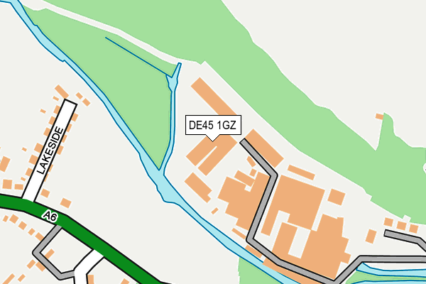
DE45 1GZ is located in the Bakewell electoral ward, within the local authority district of Derbyshire Dales and the English Parliamentary constituency of Derbyshire Dales. The Sub Integrated Care Board (ICB) Location is NHS Derby and Derbyshire ICB - 15M and the police force is Derbyshire. This postcode has been in use since December 2013.


GetTheData
Source: OS OpenMap – Local (Ordnance Survey)
Source: OS VectorMap District (Ordnance Survey)
Licence: Open Government Licence (requires attribution)
| Easting | 421092 |
| Northing | 369216 |
| Latitude | 53.219600 |
| Longitude | -1.685572 |
GetTheData
Source: Open Postcode Geo
Licence: Open Government Licence
| Country | England |
| Postcode District | DE45 |
| ➜ DE45 open data dashboard ➜ See where DE45 is on a map ➜ Where is Bakewell? | |
GetTheData
Source: Land Registry Price Paid Data
Licence: Open Government Licence
Elevation or altitude of DE45 1GZ as distance above sea level:
| Metres | Feet | |
|---|---|---|
| Elevation | 130m | 427ft |
Elevation is measured from the approximate centre of the postcode, to the nearest point on an OS contour line from OS Terrain 50, which has contour spacing of ten vertical metres.
➜ How high above sea level am I? Find the elevation of your current position using your device's GPS.
GetTheData
Source: Open Postcode Elevation
Licence: Open Government Licence
| Ward | Bakewell |
| Constituency | Derbyshire Dales |
GetTheData
Source: ONS Postcode Database
Licence: Open Government Licence
| May 2022 | Burglary | On or near Sports/Recreation Area | 415m |
| April 2022 | Violence and sexual offences | On or near Buxton Road | 233m |
| April 2022 | Violence and sexual offences | On or near Buxton Road | 233m |
| ➜ Get more crime data in our Crime section | |||
GetTheData
Source: data.police.uk
Licence: Open Government Licence
| Lakeside (Buxton Road) | Bakewell | 260m |
| Lumford Mill (Buxton Road) | Bakewell | 298m |
| Lumford Mill (Buxton Road) | Bakewell | 313m |
| Lakeside (Buxton Road) | Bakewell | 416m |
| Fire Station (Buxton Road) | Bakewell | 641m |
GetTheData
Source: NaPTAN
Licence: Open Government Licence
GetTheData
Source: ONS Postcode Database
Licence: Open Government Licence


➜ Get more ratings from the Food Standards Agency
GetTheData
Source: Food Standards Agency
Licence: FSA terms & conditions
| Last Collection | |||
|---|---|---|---|
| Location | Mon-Fri | Sat | Distance |
| The Field | 17:30 | 10:00 | 472m |
| Buxton Road | 17:30 | 08:15 | 658m |
| Oddfellows Terrace | 17:30 | 08:15 | 785m |
GetTheData
Source: Dracos
Licence: Creative Commons Attribution-ShareAlike
| Facility | Distance |
|---|---|
| Saint Anselms School Stanedge Road, Bakewell Swimming Pool, Sports Hall, Grass Pitches, Artificial Grass Pitch | 553m |
| Bakewell Swimming Pool Granby Road, Bakewell Swimming Pool, Health and Fitness Gym | 1.1km |
| Bakewell Golf Club Station Road, Bakewell Golf | 1.3km |
GetTheData
Source: Active Places
Licence: Open Government Licence
| School | Phase of Education | Distance |
|---|---|---|
| St Anselm's School Stanedge Road, Bakewell, DE45 1DP | Not applicable | 578m |
| Bakewell CofE Infant School Bath Street, Bakewell, DE45 1BX | Primary | 859m |
| Lady Manners School Shutts Lane, Bakewell, DE45 1JA | Secondary | 1.5km |
GetTheData
Source: Edubase
Licence: Open Government Licence
| Risk of DE45 1GZ flooding from rivers and sea | High |
| ➜ DE45 1GZ flood map | |
GetTheData
Source: Open Flood Risk by Postcode
Licence: Open Government Licence
The below table lists the International Territorial Level (ITL) codes (formerly Nomenclature of Territorial Units for Statistics (NUTS) codes) and Local Administrative Units (LAU) codes for DE45 1GZ:
| ITL 1 Code | Name |
|---|---|
| TLF | East Midlands (England) |
| ITL 2 Code | Name |
| TLF1 | Derbyshire and Nottinghamshire |
| ITL 3 Code | Name |
| TLF13 | South and West Derbyshire |
| LAU 1 Code | Name |
| E07000035 | Derbyshire Dales |
GetTheData
Source: ONS Postcode Directory
Licence: Open Government Licence
The below table lists the Census Output Area (OA), Lower Layer Super Output Area (LSOA), and Middle Layer Super Output Area (MSOA) for DE45 1GZ:
| Code | Name | |
|---|---|---|
| OA | E00099137 | |
| LSOA | E01019600 | Derbyshire Dales 002A |
| MSOA | E02004069 | Derbyshire Dales 002 |
GetTheData
Source: ONS Postcode Directory
Licence: Open Government Licence
| DE45 1GN | Lakeside | 245m |
| DE45 1GT | Ashford Road | 289m |
| DE45 1GH | New Lumford | 326m |
| DE45 1DT | Vernon Green | 372m |
| DE45 1FZ | Vernon Drive | 406m |
| DE45 1GL | Ashford Road | 426m |
| DE45 1GG | Old Lumford Cottages | 458m |
| DE45 1GF | Holme Lane | 519m |
| DE45 1DH | Undercliffe | 564m |
| DE45 1DG | Stanedge Road | 710m |
GetTheData
Source: Open Postcode Geo; Land Registry Price Paid Data
Licence: Open Government Licence