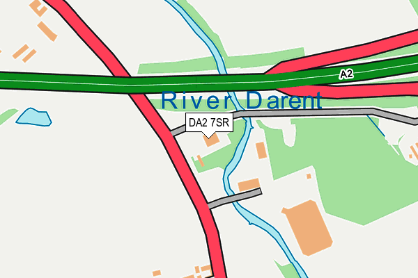
DA2 7SR is located in the Wilmington, Sutton-at-Hone & Hawley electoral ward, within the local authority district of Dartford and the English Parliamentary constituency of Dartford. The Sub Integrated Care Board (ICB) Location is NHS Kent and Medway ICB - 91Q and the police force is Kent. This postcode has been in use since January 1980.


GetTheData
Source: OS OpenMap – Local (Ordnance Survey)
Source: OS VectorMap District (Ordnance Survey)
Licence: Open Government Licence (requires attribution)
| Easting | 555191 |
| Northing | 171921 |
| Latitude | 51.425054 |
| Longitude | 0.230782 |
GetTheData
Source: Open Postcode Geo
Licence: Open Government Licence
| Country | England |
| Postcode District | DA2 |
| ➜ DA2 open data dashboard ➜ See where DA2 is on a map | |
GetTheData
Source: Land Registry Price Paid Data
Licence: Open Government Licence
Elevation or altitude of DA2 7SR as distance above sea level:
| Metres | Feet | |
|---|---|---|
| Elevation | 10m | 33ft |
Elevation is measured from the approximate centre of the postcode, to the nearest point on an OS contour line from OS Terrain 50, which has contour spacing of ten vertical metres.
➜ How high above sea level am I? Find the elevation of your current position using your device's GPS.
GetTheData
Source: Open Postcode Elevation
Licence: Open Government Licence
| Ward | Wilmington, Sutton-at-hone & Hawley |
| Constituency | Dartford |
GetTheData
Source: ONS Postcode Database
Licence: Open Government Licence
| June 2022 | Other theft | On or near Parking Area | 238m |
| June 2022 | Criminal damage and arson | On or near Hawley Road | 299m |
| June 2022 | Criminal damage and arson | On or near Hawley Road | 299m |
| ➜ Get more crime data in our Crime section | |||
GetTheData
Source: data.police.uk
Licence: Open Government Licence
| Shirehall Road (Hawley Road) | Hawley | 120m |
| Shirehall Road (Hawley Road) | Hawley | 289m |
| Hawley Manor (Hawley Road) | Hawley | 305m |
| Hawley Manor (Hawley Road) | Hawley | 314m |
| The Four Lymes (Hawley Road) | Hawley | 492m |
| Dartford Station | 2.6km |
| Farningham Road Station | 2.6km |
| Stone Crossing Station | 3.7km |
GetTheData
Source: NaPTAN
Licence: Open Government Licence
GetTheData
Source: ONS Postcode Database
Licence: Open Government Licence


➜ Get more ratings from the Food Standards Agency
GetTheData
Source: Food Standards Agency
Licence: FSA terms & conditions
| Last Collection | |||
|---|---|---|---|
| Location | Mon-Fri | Sat | Distance |
| Mill Road | 17:30 | 11:00 | 196m |
| Chave Road | 18:30 | 12:15 | 286m |
| Dartford Trade Park | 18:30 | 12:00 | 882m |
GetTheData
Source: Dracos
Licence: Creative Commons Attribution-ShareAlike
| Facility | Distance |
|---|---|
| King Georges Playing Field (Dartford) Hawley Road, Dartford Grass Pitches | 411m |
| Goals (Dartford) Green Street Green Road, Dartford Artificial Grass Pitch | 1.3km |
| Princes Park Stadium Grassbanks, Dartford Artificial Grass Pitch, Golf, Grass Pitches, Squash Courts | 1.3km |
GetTheData
Source: Active Places
Licence: Open Government Licence
| School | Phase of Education | Distance |
|---|---|---|
| The Leigh Academy Green Street Green Road, Dartford, DA1 1QE | Secondary | 1.3km |
| Fleetdown Primary Academy Lunedale Road, Darenth, Dartford, DA2 6JX | Primary | 1.5km |
| Sutton-At-Hone Church of England Primary School Church Road, Sutton-At-Hone, Dartford, DA4 9EX | Primary | 1.6km |
GetTheData
Source: Edubase
Licence: Open Government Licence
| Risk of DA2 7SR flooding from rivers and sea | High |
| ➜ DA2 7SR flood map | |
GetTheData
Source: Open Flood Risk by Postcode
Licence: Open Government Licence
The below table lists the International Territorial Level (ITL) codes (formerly Nomenclature of Territorial Units for Statistics (NUTS) codes) and Local Administrative Units (LAU) codes for DA2 7SR:
| ITL 1 Code | Name |
|---|---|
| TLJ | South East (England) |
| ITL 2 Code | Name |
| TLJ4 | Kent |
| ITL 3 Code | Name |
| TLJ43 | Kent Thames Gateway |
| LAU 1 Code | Name |
| E07000107 | Dartford |
GetTheData
Source: ONS Postcode Directory
Licence: Open Government Licence
The below table lists the Census Output Area (OA), Lower Layer Super Output Area (LSOA), and Middle Layer Super Output Area (MSOA) for DA2 7SR:
| Code | Name | |
|---|---|---|
| OA | E00122722 | |
| LSOA | E01024173 | Dartford 011A |
| MSOA | E02005038 | Dartford 011 |
GetTheData
Source: ONS Postcode Directory
Licence: Open Government Licence
| DA2 7RG | Tay Villas | 222m |
| DA2 7RB | Hawley Road | 237m |
| DA2 7RQ | Coopers Cottages | 265m |
| DA2 7RZ | Mill Road | 277m |
| DA2 7RP | Shirehall Road | 350m |
| DA2 7RW | Hawley Road | 374m |
| DA2 7RY | Mill Road | 378m |
| DA1 1PY | Hawley Road | 414m |
| DA1 1PX | Hawley Road | 428m |
| DA2 7RN | Hawley Terrace | 438m |
GetTheData
Source: Open Postcode Geo; Land Registry Price Paid Data
Licence: Open Government Licence