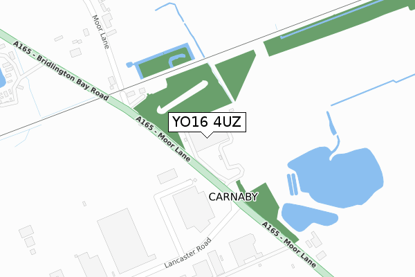
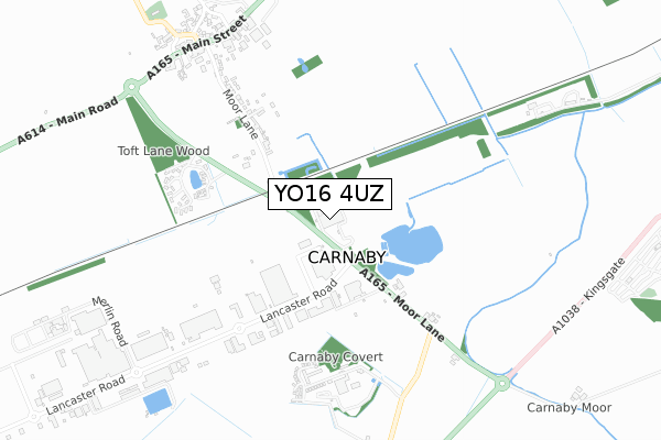
YO16 4UZ is located in the East Wolds and Coastal electoral ward, within the unitary authority of East Riding of Yorkshire and the English Parliamentary constituency of East Yorkshire. The Sub Integrated Care Board (ICB) Location is NHS Humber and North Yorkshire ICB - 02Y and the police force is Humberside. This postcode has been in use since January 1995.


GetTheData
Source: OS Open Zoomstack (Ordnance Survey)
Licence: Open Government Licence (requires attribution)
Attribution: Contains OS data © Crown copyright and database right 2024
Source: Open Postcode Geo
Licence: Open Government Licence (requires attribution)
Attribution: Contains OS data © Crown copyright and database right 2024; Contains Royal Mail data © Royal Mail copyright and database right 2024; Source: Office for National Statistics licensed under the Open Government Licence v.3.0
| Easting | 515129 |
| Northing | 464807 |
| Latitude | 54.066347 |
| Longitude | -0.242294 |
GetTheData
Source: Open Postcode Geo
Licence: Open Government Licence
| Country | England |
| Postcode District | YO16 |
| ➜ YO16 open data dashboard ➜ See where YO16 is on a map ➜ Where is Carnaby? | |
GetTheData
Source: Land Registry Price Paid Data
Licence: Open Government Licence
Elevation or altitude of YO16 4UZ as distance above sea level:
| Metres | Feet | |
|---|---|---|
| Elevation | 10m | 33ft |
Elevation is measured from the approximate centre of the postcode, to the nearest point on an OS contour line from OS Terrain 50, which has contour spacing of ten vertical metres.
➜ How high above sea level am I? Find the elevation of your current position using your device's GPS.
GetTheData
Source: Open Postcode Elevation
Licence: Open Government Licence
| Ward | East Wolds And Coastal |
| Constituency | East Yorkshire |
GetTheData
Source: ONS Postcode Database
Licence: Open Government Licence
| November 2023 | Vehicle crime | On or near Brookfield Close | 497m |
| June 2023 | Violence and sexual offences | On or near Brookfield Close | 497m |
| February 2022 | Violence and sexual offences | On or near Moor Lane | 80m |
| ➜ Get more crime data in our Crime section | |||
GetTheData
Source: data.police.uk
Licence: Open Government Licence
| Carnaby Industrial Estate (Lancaster Road) | Carnaby | 134m |
| Carnaby Industrial Estate (Lancaster Road) | Carnaby | 232m |
| Carnaby Industrial Estate (Lancaster Road) | Carnaby | 245m |
| Bridlington Carnaby Ind Est (Lancaster Road) | Carnaby | 393m |
| Carnaby Industrial Estate (Lancaster Road) | Carnaby | 417m |
| Bridlington Station | 3.5km |
GetTheData
Source: NaPTAN
Licence: Open Government Licence
GetTheData
Source: ONS Postcode Database
Licence: Open Government Licence


➜ Get more ratings from the Food Standards Agency
GetTheData
Source: Food Standards Agency
Licence: FSA terms & conditions
| Last Collection | |||
|---|---|---|---|
| Location | Mon-Fri | Sat | Distance |
| Carnaby Industrial Estate | 18:00 | 11:00 | 232m |
| Carnaby Industrial Estate | 18:00 | 11:00 | 237m |
| South Cliff Caravan Park | 16:00 | 11:00 | 1,601m |
GetTheData
Source: Dracos
Licence: Creative Commons Attribution-ShareAlike
| Facility | Distance |
|---|---|
| Palms Leisure Club Main Street, Carnaby, Bridlington Health and Fitness Gym, Swimming Pool | 778m |
| Matson Road Playing Field Matson Road, Bridlington Grass Pitches | 2.2km |
| 1gym (Bridlington) (Closed) Bessingby Way, Bridlington Health and Fitness Gym, Studio | 2.3km |
GetTheData
Source: Active Places
Licence: Open Government Licence
| School | Phase of Education | Distance |
|---|---|---|
| Hilderthorpe Primary School Shaftesbury Road, Bridlington, YO15 3PP | Primary | 2.4km |
| Our Lady and St Peter Catholic Primary School A Catholic Voluntary Academy George Street, Bridlington, YO15 3PS | Primary | 2.8km |
| Bridlington School Bessingby Road, Bridlington, YO16 4QU | Secondary | 2.9km |
GetTheData
Source: Edubase
Licence: Open Government Licence
The below table lists the International Territorial Level (ITL) codes (formerly Nomenclature of Territorial Units for Statistics (NUTS) codes) and Local Administrative Units (LAU) codes for YO16 4UZ:
| ITL 1 Code | Name |
|---|---|
| TLE | Yorkshire and The Humber |
| ITL 2 Code | Name |
| TLE1 | East Yorkshire and Northern Lincolnshire |
| ITL 3 Code | Name |
| TLE12 | East Riding of Yorkshire |
| LAU 1 Code | Name |
| E06000011 | East Riding of Yorkshire |
GetTheData
Source: ONS Postcode Directory
Licence: Open Government Licence
The below table lists the Census Output Area (OA), Lower Layer Super Output Area (LSOA), and Middle Layer Super Output Area (MSOA) for YO16 4UZ:
| Code | Name | |
|---|---|---|
| OA | E00065512 | |
| LSOA | E01012992 | East Riding of Yorkshire 006D |
| MSOA | E02002689 | East Riding of Yorkshire 006 |
GetTheData
Source: ONS Postcode Directory
Licence: Open Government Licence
| YO15 3QG | 356m | |
| YO16 4UX | Brookfield Close | 484m |
| YO16 4UT | Moor Lane | 485m |
| YO16 4UU | Moor Lane | 520m |
| YO15 3QQ | Carnaby Covert Lane | 590m |
| YO15 3QA | Carnaby Mews | 641m |
| YO16 4UJ | Main Street | 822m |
| YO16 4BY | Sycamore Close | 882m |
| YO16 4UL | Temple Lane | 883m |
| YO16 4UP | Church Lane | 904m |
GetTheData
Source: Open Postcode Geo; Land Registry Price Paid Data
Licence: Open Government Licence