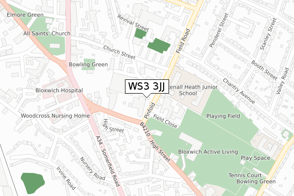
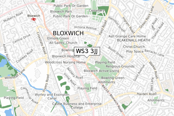
WS3 3JJ is located in the Bloxwich East electoral ward, within the metropolitan district of Walsall and the English Parliamentary constituency of Walsall North. The Sub Integrated Care Board (ICB) Location is NHS Black Country ICB - D2P2L and the police force is West Midlands. This postcode has been in use since January 1980.


GetTheData
Source: OS Open Zoomstack (Ordnance Survey)
Licence: Open Government Licence (requires attribution)
Attribution: Contains OS data © Crown copyright and database right 2024
Source: Open Postcode Geo
Licence: Open Government Licence (requires attribution)
Attribution: Contains OS data © Crown copyright and database right 2024; Contains Royal Mail data © Royal Mail copyright and database right 2024; Source: Office for National Statistics licensed under the Open Government Licence v.3.0
| Easting | 400070 |
| Northing | 301732 |
| Latitude | 52.613363 |
| Longitude | -2.000400 |
GetTheData
Source: Open Postcode Geo
Licence: Open Government Licence
| Country | England |
| Postcode District | WS3 |
| ➜ WS3 open data dashboard ➜ See where WS3 is on a map ➜ Where is Bloxwich? | |
GetTheData
Source: Land Registry Price Paid Data
Licence: Open Government Licence
Elevation or altitude of WS3 3JJ as distance above sea level:
| Metres | Feet | |
|---|---|---|
| Elevation | 160m | 525ft |
Elevation is measured from the approximate centre of the postcode, to the nearest point on an OS contour line from OS Terrain 50, which has contour spacing of ten vertical metres.
➜ How high above sea level am I? Find the elevation of your current position using your device's GPS.
GetTheData
Source: Open Postcode Elevation
Licence: Open Government Licence
| Ward | Bloxwich East |
| Constituency | Walsall North |
GetTheData
Source: ONS Postcode Database
Licence: Open Government Licence
| June 2022 | Criminal damage and arson | On or near Pinfold | 42m |
| June 2022 | Public order | On or near Pinfold | 42m |
| June 2022 | Anti-social behaviour | On or near Field Road | 89m |
| ➜ Get more crime data in our Crime section | |||
GetTheData
Source: data.police.uk
Licence: Open Government Licence
| Woodall St (Field Rd) | Blakenall Heath | 35m |
| Woodall St (Field Rd) | Blakenall Heath | 39m |
| The Pinfold (High St) | Blakenall Heath | 93m |
| The Pinfold (High St) | Blakenall Heath | 100m |
| Stokes St (Somerfield Rd) | Blakenall Heath | 202m |
| Bloxwich Station | 0.9km |
| Bloxwich North Station | 1.8km |
| Walsall Station | 3.4km |
GetTheData
Source: NaPTAN
Licence: Open Government Licence
GetTheData
Source: ONS Postcode Database
Licence: Open Government Licence


➜ Get more ratings from the Food Standards Agency
GetTheData
Source: Food Standards Agency
Licence: FSA terms & conditions
| Last Collection | |||
|---|---|---|---|
| Location | Mon-Fri | Sat | Distance |
| Chantry Avenue | 17:00 | 11:45 | 174m |
| High Street | 17:30 | 12:00 | 359m |
| Bloxwich Post Office | 17:30 | 12:15 | 481m |
GetTheData
Source: Dracos
Licence: Creative Commons Attribution-ShareAlike
| Facility | Distance |
|---|---|
| Bloxwich Leisure Centre (Closed) High Street, Bloxwich, Walsall Sports Hall, Swimming Pool, Health and Fitness Gym, Studio | 132m |
| Bloxwich Active Living Centre High Street, Bloxwich, Walsall Swimming Pool, Sports Hall, Health and Fitness Gym, Studio | 236m |
| Leamore Park Blakenall Lane, Walsall Grass Pitches, Outdoor Tennis Courts | 393m |
GetTheData
Source: Active Places
Licence: Open Government Licence
| School | Phase of Education | Distance |
|---|---|---|
| Blakenall Heath Junior School Field Road, Bloxwich, Walsall, WS3 3JF | Primary | 182m |
| Leamore Primary School Bloxwich Road, Leamore, Walsall, WS3 2BB | Primary | 390m |
| Sunshine Infant and Nursery School Blakenall Lane, Leamore, Walsall, WS3 1HF | Primary | 464m |
GetTheData
Source: Edubase
Licence: Open Government Licence
The below table lists the International Territorial Level (ITL) codes (formerly Nomenclature of Territorial Units for Statistics (NUTS) codes) and Local Administrative Units (LAU) codes for WS3 3JJ:
| ITL 1 Code | Name |
|---|---|
| TLG | West Midlands (England) |
| ITL 2 Code | Name |
| TLG3 | West Midlands |
| ITL 3 Code | Name |
| TLG38 | Walsall |
| LAU 1 Code | Name |
| E08000030 | Walsall |
GetTheData
Source: ONS Postcode Directory
Licence: Open Government Licence
The below table lists the Census Output Area (OA), Lower Layer Super Output Area (LSOA), and Middle Layer Super Output Area (MSOA) for WS3 3JJ:
| Code | Name | |
|---|---|---|
| OA | E00051976 | |
| LSOA | E01010287 | Walsall 012B |
| MSOA | E02002121 | Walsall 012 |
GetTheData
Source: ONS Postcode Directory
Licence: Open Government Licence
| WS3 3JL | Pinfold | 40m |
| WS3 3JH | Woodall Street | 93m |
| WS3 3HG | Woodall Street | 114m |
| WS3 2DF | High Street | 120m |
| WS3 3JQ | Church Street | 134m |
| WS3 3JE | Field Road | 151m |
| WS3 2DG | High Street | 174m |
| WS3 2EW | Somerfield Road | 197m |
| WS3 2BZ | High Street | 213m |
| WS3 3JD | Field Road | 222m |
GetTheData
Source: Open Postcode Geo; Land Registry Price Paid Data
Licence: Open Government Licence