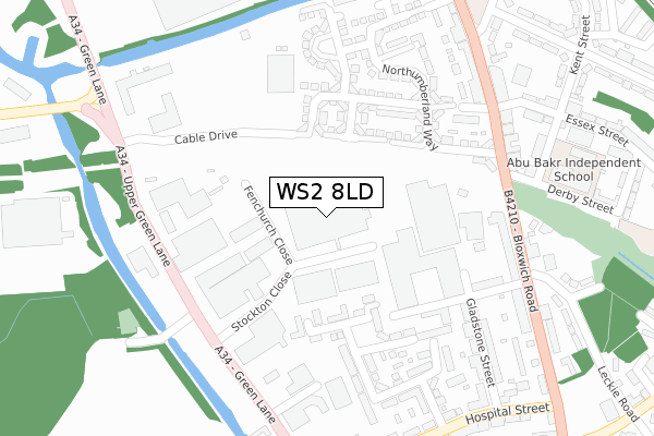
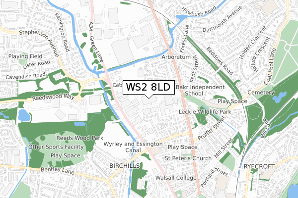
WS2 8LD is located in the Birchills Leamore electoral ward, within the metropolitan district of Walsall and the English Parliamentary constituency of Walsall North. The Sub Integrated Care Board (ICB) Location is NHS Black Country ICB - D2P2L and the police force is West Midlands. This postcode has been in use since September 1981.


GetTheData
Source: OS Open Zoomstack (Ordnance Survey)
Licence: Open Government Licence (requires attribution)
Attribution: Contains OS data © Crown copyright and database right 2024
Source: Open Postcode Geo
Licence: Open Government Licence (requires attribution)
Attribution: Contains OS data © Crown copyright and database right 2024; Contains Royal Mail data © Royal Mail copyright and database right 2024; Source: Office for National Statistics licensed under the Open Government Licence v.3.0
| Easting | 400676 |
| Northing | 299891 |
| Latitude | 52.596812 |
| Longitude | -1.991453 |
GetTheData
Source: Open Postcode Geo
Licence: Open Government Licence
| Country | England |
| Postcode District | WS2 |
| ➜ WS2 open data dashboard ➜ See where WS2 is on a map ➜ Where is Walsall? | |
GetTheData
Source: Land Registry Price Paid Data
Licence: Open Government Licence
Elevation or altitude of WS2 8LD as distance above sea level:
| Metres | Feet | |
|---|---|---|
| Elevation | 140m | 459ft |
Elevation is measured from the approximate centre of the postcode, to the nearest point on an OS contour line from OS Terrain 50, which has contour spacing of ten vertical metres.
➜ How high above sea level am I? Find the elevation of your current position using your device's GPS.
GetTheData
Source: Open Postcode Elevation
Licence: Open Government Licence
| Ward | Birchills Leamore |
| Constituency | Walsall North |
GetTheData
Source: ONS Postcode Database
Licence: Open Government Licence
| June 2022 | Vehicle crime | On or near Stockton Close | 126m |
| June 2022 | Criminal damage and arson | On or near Upper Green Lane | 273m |
| June 2022 | Drugs | On or near Norfolk Place | 285m |
| ➜ Get more crime data in our Crime section | |||
GetTheData
Source: data.police.uk
Licence: Open Government Licence
| Rayboulds Bridge Rd (Green Lane) | Birchills | 242m |
| Rayboulds Bridge Rd (Green Lane) | Birchills | 253m |
| Derby St (Bloxwich Road) | Birchills | 281m |
| Derby St (Bloxwich Road) | Birchills | 283m |
| Northcote St (Bloxwich Road) | Birchills | 304m |
| Walsall Station | 1.5km |
| Bloxwich Station | 2.7km |
| Bloxwich North Station | 3.6km |
GetTheData
Source: NaPTAN
Licence: Open Government Licence
GetTheData
Source: ONS Postcode Database
Licence: Open Government Licence


➜ Get more ratings from the Food Standards Agency
GetTheData
Source: Food Standards Agency
Licence: FSA terms & conditions
| Last Collection | |||
|---|---|---|---|
| Location | Mon-Fri | Sat | Distance |
| North Walsall | 17:15 | 12:00 | 315m |
| Dartmouth Avenue | 16:30 | 11:30 | 800m |
| Stafford Street | 17:15 | 12:00 | 828m |
GetTheData
Source: Dracos
Licence: Creative Commons Attribution-ShareAlike
| Facility | Distance |
|---|---|
| Reedswood Park (Closed) Bentley Lane, Walsall Grass Pitches | 723m |
| Fitbods Fitness (Closed) Stafford Street, Walsall Health and Fitness Gym, Studio | 860m |
| Forest Community Arts Centre (Closed) Hawbush Road, Walsall Sports Hall, Health and Fitness Gym, Studio, Squash Courts | 878m |
GetTheData
Source: Active Places
Licence: Open Government Licence
| School | Phase of Education | Distance |
|---|---|---|
| North Walsall Primary Academy Derby Street, Walsall, WS2 7BH | Primary | 370m |
| Croft Academy Croft Street, Walsall, WS2 8JE | Primary | 439m |
| St Patrick's Catholic Primary School, Walsall Blue Lane East, Walsall, WS2 8HN | Primary | 861m |
GetTheData
Source: Edubase
Licence: Open Government Licence
The below table lists the International Territorial Level (ITL) codes (formerly Nomenclature of Territorial Units for Statistics (NUTS) codes) and Local Administrative Units (LAU) codes for WS2 8LD:
| ITL 1 Code | Name |
|---|---|
| TLG | West Midlands (England) |
| ITL 2 Code | Name |
| TLG3 | West Midlands |
| ITL 3 Code | Name |
| TLG38 | Walsall |
| LAU 1 Code | Name |
| E08000030 | Walsall |
GetTheData
Source: ONS Postcode Directory
Licence: Open Government Licence
The below table lists the Census Output Area (OA), Lower Layer Super Output Area (LSOA), and Middle Layer Super Output Area (MSOA) for WS2 8LD:
| Code | Name | |
|---|---|---|
| OA | E00168247 | |
| LSOA | E01010375 | Walsall 018E |
| MSOA | E02002127 | Walsall 018 |
GetTheData
Source: ONS Postcode Directory
Licence: Open Government Licence
| WS2 8AE | Thornbury Road | 150m |
| WS2 7BS | Yorkshire Grove | 176m |
| WS2 8JJ | Thornbury Road | 201m |
| WS2 8BG | Ashdown Grove | 212m |
| WS2 7BF | Northumberland Way | 236m |
| WS2 8BQ | Northcote Street | 256m |
| WS2 8JL | Thornbury Road | 257m |
| WS2 7BA | Norfolk Place | 259m |
| WS2 8LE | Green Lane | 263m |
| WS2 8BS | Bloxwich Road | 279m |
GetTheData
Source: Open Postcode Geo; Land Registry Price Paid Data
Licence: Open Government Licence