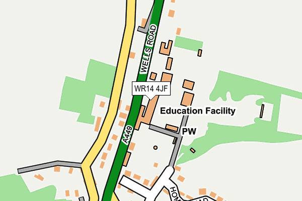
WR14 4JF is located in the Castlemorton, Welland & Wells electoral ward, within the local authority district of Malvern Hills and the English Parliamentary constituency of West Worcestershire. The Sub Integrated Care Board (ICB) Location is NHS Herefordshire and Worcestershire ICB - 18C and the police force is West Mercia. This postcode has been in use since June 1981.


GetTheData
Source: OS OpenMap – Local (Ordnance Survey)
Source: OS VectorMap District (Ordnance Survey)
Licence: Open Government Licence (requires attribution)
| Easting | 377280 |
| Northing | 241630 |
| Latitude | 52.072565 |
| Longitude | -2.332892 |
GetTheData
Source: Open Postcode Geo
Licence: Open Government Licence
| Country | England |
| Postcode District | WR14 |
| ➜ WR14 open data dashboard ➜ See where WR14 is on a map ➜ Where is Malvern Wells? | |
GetTheData
Source: Land Registry Price Paid Data
Licence: Open Government Licence
Elevation or altitude of WR14 4JF as distance above sea level:
| Metres | Feet | |
|---|---|---|
| Elevation | 150m | 492ft |
Elevation is measured from the approximate centre of the postcode, to the nearest point on an OS contour line from OS Terrain 50, which has contour spacing of ten vertical metres.
➜ How high above sea level am I? Find the elevation of your current position using your device's GPS.
GetTheData
Source: Open Postcode Elevation
Licence: Open Government Licence
| Ward | Castlemorton, Welland & Wells |
| Constituency | West Worcestershire |
GetTheData
Source: ONS Postcode Database
Licence: Open Government Licence
| May 2022 | Criminal damage and arson | On or near Richmonds Pitch | 174m |
| April 2022 | Violence and sexual offences | On or near Richmonds Pitch | 174m |
| April 2022 | Other theft | On or near Wells Close | 344m |
| ➜ Get more crime data in our Crime section | |||
GetTheData
Source: data.police.uk
Licence: Open Government Licence
| Upper Welland Road (Wells Road) | Malvern Wells | 110m |
| Upper Welland Road (Wells Road) | Malvern Wells | 182m |
| Wells Road | Malvern Wells | 269m |
| Wells Road | Malvern Wells | 300m |
| Green Lane Church (Wells Road) | Malvern Wells | 587m |
| Colwall Station | 1.8km |
| Great Malvern Station | 4.2km |
GetTheData
Source: NaPTAN
Licence: Open Government Licence
GetTheData
Source: ONS Postcode Database
Licence: Open Government Licence

➜ Get more ratings from the Food Standards Agency
GetTheData
Source: Food Standards Agency
Licence: FSA terms & conditions
| Last Collection | |||
|---|---|---|---|
| Location | Mon-Fri | Sat | Distance |
| The Abbey | 17:15 | 11:30 | 37m |
| Kings Road | 17:15 | 11:00 | 226m |
| Malvern Wells P.o. | 17:30 | 11:30 | 741m |
GetTheData
Source: Dracos
Licence: Creative Commons Attribution-ShareAlike
| Facility | Distance |
|---|---|
| Abbey College In Malvern Wells Road, Malvern Health and Fitness Gym, Grass Pitches, Sports Hall, Swimming Pool, Outdoor Tennis Courts | 0m |
| Malvern Squash Rackets Club (Closed) Wells Road, Malvern Squash Courts | 1.2km |
| The Worcestershire Golf Club Ltd Woodfarm Road, Malvern Golf | 1.7km |
GetTheData
Source: Active Places
Licence: Open Government Licence
| School | Phase of Education | Distance |
|---|---|---|
| Abbey College in Malvern 253 Wells Road, Malvern, WR14 4JF | Not applicable | 10m |
| Malvern Wells CofE Primary School 263 Wells Road, Malvern Wells, WR14 4HF | Primary | 126m |
| The Downs, Malvern College Prep School Brockhill Road, Colwall, Malvern, WR13 6EY | Not applicable | 2.1km |
GetTheData
Source: Edubase
Licence: Open Government Licence
The below table lists the International Territorial Level (ITL) codes (formerly Nomenclature of Territorial Units for Statistics (NUTS) codes) and Local Administrative Units (LAU) codes for WR14 4JF:
| ITL 1 Code | Name |
|---|---|
| TLG | West Midlands (England) |
| ITL 2 Code | Name |
| TLG1 | Herefordshire, Worcestershire and Warwickshire |
| ITL 3 Code | Name |
| TLG12 | Worcestershire CC |
| LAU 1 Code | Name |
| E07000235 | Malvern Hills |
GetTheData
Source: ONS Postcode Directory
Licence: Open Government Licence
The below table lists the Census Output Area (OA), Lower Layer Super Output Area (LSOA), and Middle Layer Super Output Area (MSOA) for WR14 4JF:
| Code | Name | |
|---|---|---|
| OA | E00164345 | |
| LSOA | E01032218 | Malvern Hills 010D |
| MSOA | E02006719 | Malvern Hills 010 |
GetTheData
Source: ONS Postcode Directory
Licence: Open Government Licence
| WR14 4HL | Kings Road | 200m |
| WR14 4LF | Holywell Road | 235m |
| WR14 4HG | Homestead Close | 248m |
| WR14 4HJ | Upper Welland Road | 270m |
| WR14 4HH | Wells Road | 282m |
| WR14 4HF | Wells Road | 303m |
| WR14 4HN | Upper Welland Road | 307m |
| WR14 4HW | Assarts Road | 314m |
| WR14 4HD | Wells Road | 334m |
| WR14 4JD | Woodlands Close | 340m |
GetTheData
Source: Open Postcode Geo; Land Registry Price Paid Data
Licence: Open Government Licence