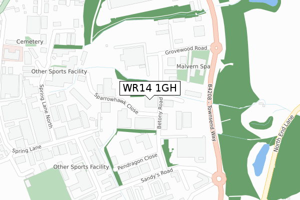
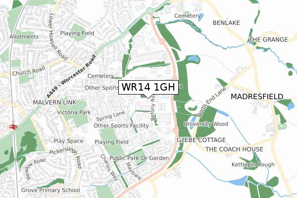
WR14 1GH is located in the Link electoral ward, within the local authority district of Malvern Hills and the English Parliamentary constituency of West Worcestershire. The Sub Integrated Care Board (ICB) Location is NHS Herefordshire and Worcestershire ICB - 18C and the police force is West Mercia. This postcode has been in use since February 2018.


GetTheData
Source: OS Open Zoomstack (Ordnance Survey)
Licence: Open Government Licence (requires attribution)
Attribution: Contains OS data © Crown copyright and database right 2024
Source: Open Postcode Geo
Licence: Open Government Licence (requires attribution)
Attribution: Contains OS data © Crown copyright and database right 2024; Contains Royal Mail data © Royal Mail copyright and database right 2024; Source: Office for National Statistics licensed under the Open Government Licence v.3.0
| Easting | 379361 |
| Northing | 247708 |
| Latitude | 52.127301 |
| Longitude | -2.302897 |
GetTheData
Source: Open Postcode Geo
Licence: Open Government Licence
| Country | England |
| Postcode District | WR14 |
| ➜ WR14 open data dashboard ➜ See where WR14 is on a map ➜ Where is Great Malvern? | |
GetTheData
Source: Land Registry Price Paid Data
Licence: Open Government Licence
Elevation or altitude of WR14 1GH as distance above sea level:
| Metres | Feet | |
|---|---|---|
| Elevation | 40m | 131ft |
Elevation is measured from the approximate centre of the postcode, to the nearest point on an OS contour line from OS Terrain 50, which has contour spacing of ten vertical metres.
➜ How high above sea level am I? Find the elevation of your current position using your device's GPS.
GetTheData
Source: Open Postcode Elevation
Licence: Open Government Licence
| Ward | Link |
| Constituency | West Worcestershire |
GetTheData
Source: ONS Postcode Database
Licence: Open Government Licence
| April 2023 | Public order | On or near Spindle Road | 470m |
| October 2022 | Burglary | On or near Sparrowhawk Close | 95m |
| October 2022 | Vehicle crime | On or near Sparrowhawk Close | 95m |
| ➜ Get more crime data in our Crime section | |||
GetTheData
Source: data.police.uk
Licence: Open Government Licence
| Betony Road Northbound (Betony Road) | Enigma Park | 26m |
| Betony Road Southbound (Betony Road) | Enigma Park | 63m |
| Grovewood Road Westbound (Grovewood Road) | Enigma Park | 207m |
| Grovewood Road Eastbound (Grovewood Road) | Enigma Park | 207m |
| Whiteacres Medical Centre (Sandy's Road) | Enigma Park | 276m |
| Malvern Link Station | 1.2km |
| Great Malvern Station | 2.3km |
GetTheData
Source: NaPTAN
Licence: Open Government Licence
Estimated total energy consumption in WR14 1GH by fuel type, 2015.
| Consumption (kWh) | 104,070 |
|---|---|
| Meter count | 8 |
| Mean (kWh/meter) | 13,009 |
| Median (kWh/meter) | 10,977 |
GetTheData
Source: Postcode level gas estimates: 2015 (experimental)
Source: Postcode level electricity estimates: 2015 (experimental)
Licence: Open Government Licence
GetTheData
Source: ONS Postcode Database
Licence: Open Government Licence


➜ Get more ratings from the Food Standards Agency
GetTheData
Source: Food Standards Agency
Licence: FSA terms & conditions
| Last Collection | |||
|---|---|---|---|
| Location | Mon-Fri | Sat | Distance |
| Sandys Road Business Box | 18:45 | 265m | |
| Safeway Supermarkt | 16:30 | 11:00 | 523m |
| Spring Lane | 17:30 | 11:15 | 544m |
GetTheData
Source: Dracos
Licence: Creative Commons Attribution-ShareAlike
| Facility | Distance |
|---|---|
| The Malvern Grovewood Road, Malvern Health and Fitness Gym, Swimming Pool, Studio | 189m |
| Revolution Gym (Closed) The Park, Spring Lane South, Malvern Health and Fitness Gym | 377m |
| Anytime Fitness (Malvern) Townsend Way, Malvern Health and Fitness Gym, Studio | 393m |
GetTheData
Source: Active Places
Licence: Open Government Licence
| School | Phase of Education | Distance |
|---|---|---|
| St Matthias Church of England Primary School Cromwell Road, Malvern Link, WR14 1NA | Primary | 1.1km |
| Madresfield CofE Primary School 40 Madresfield Village, Madresfield, Malvern, WR13 5AA | Primary | 1.1km |
| Grove Primary School Pickersleigh Grove, Malvern, WR14 2LU | Primary | 1.3km |
GetTheData
Source: Edubase
Licence: Open Government Licence
The below table lists the International Territorial Level (ITL) codes (formerly Nomenclature of Territorial Units for Statistics (NUTS) codes) and Local Administrative Units (LAU) codes for WR14 1GH:
| ITL 1 Code | Name |
|---|---|
| TLG | West Midlands (England) |
| ITL 2 Code | Name |
| TLG1 | Herefordshire, Worcestershire and Warwickshire |
| ITL 3 Code | Name |
| TLG12 | Worcestershire CC |
| LAU 1 Code | Name |
| E07000235 | Malvern Hills |
GetTheData
Source: ONS Postcode Directory
Licence: Open Government Licence
The below table lists the Census Output Area (OA), Lower Layer Super Output Area (LSOA), and Middle Layer Super Output Area (MSOA) for WR14 1GH:
| Code | Name | |
|---|---|---|
| OA | E00164213 | |
| LSOA | E01032196 | Malvern Hills 004C |
| MSOA | E02006713 | Malvern Hills 004 |
GetTheData
Source: ONS Postcode Directory
Licence: Open Government Licence
| WR14 1GZ | Britannia Way | 117m |
| WR14 1GD | Grovewood Road | 175m |
| WR14 1GP | Chequers Close | 282m |
| WR14 1JJ | Sandys Road | 297m |
| WR14 1BU | Spring Lane North | 328m |
| WR14 1GF | The Haysfield | 374m |
| WR14 1AT | Spring Lane South | 376m |
| WR14 2WE | Mansfield Road | 390m |
| WR14 1EZ | Worcester Road | 442m |
| WR14 2WD | Malus Close | 444m |
GetTheData
Source: Open Postcode Geo; Land Registry Price Paid Data
Licence: Open Government Licence