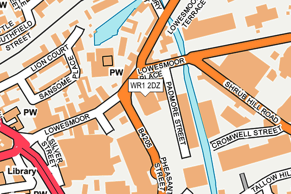
WR1 2DZ is located in the Cathedral electoral ward, within the local authority district of Worcester and the English Parliamentary constituency of Worcester. The Sub Integrated Care Board (ICB) Location is NHS Herefordshire and Worcestershire ICB - 18C and the police force is West Mercia. This postcode has been in use since August 2010.


GetTheData
Source: OS OpenMap – Local (Ordnance Survey)
Source: OS VectorMap District (Ordnance Survey)
Licence: Open Government Licence (requires attribution)
| Easting | 385369 |
| Northing | 255217 |
| Latitude | 52.195005 |
| Longitude | -2.215461 |
GetTheData
Source: Open Postcode Geo
Licence: Open Government Licence
| Country | England |
| Postcode District | WR1 |
| ➜ WR1 open data dashboard ➜ See where WR1 is on a map ➜ Where is Worcester? | |
GetTheData
Source: Land Registry Price Paid Data
Licence: Open Government Licence
Elevation or altitude of WR1 2DZ as distance above sea level:
| Metres | Feet | |
|---|---|---|
| Elevation | 20m | 66ft |
Elevation is measured from the approximate centre of the postcode, to the nearest point on an OS contour line from OS Terrain 50, which has contour spacing of ten vertical metres.
➜ How high above sea level am I? Find the elevation of your current position using your device's GPS.
GetTheData
Source: Open Postcode Elevation
Licence: Open Government Licence
| Ward | Cathedral |
| Constituency | Worcester |
GetTheData
Source: ONS Postcode Database
Licence: Open Government Licence
| January 2024 | Criminal damage and arson | On or near Park/Open Space | 172m |
| January 2024 | Violence and sexual offences | On or near Park/Open Space | 172m |
| January 2024 | Public order | On or near St Swithin'S Street | 419m |
| ➜ Get more crime data in our Crime section | |||
GetTheData
Source: data.police.uk
Licence: Open Government Licence
| Lowesmoor Terrace | Lowesmoor | 38m |
| Lowesmoor (B4550) | Lowesmoor | 55m |
| Lowesmoor (B4550) | Lowesmoor | 60m |
| First Depot (Padmore Street) | Lowesmoor | 95m |
| Shrub Hill Road (Shrub Hill Road (B4205)) | Worcester | 228m |
| Worcester Shrub Hill Station | 0.4km |
| Worcester Foregate Street Station | 0.4km |
GetTheData
Source: NaPTAN
Licence: Open Government Licence
GetTheData
Source: ONS Postcode Database
Licence: Open Government Licence

➜ Get more ratings from the Food Standards Agency
GetTheData
Source: Food Standards Agency
Licence: FSA terms & conditions
| Last Collection | |||
|---|---|---|---|
| Location | Mon-Fri | Sat | Distance |
| Lowesmoor Place | 18:00 | 11:30 | 56m |
| Lowesmoor P.o. | 18:15 | 11:30 | 151m |
| Cornmarket | 18:45 | 11:30 | 312m |
GetTheData
Source: Dracos
Licence: Creative Commons Attribution-ShareAlike
| Facility | Distance |
|---|---|
| Puregym (Worcester) Silver Street, Worcester Health and Fitness Gym | 206m |
| Fit For Free (Worcester) (Closed) George Street, Worcester Health and Fitness Gym, Studio | 214m |
| Vertical Limit Shrub Hill Industrial Estate, Worcester Health and Fitness Gym | 222m |
GetTheData
Source: Active Places
Licence: Open Government Licence
| School | Phase of Education | Distance |
|---|---|---|
| Stanley Road Primary School Stanley Road, Worcester, WR5 1BD | Primary | 594m |
| Newbridge School Midland Road, Worcester, WR5 1DS | Not applicable | 651m |
| Fort Royal Wyld's Lane, Worcester, WR5 1DR | Not applicable | 862m |
GetTheData
Source: Edubase
Licence: Open Government Licence
The below table lists the International Territorial Level (ITL) codes (formerly Nomenclature of Territorial Units for Statistics (NUTS) codes) and Local Administrative Units (LAU) codes for WR1 2DZ:
| ITL 1 Code | Name |
|---|---|
| TLG | West Midlands (England) |
| ITL 2 Code | Name |
| TLG1 | Herefordshire, Worcestershire and Warwickshire |
| ITL 3 Code | Name |
| TLG12 | Worcestershire CC |
| LAU 1 Code | Name |
| E07000237 | Worcester |
GetTheData
Source: ONS Postcode Directory
Licence: Open Government Licence
The below table lists the Census Output Area (OA), Lower Layer Super Output Area (LSOA), and Middle Layer Super Output Area (MSOA) for WR1 2DZ:
| Code | Name | |
|---|---|---|
| OA | E00172268 | |
| LSOA | E01033248 | Worcester 011E |
| MSOA | E02006744 | Worcester 011 |
GetTheData
Source: ONS Postcode Directory
Licence: Open Government Licence
| WR1 2SB | Lowesmoor | 40m |
| WR1 2SE | Lowesmoor | 61m |
| WR1 2EE | Pheasant Street | 95m |
| WR1 2RS | Lowesmoor | 121m |
| WR1 2RX | Lowesmoor Terrace | 158m |
| WR1 2SG | Lowesmoor | 161m |
| WR1 1NE | Black Horse Walk | 166m |
| WR1 1UA | Sansome Place | 191m |
| WR1 1UT | Lion Court | 214m |
| WR1 2DY | George Street | 252m |
GetTheData
Source: Open Postcode Geo; Land Registry Price Paid Data
Licence: Open Government Licence