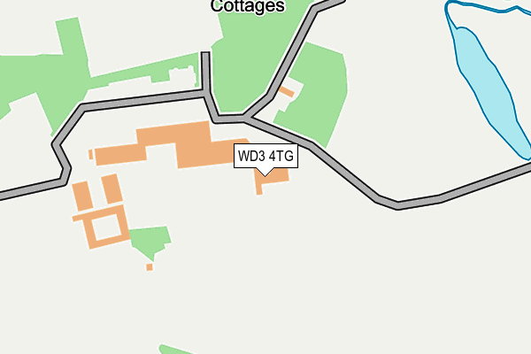
WD3 4TG is located in the Chorleywood North & Sarratt electoral ward, within the local authority district of Three Rivers and the English Parliamentary constituency of South West Hertfordshire. The Sub Integrated Care Board (ICB) Location is NHS Hertfordshire and West Essex ICB - 06N and the police force is Hertfordshire. This postcode has been in use since August 2002.


GetTheData
Source: OS OpenMap – Local (Ordnance Survey)
Source: OS VectorMap District (Ordnance Survey)
Licence: Open Government Licence (requires attribution)
| Easting | 508198 |
| Northing | 198770 |
| Latitude | 51.677285 |
| Longitude | -0.436558 |
GetTheData
Source: Open Postcode Geo
Licence: Open Government Licence
| Country | England |
| Postcode District | WD3 |
| ➜ WD3 open data dashboard ➜ See where WD3 is on a map | |
GetTheData
Source: Land Registry Price Paid Data
Licence: Open Government Licence
Elevation or altitude of WD3 4TG as distance above sea level:
| Metres | Feet | |
|---|---|---|
| Elevation | 80m | 262ft |
Elevation is measured from the approximate centre of the postcode, to the nearest point on an OS contour line from OS Terrain 50, which has contour spacing of ten vertical metres.
➜ How high above sea level am I? Find the elevation of your current position using your device's GPS.
GetTheData
Source: Open Postcode Elevation
Licence: Open Government Licence
| Ward | Chorleywood North & Sarratt |
| Constituency | South West Hertfordshire |
GetTheData
Source: ONS Postcode Database
Licence: Open Government Licence
| Russell Lane (Hempstead Road) | North Watford | 719m |
| Russell Lane (Hempstead Road) | North Watford | 729m |
| Grove Mill Lane (Hempstead Road) | North Watford | 822m |
| Grove Mill Lane (Hempstead Road) | North Watford | 890m |
| Courtlands Drive (Hempstead Road) | North Watford | 1,087m |
| Watford Junction Station | 3.2km |
| Watford North Station | 3.2km |
| Kings Langley Station | 3.2km |
GetTheData
Source: NaPTAN
Licence: Open Government Licence
| Percentage of properties with Next Generation Access | 100.0% |
| Percentage of properties with Superfast Broadband | 0.0% |
| Percentage of properties with Ultrafast Broadband | 0.0% |
| Percentage of properties with Full Fibre Broadband | 0.0% |
Superfast Broadband is between 30Mbps and 300Mbps
Ultrafast Broadband is > 300Mbps
| Percentage of properties unable to receive 2Mbps | 0.0% |
| Percentage of properties unable to receive 5Mbps | 0.0% |
| Percentage of properties unable to receive 10Mbps | 0.0% |
| Percentage of properties unable to receive 30Mbps | 100.0% |
GetTheData
Source: Ofcom
Licence: Ofcom Terms of Use (requires attribution)
GetTheData
Source: ONS Postcode Database
Licence: Open Government Licence


➜ Get more ratings from the Food Standards Agency
GetTheData
Source: Food Standards Agency
Licence: FSA terms & conditions
| Last Collection | |||
|---|---|---|---|
| Location | Mon-Fri | Sat | Distance |
| Ridge Lane | 17:30 | 12:00 | 1,299m |
| Wd24 Goodwood P.o Watford | 17:30 | 12:00 | 1,444m |
| Nascot Wood Road | 17:30 | 12:00 | 1,540m |
GetTheData
Source: Dracos
Licence: Creative Commons Attribution-ShareAlike
| Facility | Distance |
|---|---|
| The Grove Chandlers Cross, Rickmansworth Health and Fitness Gym, Swimming Pool, Golf, Studio, Outdoor Tennis Courts, Grass Pitches | 0m |
| Watford Grammar School For Boys (New Field) Coningesby Drive, Watford Grass Pitches, Artificial Grass Pitch | 1.2km |
| Herts Bowling Club Bellmount Wood Avenue, Watford Indoor Bowls | 1.2km |
GetTheData
Source: Active Places
Licence: Open Government Licence
| School | Phase of Education | Distance |
|---|---|---|
| Holy Rood Catholic Primary School Greenbank Road, Watford, WD17 4FS | Primary | 890m |
| Cassiobury Infant and Nursery School Bellmount Wood Avenue, Watford, WD17 3PE | Primary | 1.4km |
| Cassiobury Junior School Bellmount Wood Avenue, Watford, WD17 3PD | Primary | 1.5km |
GetTheData
Source: Edubase
Licence: Open Government Licence
The below table lists the International Territorial Level (ITL) codes (formerly Nomenclature of Territorial Units for Statistics (NUTS) codes) and Local Administrative Units (LAU) codes for WD3 4TG:
| ITL 1 Code | Name |
|---|---|
| TLH | East |
| ITL 2 Code | Name |
| TLH2 | Bedfordshire and Hertfordshire |
| ITL 3 Code | Name |
| TLH23 | Hertfordshire CC |
| LAU 1 Code | Name |
| E07000102 | Three Rivers |
GetTheData
Source: ONS Postcode Directory
Licence: Open Government Licence
The below table lists the Census Output Area (OA), Lower Layer Super Output Area (LSOA), and Middle Layer Super Output Area (MSOA) for WD3 4TG:
| Code | Name | |
|---|---|---|
| OA | E00121132 | |
| LSOA | E01023854 | Three Rivers 003D |
| MSOA | E02004958 | Three Rivers 003 |
GetTheData
Source: ONS Postcode Directory
Licence: Open Government Licence
| WD17 3TU | Grove Mill Lane | 540m |
| WD17 3NL | Hempstead Road | 631m |
| WD17 4NA | Hempstead Road | 721m |
| WD17 3TT | Heath Farm Court | 748m |
| WD17 4JX | Hempstead Road | 749m |
| WD17 4JW | Lebanon Close | 799m |
| WD17 4JU | The Drive | 806m |
| WD17 4JT | The Drive | 841m |
| WD17 4JJ | Greenbank Road | 864m |
| WD17 3TY | Beechpark Way | 893m |
GetTheData
Source: Open Postcode Geo; Land Registry Price Paid Data
Licence: Open Government Licence