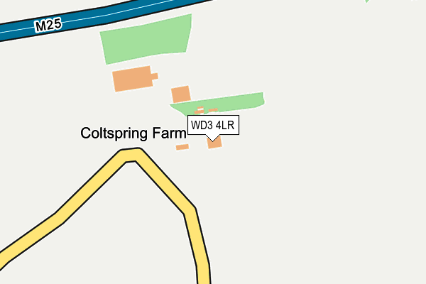
WD3 4LR is located in the Chorleywood North & Sarratt electoral ward, within the local authority district of Three Rivers and the English Parliamentary constituency of South West Hertfordshire. The Sub Integrated Care Board (ICB) Location is NHS Hertfordshire and West Essex ICB - 06N and the police force is Hertfordshire. This postcode has been in use since January 1980.


GetTheData
Source: OS OpenMap – Local (Ordnance Survey)
Source: OS VectorMap District (Ordnance Survey)
Licence: Open Government Licence (requires attribution)
| Easting | 506010 |
| Northing | 198058 |
| Latitude | 51.671307 |
| Longitude | -0.468385 |
GetTheData
Source: Open Postcode Geo
Licence: Open Government Licence
| Country | England |
| Postcode District | WD3 |
| ➜ WD3 open data dashboard ➜ See where WD3 is on a map | |
GetTheData
Source: Land Registry Price Paid Data
Licence: Open Government Licence
Elevation or altitude of WD3 4LR as distance above sea level:
| Metres | Feet | |
|---|---|---|
| Elevation | 90m | 295ft |
Elevation is measured from the approximate centre of the postcode, to the nearest point on an OS contour line from OS Terrain 50, which has contour spacing of ten vertical metres.
➜ How high above sea level am I? Find the elevation of your current position using your device's GPS.
GetTheData
Source: Open Postcode Elevation
Licence: Open Government Licence
| Ward | Chorleywood North & Sarratt |
| Constituency | South West Hertfordshire |
GetTheData
Source: ONS Postcode Database
Licence: Open Government Licence
| January 2022 | Criminal damage and arson | On or near Redhall Lane | 423m |
| December 2021 | Burglary | On or near Redhall Lane | 423m |
| April 2021 | Drugs | On or near Redhall Lane | 423m |
| ➜ Get more crime data in our Crime section | |||
GetTheData
Source: data.police.uk
Licence: Open Government Licence
| Redhall Lane (Sarratt Road) | Chandler's Cross | 531m |
| Redhall Lane (Sarratt Lane) | Chandler's Cross | 559m |
| Model Farm (Sarratt Road) | Croxley Green | 1,099m |
| Model Farm (Sarratt Road) | Croxley Green | 1,170m |
| Deadman's Ash Lane (Dimmocks Lane) | Sarratt | 1,666m |
| Rickmansworth Station | 3.5km |
| Chorleywood Station | 3.9km |
| Kings Langley Station | 4.4km |
GetTheData
Source: NaPTAN
Licence: Open Government Licence
GetTheData
Source: ONS Postcode Database
Licence: Open Government Licence


➜ Get more ratings from the Food Standards Agency
GetTheData
Source: Food Standards Agency
Licence: FSA terms & conditions
| Last Collection | |||
|---|---|---|---|
| Location | Mon-Fri | Sat | Distance |
| Chandlers Cross | 17:00 | 12:00 | 567m |
| Sarratt P.o | 17:15 | 12:00 | 2,168m |
| Baldwins Lane P.o | 17:15 | 12:00 | 2,375m |
GetTheData
Source: Dracos
Licence: Creative Commons Attribution-ShareAlike
| Facility | Distance |
|---|---|
| York House School Sarratt Road, Croxley Green, Rickmansworth Grass Pitches, Outdoor Tennis Courts, Swimming Pool, Sports Hall, Artificial Grass Pitch, Cycling, Studio | 1.1km |
| King George V Playing Fields (Sarratt) George V Way, Sarratt Grass Pitches, Outdoor Tennis Courts, Indoor Bowls | 1.9km |
| Little Green Junior School Lincoln Drive, Croxley Green, Rickmansworth Grass Pitches | 2.2km |
GetTheData
Source: Active Places
Licence: Open Government Licence
| School | Phase of Education | Distance |
|---|---|---|
| York House School Sarratt Road, Croxley Green, Rickmansworth, WD3 4LW | Not applicable | 1.1km |
| Sarratt Church of England Primary School The Green, Sarratt, Rickmansworth, WD3 6AS | Primary | 2.1km |
| Little Green Junior School Lincoln Drive, Croxley Green, Rickmansworth, WD3 3NJ | Primary | 2.2km |
GetTheData
Source: Edubase
Licence: Open Government Licence
The below table lists the International Territorial Level (ITL) codes (formerly Nomenclature of Territorial Units for Statistics (NUTS) codes) and Local Administrative Units (LAU) codes for WD3 4LR:
| ITL 1 Code | Name |
|---|---|
| TLH | East |
| ITL 2 Code | Name |
| TLH2 | Bedfordshire and Hertfordshire |
| ITL 3 Code | Name |
| TLH23 | Hertfordshire CC |
| LAU 1 Code | Name |
| E07000102 | Three Rivers |
GetTheData
Source: ONS Postcode Directory
Licence: Open Government Licence
The below table lists the Census Output Area (OA), Lower Layer Super Output Area (LSOA), and Middle Layer Super Output Area (MSOA) for WD3 4LR:
| Code | Name | |
|---|---|---|
| OA | E00121132 | |
| LSOA | E01023854 | Three Rivers 003D |
| MSOA | E02004958 | Three Rivers 003 |
GetTheData
Source: ONS Postcode Directory
Licence: Open Government Licence
| WD3 4LS | Redhall Lane | 458m |
| WD3 4LX | Redhall Lane | 556m |
| WD3 4HD | Chandlers Lane | 717m |
| WD3 4NF | Chandlers Lane | 777m |
| WD3 4NE | Chandlers Lane | 801m |
| WD3 4LY | Firtree Hill | 890m |
| WD3 6AQ | Sarratt Road | 892m |
| WD3 4ND | White Shack Lane | 932m |
| WD3 4LH | Clarendon Fields | 953m |
| WD3 4LZ | Firtree Hill | 963m |
GetTheData
Source: Open Postcode Geo; Land Registry Price Paid Data
Licence: Open Government Licence