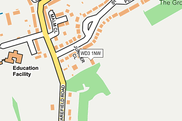
WD3 1NW is located in the Rickmansworth Town electoral ward, within the local authority district of Three Rivers and the English Parliamentary constituency of South West Hertfordshire. The Sub Integrated Care Board (ICB) Location is NHS Hertfordshire and West Essex ICB - 06N and the police force is Hertfordshire. This postcode has been in use since January 1980.


GetTheData
Source: OS OpenMap – Local (Ordnance Survey)
Source: OS VectorMap District (Ordnance Survey)
Licence: Open Government Licence (requires attribution)
| Easting | 505959 |
| Northing | 193464 |
| Latitude | 51.630024 |
| Longitude | -0.470512 |
GetTheData
Source: Open Postcode Geo
Licence: Open Government Licence
| Country | England |
| Postcode District | WD3 |
| ➜ WD3 open data dashboard ➜ See where WD3 is on a map ➜ Where is Rickmansworth? | |
GetTheData
Source: Land Registry Price Paid Data
Licence: Open Government Licence
Elevation or altitude of WD3 1NW as distance above sea level:
| Metres | Feet | |
|---|---|---|
| Elevation | 60m | 197ft |
Elevation is measured from the approximate centre of the postcode, to the nearest point on an OS contour line from OS Terrain 50, which has contour spacing of ten vertical metres.
➜ How high above sea level am I? Find the elevation of your current position using your device's GPS.
GetTheData
Source: Open Postcode Elevation
Licence: Open Government Licence
| Ward | Rickmansworth Town |
| Constituency | South West Hertfordshire |
GetTheData
Source: ONS Postcode Database
Licence: Open Government Licence
| January 2024 | Vehicle crime | On or near Frogmoor Lane | 320m |
| October 2023 | Other crime | On or near Juniper Gate | 194m |
| October 2023 | Other theft | On or near Frogmoor Lane | 320m |
| ➜ Get more crime data in our Crime section | |||
GetTheData
Source: data.police.uk
Licence: Open Government Licence
| Stockers Farm Road (Harefield Road) | The Grove | 110m |
| Stockers Farm Road (Harefield Road) | The Grove | 191m |
| Woodcock Hill Cemetery (Harefield Road) | Rickmansworth | 275m |
| Woodcock Hill Cemetery (Harefield Road) | Rickmansworth | 302m |
| Tesco (Harefield Road) | The Grove | 305m |
| Rickmansworth Underground Station | Rickmansworth | 1,154m |
| Rickmansworth Station | 1.2km |
| Chorleywood Station | 4.3km |
GetTheData
Source: NaPTAN
Licence: Open Government Licence
| Percentage of properties with Next Generation Access | 100.0% |
| Percentage of properties with Superfast Broadband | 100.0% |
| Percentage of properties with Ultrafast Broadband | 100.0% |
| Percentage of properties with Full Fibre Broadband | 0.0% |
Superfast Broadband is between 30Mbps and 300Mbps
Ultrafast Broadband is > 300Mbps
| Percentage of properties unable to receive 2Mbps | 0.0% |
| Percentage of properties unable to receive 5Mbps | 0.0% |
| Percentage of properties unable to receive 10Mbps | 0.0% |
| Percentage of properties unable to receive 30Mbps | 0.0% |
GetTheData
Source: Ofcom
Licence: Ofcom Terms of Use (requires attribution)
GetTheData
Source: ONS Postcode Database
Licence: Open Government Licence


➜ Get more ratings from the Food Standards Agency
GetTheData
Source: Food Standards Agency
Licence: FSA terms & conditions
| Last Collection | |||
|---|---|---|---|
| Location | Mon-Fri | Sat | Distance |
| White Bear Batchworth | 17:30 | 11:30 | 482m |
| Rickmansworth Branch Office | 19:00 | 12:00 | 1,008m |
| Rectory Road | 17:30 | 12:00 | 1,106m |
GetTheData
Source: Dracos
Licence: Creative Commons Attribution-ShareAlike
| Facility | Distance |
|---|---|
| Batchworth Park Golf Course London Road, Rickmansworth Golf | 613m |
| Rickmansworth Golf Course Moor Lane, Rickmansworth Golf | 870m |
| Body Coach Gym High Street, Rickmansworth Health and Fitness Gym | 1.1km |
GetTheData
Source: Active Places
Licence: Open Government Licence
| School | Phase of Education | Distance |
|---|---|---|
| St Mary's Church of England Primary School, Rickmansworth Stockers Farm Road, St Mary's Church of England Primary School, Rickmansworth, WD3 1NY | Primary | 312m |
| Saint Joan of Arc Catholic School High Street, Rickmansworth, WD3 1HG | Secondary | 1.2km |
| Rickmansworth Park Junior Mixed and Infant School Park Road, Rickmansworth, WD3 1HU | Primary | 1.5km |
GetTheData
Source: Edubase
Licence: Open Government Licence
The below table lists the International Territorial Level (ITL) codes (formerly Nomenclature of Territorial Units for Statistics (NUTS) codes) and Local Administrative Units (LAU) codes for WD3 1NW:
| ITL 1 Code | Name |
|---|---|
| TLH | East |
| ITL 2 Code | Name |
| TLH2 | Bedfordshire and Hertfordshire |
| ITL 3 Code | Name |
| TLH23 | Hertfordshire CC |
| LAU 1 Code | Name |
| E07000102 | Three Rivers |
GetTheData
Source: ONS Postcode Directory
Licence: Open Government Licence
The below table lists the Census Output Area (OA), Lower Layer Super Output Area (LSOA), and Middle Layer Super Output Area (MSOA) for WD3 1NW:
| Code | Name | |
|---|---|---|
| OA | E00121117 | |
| LSOA | E01023849 | Three Rivers 011D |
| MSOA | E02004966 | Three Rivers 011 |
GetTheData
Source: ONS Postcode Directory
Licence: Open Government Licence
| WD3 1NN | Sherfield Avenue | 55m |
| WD3 1NR | Malm Close | 135m |
| WD3 1NL | Sherfield Avenue | 141m |
| WD3 1PA | Harefield Road | 149m |
| WD3 1NT | Juniper Gate | 170m |
| WD3 1NP | Harefield Road | 191m |
| WD3 1PB | Harefield Road | 200m |
| WD3 1ND | Harefield Road | 218m |
| WD3 1NU | Harefield Road | 231m |
| WD3 1NJ | Plaitford Close | 250m |
GetTheData
Source: Open Postcode Geo; Land Registry Price Paid Data
Licence: Open Government Licence