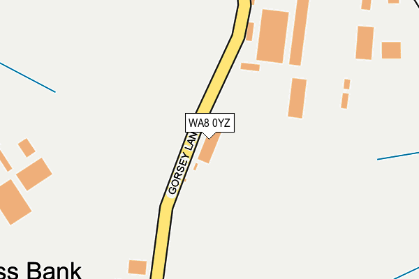
WA8 0YZ lies on Gorsey Lane in Widnes. WA8 0YZ is located in the Halton View electoral ward, within the unitary authority of Halton and the English Parliamentary constituency of Halton. The Sub Integrated Care Board (ICB) Location is NHS Cheshire and Merseyside ICB - 01F and the police force is Cheshire. This postcode has been in use since March 1983.


GetTheData
Source: OS OpenMap – Local (Ordnance Survey)
Source: OS VectorMap District (Ordnance Survey)
Licence: Open Government Licence (requires attribution)
| Easting | 353146 |
| Northing | 385807 |
| Latitude | 53.367057 |
| Longitude | -2.705598 |
GetTheData
Source: Open Postcode Geo
Licence: Open Government Licence
| Street | Gorsey Lane |
| Town/City | Widnes |
| Country | England |
| Postcode District | WA8 |
| ➜ WA8 open data dashboard ➜ See where WA8 is on a map ➜ Where is Widnes? | |
GetTheData
Source: Land Registry Price Paid Data
Licence: Open Government Licence
Elevation or altitude of WA8 0YZ as distance above sea level:
| Metres | Feet | |
|---|---|---|
| Elevation | 10m | 33ft |
Elevation is measured from the approximate centre of the postcode, to the nearest point on an OS contour line from OS Terrain 50, which has contour spacing of ten vertical metres.
➜ How high above sea level am I? Find the elevation of your current position using your device's GPS.
GetTheData
Source: Open Postcode Elevation
Licence: Open Government Licence
| Ward | Halton View |
| Constituency | Halton |
GetTheData
Source: ONS Postcode Database
Licence: Open Government Licence
| May 2022 | Vehicle crime | On or near Gorsey Lane | 250m |
| March 2022 | Violence and sexual offences | On or near Gorsey Lane | 250m |
| March 2022 | Criminal damage and arson | On or near Johnson'S Lane | 351m |
| ➜ Gorsey Lane crime map and outcomes | |||
GetTheData
Source: data.police.uk
Licence: Open Government Licence
| Suttons (Gorsey Lane) | Moss Bank | 218m |
| Suttons (Gorseyn Lane) | Moss Bank | 222m |
| Johnsons Lane (Gorsey Lane) | Moss Bank | 314m |
| Gorsey Lane | Widnes | 598m |
| Gorsey Lane | Widnes | 618m |
| Widnes Station | 2.3km |
| Runcorn Station | 3.9km |
| Sankey for Penketh Station | 4.6km |
GetTheData
Source: NaPTAN
Licence: Open Government Licence
GetTheData
Source: ONS Postcode Database
Licence: Open Government Licence


➜ Get more ratings from the Food Standards Agency
GetTheData
Source: Food Standards Agency
Licence: FSA terms & conditions
| Last Collection | |||
|---|---|---|---|
| Location | Mon-Fri | Sat | Distance |
| Moorfield Road | 18:00 | 11:00 | 1,308m |
| Elliott Street | 17:30 | 11:00 | 1,513m |
| Lytham Road | 17:30 | 11:00 | 1,659m |
GetTheData
Source: Dracos
Licence: Creative Commons Attribution-ShareAlike
| Facility | Distance |
|---|---|
| Puregym (Widnes) Widnes Health and Fitness Gym, Studio | 1.2km |
| Dw Fitness First (Widnes) (Closed) Cross Street, Widnes Swimming Pool, Health and Fitness Gym, Studio | 1.2km |
| Crow Wood Park Bancroft Road, Widnes Grass Pitches | 1.3km |
GetTheData
Source: Active Places
Licence: Open Government Licence
| School | Phase of Education | Distance |
|---|---|---|
| St John Fisher Catholic Primary School Edward Street, Widnes, WA8 0BW | Primary | 600m |
| Aspiring Foundations Federated Nursery Schools - Warrington Road Nursery School Naylor Road, Warrington Road Childrens Centre, Widnes, WA8 0BS | Nursery | 642m |
| Brookfields School Moorfield Road, Widnes, WA8 3JA | Not applicable | 968m |
GetTheData
Source: Edubase
Licence: Open Government Licence
The below table lists the International Territorial Level (ITL) codes (formerly Nomenclature of Territorial Units for Statistics (NUTS) codes) and Local Administrative Units (LAU) codes for WA8 0YZ:
| ITL 1 Code | Name |
|---|---|
| TLD | North West (England) |
| ITL 2 Code | Name |
| TLD7 | Merseyside |
| ITL 3 Code | Name |
| TLD71 | East Merseyside |
| LAU 1 Code | Name |
| E06000006 | Halton |
GetTheData
Source: ONS Postcode Directory
Licence: Open Government Licence
The below table lists the Census Output Area (OA), Lower Layer Super Output Area (LSOA), and Middle Layer Super Output Area (MSOA) for WA8 0YZ:
| Code | Name | |
|---|---|---|
| OA | E00062614 | |
| LSOA | E01012412 | Halton 003C |
| MSOA | E02002576 | Halton 003 |
GetTheData
Source: ONS Postcode Directory
Licence: Open Government Licence
| WA8 0BT | French Street | 585m |
| WA8 0BJ | Kingham Close | 615m |
| WA8 0SW | Tanhouse Lane | 624m |
| WA8 0BS | Naylor Road | 627m |
| WA8 0BU | Green Oaks Path | 629m |
| WA8 0BN | Melville Close | 662m |
| WA8 0BH | Wilson Close | 664m |
| WA8 0BP | Castle Street | 673m |
| WA8 0AS | Warrington Road | 679m |
| WA8 0BL | Ashford Way | 681m |
GetTheData
Source: Open Postcode Geo; Land Registry Price Paid Data
Licence: Open Government Licence