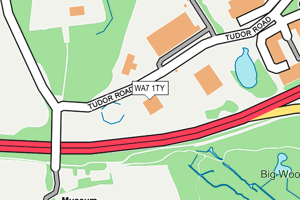
WA7 1TY is located in the Daresbury, Moore & Sandymoor electoral ward, within the unitary authority of Halton and the English Parliamentary constituency of Weaver Vale. The Sub Integrated Care Board (ICB) Location is NHS Cheshire and Merseyside ICB - 01F and the police force is Cheshire. This postcode has been in use since December 1997.


GetTheData
Source: OS OpenMap – Local (Ordnance Survey)
Source: OS VectorMap District (Ordnance Survey)
Licence: Open Government Licence (requires attribution)
| Easting | 355016 |
| Northing | 383273 |
| Latitude | 53.344444 |
| Longitude | -2.677136 |
GetTheData
Source: Open Postcode Geo
Licence: Open Government Licence
| Country | England |
| Postcode District | WA7 |
| ➜ WA7 open data dashboard ➜ See where WA7 is on a map ➜ Where is Runcorn? | |
GetTheData
Source: Land Registry Price Paid Data
Licence: Open Government Licence
Elevation or altitude of WA7 1TY as distance above sea level:
| Metres | Feet | |
|---|---|---|
| Elevation | 20m | 66ft |
Elevation is measured from the approximate centre of the postcode, to the nearest point on an OS contour line from OS Terrain 50, which has contour spacing of ten vertical metres.
➜ How high above sea level am I? Find the elevation of your current position using your device's GPS.
GetTheData
Source: Open Postcode Elevation
Licence: Open Government Licence
| Ward | Daresbury, Moore & Sandymoor |
| Constituency | Weaver Vale |
GetTheData
Source: ONS Postcode Database
Licence: Open Government Licence
| June 2022 | Anti-social behaviour | On or near Canal Reach | 396m |
| June 2022 | Criminal damage and arson | On or near Priory Road | 500m |
| June 2022 | Violence and sexual offences | On or near Priory Road | 500m |
| ➜ Get more crime data in our Crime section | |||
GetTheData
Source: data.police.uk
Licence: Open Government Licence
| Manor Park (Windmill Hill Avenue North) | Manor Park | 485m |
| Southwood Avenue (Busway (Windmill Hill)) | Windmill Hill | 694m |
| Southwood Avenue (Busway (Windmill Hill)) | Windmill Hill | 723m |
| Windmill Hill (Busway (Windmill)) | Windmill Hill | 741m |
| Windmill Hill (Busway (Windmill Hill)) | Windmill Hill | 751m |
| Runcorn East Station | 2km |
| Runcorn Station | 4.2km |
| Widnes Station | 5.3km |
GetTheData
Source: NaPTAN
Licence: Open Government Licence
GetTheData
Source: ONS Postcode Database
Licence: Open Government Licence


➜ Get more ratings from the Food Standards Agency
GetTheData
Source: Food Standards Agency
Licence: FSA terms & conditions
| Last Collection | |||
|---|---|---|---|
| Location | Mon-Fri | Sat | Distance |
| Southwood Avenue | 17:30 | 11:00 | 574m |
| Howard Court | 18:30 | 606m | |
| Plantation Close | 17:00 | 11:00 | 1,116m |
GetTheData
Source: Dracos
Licence: Creative Commons Attribution-ShareAlike
| Facility | Distance |
|---|---|
| Haddocks Wood Playing Fields Warrington Road, Runcorn Grass Pitches | 505m |
| Windmill Hill Cp School Norton Hill, Windmill Hill, Runcorn Grass Pitches | 791m |
| Bridgewater Park Primary School Plantation Close, Castlefields, Runcorn Grass Pitches | 1.2km |
GetTheData
Source: Active Places
Licence: Open Government Licence
| School | Phase of Education | Distance |
|---|---|---|
| Windmill Hill Primary School Windmill Hill, Windmill Hill South, Runcorn, WA7 6QE | Primary | 913m |
| St Augustine's Catholic Primary School, A Voluntary Academy Conwy Court, Castlefields, Runcorn, WA7 2JJ | Primary | 1km |
| Bridgewater Park Primary School Plantation Close, Castlefields, Bridgewater Park Primary School, Runcorn, WA7 2LW | Primary | 1.1km |
GetTheData
Source: Edubase
Licence: Open Government Licence
The below table lists the International Territorial Level (ITL) codes (formerly Nomenclature of Territorial Units for Statistics (NUTS) codes) and Local Administrative Units (LAU) codes for WA7 1TY:
| ITL 1 Code | Name |
|---|---|
| TLD | North West (England) |
| ITL 2 Code | Name |
| TLD7 | Merseyside |
| ITL 3 Code | Name |
| TLD71 | East Merseyside |
| LAU 1 Code | Name |
| E06000006 | Halton |
GetTheData
Source: ONS Postcode Directory
Licence: Open Government Licence
The below table lists the Census Output Area (OA), Lower Layer Super Output Area (LSOA), and Middle Layer Super Output Area (MSOA) for WA7 1TY:
| Code | Name | |
|---|---|---|
| OA | E00062483 | |
| LSOA | E01012386 | Halton 009B |
| MSOA | E02002582 | Halton 009 |
GetTheData
Source: ONS Postcode Directory
Licence: Open Government Licence
| WA7 1BD | Tudor Road | 105m |
| WA7 1UZ | Seymour Court | 355m |
| WA7 6LA | Canal Reach | 411m |
| WA7 6LB | Lockgate East | 473m |
| WA7 6LE | Lockgate West | 478m |
| WA7 1RE | Warrington Road | 479m |
| WA7 1TT | Hampton Court | 488m |
| WA7 1SJ | Howard Court | 530m |
| WA7 6LD | Bridgeway East | 536m |
| WA7 1ST | Christleton Court | 563m |
GetTheData
Source: Open Postcode Geo; Land Registry Price Paid Data
Licence: Open Government Licence