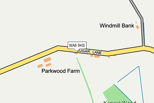
WA6 9HS is located in the Sandstone electoral ward, within the unitary authority of Cheshire West and Chester and the English Parliamentary constituency of Weaver Vale. The Sub Integrated Care Board (ICB) Location is NHS Cheshire and Merseyside ICB - 27D and the police force is Cheshire. This postcode has been in use since January 1980.


GetTheData
Source: OS OpenMap – Local (Ordnance Survey)
Source: OS VectorMap District (Ordnance Survey)
Licence: Open Government Licence (requires attribution)
| Easting | 350495 |
| Northing | 372179 |
| Latitude | 53.244326 |
| Longitude | -2.743301 |
GetTheData
Source: Open Postcode Geo
Licence: Open Government Licence
| Country | England |
| Postcode District | WA6 |
| ➜ WA6 open data dashboard ➜ See where WA6 is on a map | |
GetTheData
Source: Land Registry Price Paid Data
Licence: Open Government Licence
Elevation or altitude of WA6 9HS as distance above sea level:
| Metres | Feet | |
|---|---|---|
| Elevation | 70m | 230ft |
Elevation is measured from the approximate centre of the postcode, to the nearest point on an OS contour line from OS Terrain 50, which has contour spacing of ten vertical metres.
➜ How high above sea level am I? Find the elevation of your current position using your device's GPS.
GetTheData
Source: Open Postcode Elevation
Licence: Open Government Licence
| Ward | Sandstone |
| Constituency | Weaver Vale |
GetTheData
Source: ONS Postcode Database
Licence: Open Government Licence
| Manley Hall (Manley Lane) | Manley | 566m |
| Cob Hall Lane (Manley Lane) | Manley | 773m |
| Ravelstone Lodge (Manley Road) | Buckoak | 852m |
| Ravelstone Lodge (Manley Road) | Buckoak | 861m |
| Bay Tree Farm (Tarvin Road) | Manley | 954m |
| Mouldsworth Station | 1.6km |
| Helsby Station | 3.9km |
| Ince & Elton Station | 6.1km |
GetTheData
Source: NaPTAN
Licence: Open Government Licence
| Percentage of properties with Next Generation Access | 100.0% |
| Percentage of properties with Superfast Broadband | 0.0% |
| Percentage of properties with Ultrafast Broadband | 0.0% |
| Percentage of properties with Full Fibre Broadband | 0.0% |
Superfast Broadband is between 30Mbps and 300Mbps
Ultrafast Broadband is > 300Mbps
| Percentage of properties unable to receive 2Mbps | 0.0% |
| Percentage of properties unable to receive 5Mbps | 0.0% |
| Percentage of properties unable to receive 10Mbps | 0.0% |
| Percentage of properties unable to receive 30Mbps | 100.0% |
GetTheData
Source: Ofcom
Licence: Ofcom Terms of Use (requires attribution)
GetTheData
Source: ONS Postcode Database
Licence: Open Government Licence


➜ Get more ratings from the Food Standards Agency
GetTheData
Source: Food Standards Agency
Licence: FSA terms & conditions
| Last Collection | |||
|---|---|---|---|
| Location | Mon-Fri | Sat | Distance |
| Dunham Hill So | 16:00 | 09:00 | 3,274m |
| Robin Hood Public House | 17:00 | 09:30 | 3,414m |
| Mountain View | 16:45 | 09:00 | 3,537m |
GetTheData
Source: Dracos
Licence: Creative Commons Attribution-ShareAlike
| Facility | Distance |
|---|---|
| Ashton Hayes Cricket Club (Closed) Church Road, Ashton, Chester Grass Pitches | 2.3km |
| Helsby Golf Club Towers Lane, Helsby, Frodsham Golf | 2.3km |
| Alvanley Cricket Club Frodsham Road, Alvanley, Frodsham Grass Pitches | 2.3km |
GetTheData
Source: Active Places
Licence: Open Government Licence
| School | Phase of Education | Distance |
|---|---|---|
| Alvanley and Manley Village School Manley Road, Alvanley, Frodsham, WA6 9DD | Primary | 2km |
| Ashton Hayes Primary School Church Road, Ashton Hayes, Chester, CH3 8AB | Primary | 2.5km |
| Horn's Mill Primary School Denbigh Close, Helsby, Frodsham, WA6 0ED | Primary | 2.9km |
GetTheData
Source: Edubase
Licence: Open Government Licence
The below table lists the International Territorial Level (ITL) codes (formerly Nomenclature of Territorial Units for Statistics (NUTS) codes) and Local Administrative Units (LAU) codes for WA6 9HS:
| ITL 1 Code | Name |
|---|---|
| TLD | North West (England) |
| ITL 2 Code | Name |
| TLD6 | Cheshire |
| ITL 3 Code | Name |
| TLD63 | Cheshire West and Chester |
| LAU 1 Code | Name |
| E06000050 | Cheshire West and Chester |
GetTheData
Source: ONS Postcode Directory
Licence: Open Government Licence
The below table lists the Census Output Area (OA), Lower Layer Super Output Area (LSOA), and Middle Layer Super Output Area (MSOA) for WA6 9HS:
| Code | Name | |
|---|---|---|
| OA | E00094306 | |
| LSOA | E01018684 | Cheshire West and Chester 015A |
| MSOA | E02003877 | Cheshire West and Chester 015 |
GetTheData
Source: ONS Postcode Directory
Licence: Open Government Licence
| WA6 9HR | Sugar Lane | 484m |
| WA6 9DZ | Sugar Lane | 489m |
| WA6 9JA | Manley Lane | 490m |
| WA6 9JH | Moss Lane | 559m |
| WA6 9JN | Moss Lane | 580m |
| WA6 9HZ | Manley Quarry | 603m |
| WA6 9HU | Manley Quarry | 623m |
| WA6 9HY | Quarry Lane | 661m |
| WA6 9JL | Moss Lane | 702m |
| WA6 9JQ | Chapel Lane | 705m |
GetTheData
Source: Open Postcode Geo; Land Registry Price Paid Data
Licence: Open Government Licence