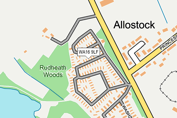
WA16 9LF is located in the Shakerley electoral ward, within the unitary authority of Cheshire West and Chester and the English Parliamentary constituency of Tatton. The Sub Integrated Care Board (ICB) Location is NHS Cheshire and Merseyside ICB - 27D and the police force is Cheshire. This postcode has been in use since June 2014.


GetTheData
Source: OS OpenMap – Local (Ordnance Survey)
Source: OS VectorMap District (Ordnance Survey)
Licence: Open Government Licence (requires attribution)
| Easting | 374091 |
| Northing | 371124 |
| Latitude | 53.236525 |
| Longitude | -2.389636 |
GetTheData
Source: Open Postcode Geo
Licence: Open Government Licence
| Country | England |
| Postcode District | WA16 |
| ➜ WA16 open data dashboard ➜ See where WA16 is on a map ➜ Where is Allostock? | |
GetTheData
Source: Land Registry Price Paid Data
Licence: Open Government Licence
Elevation or altitude of WA16 9LF as distance above sea level:
| Metres | Feet | |
|---|---|---|
| Elevation | 50m | 164ft |
Elevation is measured from the approximate centre of the postcode, to the nearest point on an OS contour line from OS Terrain 50, which has contour spacing of ten vertical metres.
➜ How high above sea level am I? Find the elevation of your current position using your device's GPS.
GetTheData
Source: Open Postcode Elevation
Licence: Open Government Licence
| Ward | Shakerley |
| Constituency | Tatton |
GetTheData
Source: ONS Postcode Database
Licence: Open Government Licence
| May 2022 | Violence and sexual offences | On or near Sports/Recreation Area | 335m |
| May 2022 | Burglary | On or near Sports/Recreation Area | 335m |
| April 2022 | Violence and sexual offences | On or near Princess Road | 256m |
| ➜ Get more crime data in our Crime section | |||
GetTheData
Source: data.police.uk
Licence: Open Government Licence
| Princess Road (Chapel Lane) | Allostock | 412m |
| Princess Road (Chapel Lane) | Allostock | 423m |
| Pine View Farm (Northwich Road) | Cranage | 719m |
| Townfield Lane (London Road) | Boots Green | 1,815m |
| Goostrey Station | 4.5km |
| Plumley Station | 4.7km |
| Holmes Chapel Station | 4.9km |
GetTheData
Source: NaPTAN
Licence: Open Government Licence
| Median download speed | 19.1Mbps |
| Average download speed | 21.6Mbps |
| Maximum download speed | 55.00Mbps |
| Median upload speed | 2.2Mbps |
| Average upload speed | 4.1Mbps |
| Maximum upload speed | 10.00Mbps |
GetTheData
Source: Ofcom
Licence: Ofcom Terms of Use (requires attribution)
GetTheData
Source: ONS Postcode Database
Licence: Open Government Licence


➜ Get more ratings from the Food Standards Agency
GetTheData
Source: Food Standards Agency
Licence: FSA terms & conditions
| Last Collection | |||
|---|---|---|---|
| Location | Mon-Fri | Sat | Distance |
| Chapel Lane | 16:00 | 09:30 | 417m |
| Wash Lane | 16:00 | 08:15 | 897m |
| Three Greyhounds | 16:00 | 08:30 | 1,123m |
GetTheData
Source: Dracos
Licence: Creative Commons Attribution-ShareAlike
| Facility | Distance |
|---|---|
| Woodside Golf Club Knutsford Road, Cranage, Crewe Golf | 1.7km |
| Goostrey Playing Fields Booth Bed Lane, Goostrey, Crewe Grass Pitches, Outdoor Tennis Courts | 2.4km |
| Club At Cranage Hall Byley Lane, Cranage, Crewe Swimming Pool, Health and Fitness Gym, Studio, Outdoor Tennis Courts, Grass Pitches | 3km |
GetTheData
Source: Active Places
Licence: Open Government Licence
| School | Phase of Education | Distance |
|---|---|---|
| Byley Primary School and Nursery Moss Lane, Byley, Middlewich, CW10 9NG | Primary | 2.5km |
| Lower Peover CofE Primary School The Cobbles, Lower Peover, Knutsford, WA16 9PZ | Primary | 3km |
| Goostrey Community Primary School Main Road, Goostrey, Near Crewe, CW4 8PE | Primary | 4km |
GetTheData
Source: Edubase
Licence: Open Government Licence
The below table lists the International Territorial Level (ITL) codes (formerly Nomenclature of Territorial Units for Statistics (NUTS) codes) and Local Administrative Units (LAU) codes for WA16 9LF:
| ITL 1 Code | Name |
|---|---|
| TLD | North West (England) |
| ITL 2 Code | Name |
| TLD6 | Cheshire |
| ITL 3 Code | Name |
| TLD63 | Cheshire West and Chester |
| LAU 1 Code | Name |
| E06000050 | Cheshire West and Chester |
GetTheData
Source: ONS Postcode Directory
Licence: Open Government Licence
The below table lists the Census Output Area (OA), Lower Layer Super Output Area (LSOA), and Middle Layer Super Output Area (MSOA) for WA16 9LF:
| Code | Name | |
|---|---|---|
| OA | E00094509 | |
| LSOA | E01018722 | Cheshire West and Chester 017E |
| MSOA | E02003878 | Cheshire West and Chester 017 |
GetTheData
Source: ONS Postcode Directory
Licence: Open Government Licence
| WA16 9LQ | Princess Road | 177m |
| WA16 9JT | Wash Lane | 207m |
| WA16 9LW | Princess Road | 326m |
| WA16 9LP | Princess Road | 348m |
| WA16 9LH | Wash Lane | 381m |
| WA16 9LL | London Road | 392m |
| WA16 9LN | Chapel Lane | 410m |
| WA16 9LS | Chapel Lane | 421m |
| WA16 9LJ | London Road | 474m |
| WA16 9JR | Middlewich Road | 479m |
GetTheData
Source: Open Postcode Geo; Land Registry Price Paid Data
Licence: Open Government Licence