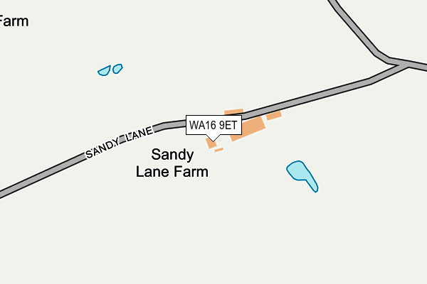
WA16 9ET is located in the Chelford electoral ward, within the unitary authority of Cheshire East and the English Parliamentary constituency of Tatton. The Sub Integrated Care Board (ICB) Location is NHS Cheshire and Merseyside ICB - 27D and the police force is Cheshire. This postcode has been in use since January 1980.


GetTheData
Source: OS OpenMap – Local (Ordnance Survey)
Source: OS VectorMap District (Ordnance Survey)
Licence: Open Government Licence (requires attribution)
| Easting | 376129 |
| Northing | 374638 |
| Latitude | 53.268191 |
| Longitude | -2.359369 |
GetTheData
Source: Open Postcode Geo
Licence: Open Government Licence
| Country | England |
| Postcode District | WA16 |
| ➜ WA16 open data dashboard ➜ See where WA16 is on a map | |
GetTheData
Source: Land Registry Price Paid Data
Licence: Open Government Licence
Elevation or altitude of WA16 9ET as distance above sea level:
| Metres | Feet | |
|---|---|---|
| Elevation | 60m | 197ft |
Elevation is measured from the approximate centre of the postcode, to the nearest point on an OS contour line from OS Terrain 50, which has contour spacing of ten vertical metres.
➜ How high above sea level am I? Find the elevation of your current position using your device's GPS.
GetTheData
Source: Open Postcode Elevation
Licence: Open Government Licence
| Ward | Chelford |
| Constituency | Tatton |
GetTheData
Source: ONS Postcode Database
Licence: Open Government Licence
| Whipping Stocks Inn (Stocks Lane) | Over Peover | 641m |
| Whipping Stocks Inn (Stocks Lane) | Over Peover | 663m |
| Radbroke Hall (Stocks Lane) | Over Peover | 757m |
| Fingerpost Farm (Holmes Chapel Road) | Toft | 1,237m |
| Fingerpost Farm (Holmes Chapel Road) | Toft | 1,247m |
| Knutsford Station | 3.8km |
| Plumley Station | 4.1km |
GetTheData
Source: NaPTAN
Licence: Open Government Licence
| Percentage of properties with Next Generation Access | 100.0% |
| Percentage of properties with Superfast Broadband | 0.0% |
| Percentage of properties with Ultrafast Broadband | 0.0% |
| Percentage of properties with Full Fibre Broadband | 0.0% |
Superfast Broadband is between 30Mbps and 300Mbps
Ultrafast Broadband is > 300Mbps
| Percentage of properties unable to receive 2Mbps | 0.0% |
| Percentage of properties unable to receive 5Mbps | 100.0% |
| Percentage of properties unable to receive 10Mbps | 100.0% |
| Percentage of properties unable to receive 30Mbps | 100.0% |
GetTheData
Source: Ofcom
Licence: Ofcom Terms of Use (requires attribution)
GetTheData
Source: ONS Postcode Database
Licence: Open Government Licence


➜ Get more ratings from the Food Standards Agency
GetTheData
Source: Food Standards Agency
Licence: FSA terms & conditions
| Last Collection | |||
|---|---|---|---|
| Location | Mon-Fri | Sat | Distance |
| Mainwaring Arms | 16:00 | 10:00 | 622m |
| Finger Post | 16:00 | 10:30 | 759m |
| Long Lane | 16:00 | 09:45 | 1,546m |
GetTheData
Source: Dracos
Licence: Creative Commons Attribution-ShareAlike
| Facility | Distance |
|---|---|
| Nuffield Fitness And Wellbeing Centre (Radbroke Hall) Stocks Lane, Over Peover Squash Courts, Studio, Artificial Grass Pitch, Health and Fitness Gym, Outdoor Tennis Courts | 721m |
| Over Peover Parish Playing Field Stocks Lane, Over Peover, Knutsford Grass Pitches | 2.7km |
| Peover Superior Primary School Stocks Lane, Over Peover, Knutsford Grass Pitches | 2.8km |
GetTheData
Source: Active Places
Licence: Open Government Licence
| School | Phase of Education | Distance |
|---|---|---|
| Lower Peover CofE Primary School The Cobbles, Lower Peover, Knutsford, WA16 9PZ | Primary | 1.9km |
| Peover Superior Endowed Primary School Stocks Lane, Over Peover, Knutsford, WA16 8TU | Primary | 2.8km |
| Bexton Primary School Blackhill Lane, Knutsford, WA16 9DB | Primary | 3.1km |
GetTheData
Source: Edubase
Licence: Open Government Licence
The below table lists the International Territorial Level (ITL) codes (formerly Nomenclature of Territorial Units for Statistics (NUTS) codes) and Local Administrative Units (LAU) codes for WA16 9ET:
| ITL 1 Code | Name |
|---|---|
| TLD | North West (England) |
| ITL 2 Code | Name |
| TLD6 | Cheshire |
| ITL 3 Code | Name |
| TLD62 | Cheshire East |
| LAU 1 Code | Name |
| E06000049 | Cheshire East |
GetTheData
Source: ONS Postcode Directory
Licence: Open Government Licence
The below table lists the Census Output Area (OA), Lower Layer Super Output Area (LSOA), and Middle Layer Super Output Area (MSOA) for WA16 9ET:
| Code | Name | |
|---|---|---|
| OA | E00094155 | |
| LSOA | E01018654 | Cheshire East 007G |
| MSOA | E02003859 | Cheshire East 007 |
GetTheData
Source: ONS Postcode Directory
Licence: Open Government Licence
| WA16 9RE | Holmes Chapel Road | 511m |
| WA16 9ES | Toft Road | 514m |
| WA16 9RB | Holmes Chapel Road | 768m |
| WA16 8TL | Sandy Lane | 865m |
| WA16 9RD | Holmes Chapel Road | 980m |
| WA16 9EZ | Stocks Lane | 1028m |
| WA16 8TH | Seven Sisters Lane | 1170m |
| WA16 9PF | Holmes Chapel Road | 1221m |
| WA16 9QX | Free Green Lane | 1247m |
| WA16 9HA | Stocks Lane | 1304m |
GetTheData
Source: Open Postcode Geo; Land Registry Price Paid Data
Licence: Open Government Licence