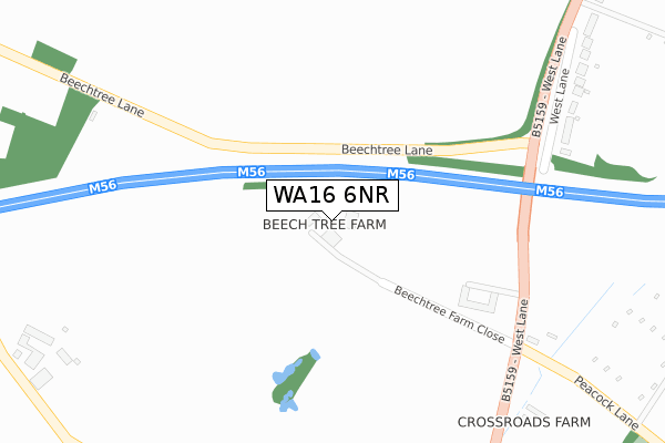
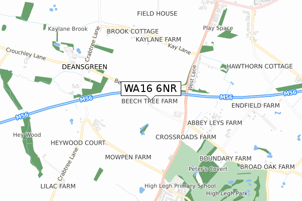
WA16 6NR is located in the High Legh electoral ward, within the unitary authority of Cheshire East and the English Parliamentary constituency of Tatton. The Sub Integrated Care Board (ICB) Location is NHS Cheshire and Merseyside ICB - 27D and the police force is Cheshire. This postcode has been in use since January 1980.


GetTheData
Source: OS Open Zoomstack (Ordnance Survey)
Licence: Open Government Licence (requires attribution)
Attribution: Contains OS data © Crown copyright and database right 2024
Source: Open Postcode Geo
Licence: Open Government Licence (requires attribution)
Attribution: Contains OS data © Crown copyright and database right 2024; Contains Royal Mail data © Royal Mail copyright and database right 2024; Source: Office for National Statistics licensed under the Open Government Licence v.3.0
| Easting | 369990 |
| Northing | 385146 |
| Latitude | 53.362328 |
| Longitude | -2.452409 |
GetTheData
Source: Open Postcode Geo
Licence: Open Government Licence
| Country | England |
| Postcode District | WA16 |
| ➜ WA16 open data dashboard ➜ See where WA16 is on a map | |
GetTheData
Source: Land Registry Price Paid Data
Licence: Open Government Licence
Elevation or altitude of WA16 6NR as distance above sea level:
| Metres | Feet | |
|---|---|---|
| Elevation | 60m | 197ft |
Elevation is measured from the approximate centre of the postcode, to the nearest point on an OS contour line from OS Terrain 50, which has contour spacing of ten vertical metres.
➜ How high above sea level am I? Find the elevation of your current position using your device's GPS.
GetTheData
Source: Open Postcode Elevation
Licence: Open Government Licence
| Ward | High Legh |
| Constituency | Tatton |
GetTheData
Source: ONS Postcode Database
Licence: Open Government Licence
| April 2021 | Violence and sexual offences | On or near West Lane | 393m |
| April 2021 | Violence and sexual offences | On or near West Lane | 393m |
| ➜ Get more crime data in our Crime section | |||
GetTheData
Source: data.police.uk
Licence: Open Government Licence
| Kay Lane (West Lane) | High Legh | 505m |
| Kay Lane (West Lane) | High Legh | 527m |
| Wrenshot Lane (West Lane) | High Legh | 735m |
| Wrenshot Lane (West Lane) | High Legh | 740m |
| Primary School (Wrenshot Lane) | High Legh | 825m |
GetTheData
Source: NaPTAN
Licence: Open Government Licence
GetTheData
Source: ONS Postcode Database
Licence: Open Government Licence


➜ Get more ratings from the Food Standards Agency
GetTheData
Source: Food Standards Agency
Licence: FSA terms & conditions
| Last Collection | |||
|---|---|---|---|
| Location | Mon-Fri | Sat | Distance |
| Deans Green | 17:30 | 07:30 | 611m |
| Broomedge S.o. | 17:00 | 12:00 | 975m |
| Wheatsheaf | 16:00 | 07:45 | 1,136m |
GetTheData
Source: Dracos
Licence: Creative Commons Attribution-ShareAlike
| Facility | Distance |
|---|---|
| High Legh Tennis Club Warrington Road, High Legh Outdoor Tennis Courts | 1.5km |
| High Legh Park Golf Club Warrington Road, High Legh, Knutsford Golf | 1.6km |
| Lymm Leisure Centre Oughtrington Lane, Lymm, Warrington Sports Hall, Swimming Pool, Health and Fitness Gym, Grass Pitches, Artificial Grass Pitch, Studio | 1.9km |
GetTheData
Source: Active Places
Licence: Open Government Licence
| School | Phase of Education | Distance |
|---|---|---|
| High Legh Primary School Wrenshot Lane, High Legh, Knutsford, WA16 6NW | Primary | 807m |
| Lymm High School Oughtrington Lane, Lymm, WA13 0RB | Secondary | 1.9km |
| Ravenbank Primary School Pepper Street, Lymm, WA13 0JT | Primary | 2.4km |
GetTheData
Source: Edubase
Licence: Open Government Licence
The below table lists the International Territorial Level (ITL) codes (formerly Nomenclature of Territorial Units for Statistics (NUTS) codes) and Local Administrative Units (LAU) codes for WA16 6NR:
| ITL 1 Code | Name |
|---|---|
| TLD | North West (England) |
| ITL 2 Code | Name |
| TLD6 | Cheshire |
| ITL 3 Code | Name |
| TLD62 | Cheshire East |
| LAU 1 Code | Name |
| E06000049 | Cheshire East |
GetTheData
Source: ONS Postcode Directory
Licence: Open Government Licence
The below table lists the Census Output Area (OA), Lower Layer Super Output Area (LSOA), and Middle Layer Super Output Area (MSOA) for WA16 6NR:
| Code | Name | |
|---|---|---|
| OA | E00093867 | |
| LSOA | E01018598 | Cheshire East 007A |
| MSOA | E02003859 | Cheshire East 007 |
GetTheData
Source: ONS Postcode Directory
Licence: Open Government Licence
| WA16 6NS | Peacock Lane | 345m |
| WA13 0TW | West Lane | 440m |
| WA16 6NP | West Lane | 514m |
| WA16 6PA | West Lane | 595m |
| WA13 0TN | Kay Lane | 605m |
| WA13 0TL | Crouchley Lane | 725m |
| WA16 6NE | West Lane | 750m |
| WA13 0RT | High Legh Road | 752m |
| WA16 6NQ | Wrenshot Lane | 757m |
| WA16 6NG | Rensherds Place | 846m |
GetTheData
Source: Open Postcode Geo; Land Registry Price Paid Data
Licence: Open Government Licence