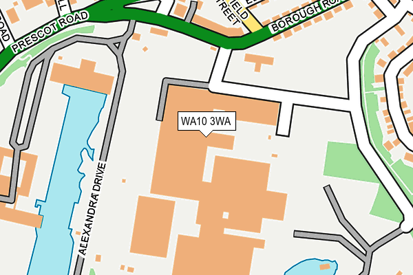
WA10 3WA is located in the St Helens Town Centre electoral ward, within the metropolitan district of St. Helens and the English Parliamentary constituency of St Helens South and Whiston. The Sub Integrated Care Board (ICB) Location is NHS Cheshire and Merseyside ICB - 01X and the police force is Merseyside. This postcode has been in use since January 1995.


GetTheData
Source: OS OpenMap – Local (Ordnance Survey)
Source: OS VectorMap District (Ordnance Survey)
Licence: Open Government Licence (requires attribution)
| Easting | 350130 |
| Northing | 394700 |
| Latitude | 53.446693 |
| Longitude | -2.752328 |
GetTheData
Source: Open Postcode Geo
Licence: Open Government Licence
| Country | England |
| Postcode District | WA10 |
| ➜ WA10 open data dashboard ➜ See where WA10 is on a map ➜ Where is St Helens? | |
GetTheData
Source: Land Registry Price Paid Data
Licence: Open Government Licence
Elevation or altitude of WA10 3WA as distance above sea level:
| Metres | Feet | |
|---|---|---|
| Elevation | 50m | 164ft |
Elevation is measured from the approximate centre of the postcode, to the nearest point on an OS contour line from OS Terrain 50, which has contour spacing of ten vertical metres.
➜ How high above sea level am I? Find the elevation of your current position using your device's GPS.
GetTheData
Source: Open Postcode Elevation
Licence: Open Government Licence
| Ward | St Helens Town Centre |
| Constituency | St Helens South And Whiston |
GetTheData
Source: ONS Postcode Database
Licence: Open Government Licence
| January 2024 | Other theft | On or near Petrol Station | 326m |
| January 2024 | Other theft | On or near Petrol Station | 326m |
| January 2024 | Other theft | On or near Petrol Station | 326m |
| ➜ Get more crime data in our Crime section | |||
GetTheData
Source: data.police.uk
Licence: Open Government Licence
| Prescot Road (Borough Road) | Ravenhead | 155m |
| Underhill Road (Prescot Road) | West Park | 254m |
| The Shires (Borough Road) | Green Bank | 312m |
| Morrisons (Boundary Road) | St Helens | 368m |
| Dunriding Lane (Prescot Road) | West Park | 370m |
| Thatto Heath Station | 1.2km |
| St Helens Central Station | 1.6km |
| Eccleston Park Station | 2.6km |
GetTheData
Source: NaPTAN
Licence: Open Government Licence
GetTheData
Source: ONS Postcode Database
Licence: Open Government Licence


➜ Get more ratings from the Food Standards Agency
GetTheData
Source: Food Standards Agency
Licence: FSA terms & conditions
| Last Collection | |||
|---|---|---|---|
| Location | Mon-Fri | Sat | Distance |
| Eccleston Hill | 16:00 | 11:00 | 317m |
| Boundary Road | 17:30 | 11:00 | 486m |
| Liverpool Road Business Box | 18:30 | 834m | |
GetTheData
Source: Dracos
Licence: Creative Commons Attribution-ShareAlike
| Facility | Distance |
|---|---|
| Ravenhead Social Club (Closed) Alexandra Drive, St. Helens Grass Pitches | 382m |
| Jd Gyms (St Helens) Boundary Road, St. Helens Health and Fitness Gym, Studio | 501m |
| Crossfit Ksh Lawrenson Street, St Helens Health and Fitness Gym, Studio | 509m |
GetTheData
Source: Active Places
Licence: Open Government Licence
| School | Phase of Education | Distance |
|---|---|---|
| St Teresa's Catholic Primary School, Devon Street St Teresa's Catholic Primary School, Devon Street, St Helens, WA10 4HX | Primary | 896m |
| St Helens College Water Street, St Helens, WA10 1PP | 16 plus | 984m |
| St Mary & St Thomas' CofE Primary School Barton Close, St Helens, WA10 2HS | Primary | 1.1km |
GetTheData
Source: Edubase
Licence: Open Government Licence
The below table lists the International Territorial Level (ITL) codes (formerly Nomenclature of Territorial Units for Statistics (NUTS) codes) and Local Administrative Units (LAU) codes for WA10 3WA:
| ITL 1 Code | Name |
|---|---|
| TLD | North West (England) |
| ITL 2 Code | Name |
| TLD7 | Merseyside |
| ITL 3 Code | Name |
| TLD71 | East Merseyside |
| LAU 1 Code | Name |
| E08000013 | St. Helens |
GetTheData
Source: ONS Postcode Directory
Licence: Open Government Licence
The below table lists the Census Output Area (OA), Lower Layer Super Output Area (LSOA), and Middle Layer Super Output Area (MSOA) for WA10 3WA:
| Code | Name | |
|---|---|---|
| OA | E00034641 | |
| LSOA | E01006835 | St. Helens 016C |
| MSOA | E02001421 | St. Helens 016 |
GetTheData
Source: ONS Postcode Directory
Licence: Open Government Licence
| WA10 3RN | Borough Road | 135m |
| WA10 3TD | Borough Road | 160m |
| WA10 3UJ | Alexandra Drive | 171m |
| WA10 3UL | Enfield Street | 193m |
| WA10 3UH | Prescot Road | 219m |
| WA10 3TB | Borough Road | 233m |
| WA10 3TX | Prescot Road | 254m |
| WA10 3TU | Prescot Road | 275m |
| WA10 3TY | Prescot Road | 276m |
| WA10 2PY | James Grove | 283m |
GetTheData
Source: Open Postcode Geo; Land Registry Price Paid Data
Licence: Open Government Licence