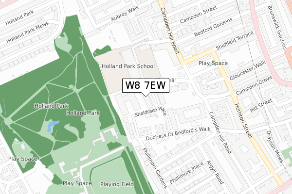
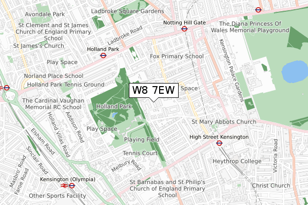
W8 7EW lies on Thornwood Gardens in London. W8 7EW is located in the Campden electoral ward, within the London borough of Kensington and Chelsea and the English Parliamentary constituency of Kensington. The Sub Integrated Care Board (ICB) Location is NHS North West London ICB - W2U3Z and the police force is Metropolitan Police. This postcode has been in use since September 2006.


GetTheData
Source: OS Open Zoomstack (Ordnance Survey)
Licence: Open Government Licence (requires attribution)
Attribution: Contains OS data © Crown copyright and database right 2025
Source: Open Postcode Geo
Licence: Open Government Licence (requires attribution)
Attribution: Contains OS data © Crown copyright and database right 2025; Contains Royal Mail data © Royal Mail copyright and database right 2025; Source: Office for National Statistics licensed under the Open Government Licence v.3.0
| Easting | 525034 |
| Northing | 179863 |
| Latitude | 51.503879 |
| Longitude | -0.199914 |
GetTheData
Source: Open Postcode Geo
Licence: Open Government Licence
| Street | Thornwood Gardens |
| Town/City | London |
| Country | England |
| Postcode District | W8 |
➜ See where W8 is on a map ➜ Where is Kensington? | |
GetTheData
Source: Land Registry Price Paid Data
Licence: Open Government Licence
Elevation or altitude of W8 7EW as distance above sea level:
| Metres | Feet | |
|---|---|---|
| Elevation | 30m | 98ft |
Elevation is measured from the approximate centre of the postcode, to the nearest point on an OS contour line from OS Terrain 50, which has contour spacing of ten vertical metres.
➜ How high above sea level am I? Find the elevation of your current position using your device's GPS.
GetTheData
Source: Open Postcode Elevation
Licence: Open Government Licence
| Ward | Campden |
| Constituency | Kensington |
GetTheData
Source: ONS Postcode Database
Licence: Open Government Licence
| Sheffield Terrace (Kensington Church Street) | Kensington | 452m |
| Phillimore Gardens (Kensington High Street) | Kensington | 489m |
| Holland Park (Holland Park Avenue) | Holland Park | 493m |
| Sheffield Terrace (Kensington Church Street) | Kensington | 501m |
| Phillimore Gardens (Kensington High Street) | Kensington | 511m |
| Holland Park Underground Station | Holland Park | 540m |
| High Street Kensington Underground Station | High Street Kensington | 586m |
| Notting Hill Gate Underground Station | Notting Hill | 641m |
| Kensington (Olympia) Underground Station | Olympia | 988m |
| Queensway Underground Station | Queensway | 1,139m |
| Kensington (Olympia) Station | 1km |
| Shepherds Bush Station | 1.2km |
| West Brompton Station | 1.9km |
GetTheData
Source: NaPTAN
Licence: Open Government Licence
| Percentage of properties with Next Generation Access | 100.0% |
| Percentage of properties with Superfast Broadband | 100.0% |
| Percentage of properties with Ultrafast Broadband | 100.0% |
| Percentage of properties with Full Fibre Broadband | 100.0% |
Superfast Broadband is between 30Mbps and 300Mbps
Ultrafast Broadband is > 300Mbps
| Median download speed | 12.3Mbps |
| Average download speed | 12.3Mbps |
| Maximum download speed | 12.36Mbps |
| Median upload speed | 0.7Mbps |
| Average upload speed | 0.7Mbps |
| Maximum upload speed | 0.90Mbps |
| Percentage of properties unable to receive 2Mbps | 0.0% |
| Percentage of properties unable to receive 5Mbps | 0.0% |
| Percentage of properties unable to receive 10Mbps | 0.0% |
| Percentage of properties unable to receive 30Mbps | 0.0% |
GetTheData
Source: Ofcom
Licence: Ofcom Terms of Use (requires attribution)
GetTheData
Source: ONS Postcode Database
Licence: Open Government Licence


➜ Get more ratings from the Food Standards Agency
GetTheData
Source: Food Standards Agency
Licence: FSA terms & conditions
| Last Collection | |||
|---|---|---|---|
| Location | Mon-Fri | Sat | Distance |
| Bedford Gardens | 17:30 | 12:00 | 243m |
| Observatory Gardens | 17:30 | 12:00 | 261m |
| Upper Phillimore Walk | 17:30 | 12:00 | 280m |
GetTheData
Source: Dracos
Licence: Creative Commons Attribution-ShareAlike
The below table lists the International Territorial Level (ITL) codes (formerly Nomenclature of Territorial Units for Statistics (NUTS) codes) and Local Administrative Units (LAU) codes for W8 7EW:
| ITL 1 Code | Name |
|---|---|
| TLI | London |
| ITL 2 Code | Name |
| TLI3 | Inner London - West |
| ITL 3 Code | Name |
| TLI33 | Kensington & Chelsea and Hammersmith & Fulham |
| LAU 1 Code | Name |
| E09000020 | Kensington and Chelsea |
GetTheData
Source: ONS Postcode Directory
Licence: Open Government Licence
The below table lists the Census Output Area (OA), Lower Layer Super Output Area (LSOA), and Middle Layer Super Output Area (MSOA) for W8 7EW:
| Code | Name | |
|---|---|---|
| OA | E00014124 | |
| LSOA | E01002825 | Kensington and Chelsea 008B |
| MSOA | E02000584 | Kensington and Chelsea 008 |
GetTheData
Source: ONS Postcode Directory
Licence: Open Government Licence
| W8 7EB | Thornwood Gardens | 35m |
| W8 7EY | Thornwood Gardens | 47m |
| W8 7EA | Thornwood Gardens | 51m |
| W8 7ER | Thornwood Gardens | 57m |
| W8 7QS | Sheldrake Place | 68m |
| W8 7QW | Duchess Of Bedfords Walk | 98m |
| W8 7QH | Campden Hill Gate | 106m |
| W8 7QJ | Campden Hill Gate | 107m |
| W8 7QN | Duchess Of Bedfords Walk | 118m |
| W8 7QP | Duchess Of Bedfords Walk | 118m |
GetTheData
Source: Open Postcode Geo; Land Registry Price Paid Data
Licence: Open Government Licence