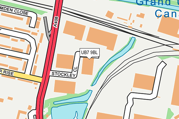
UB7 9BL is located in the West Drayton electoral ward, within the London borough of Hillingdon and the English Parliamentary constituency of Hayes and Harlington. The Sub Integrated Care Board (ICB) Location is NHS North West London ICB - W2U3Z and the police force is Metropolitan Police. This postcode has been in use since January 1980.


GetTheData
Source: OS OpenMap – Local (Ordnance Survey)
Source: OS VectorMap District (Ordnance Survey)
Licence: Open Government Licence (requires attribution)
| Easting | 507764 |
| Northing | 179673 |
| Latitude | 51.505725 |
| Longitude | -0.448690 |
GetTheData
Source: Open Postcode Geo
Licence: Open Government Licence
| Country | England |
| Postcode District | UB7 |
| ➜ UB7 open data dashboard ➜ See where UB7 is on a map ➜ Where is West Drayton? | |
GetTheData
Source: Land Registry Price Paid Data
Licence: Open Government Licence
Elevation or altitude of UB7 9BL as distance above sea level:
| Metres | Feet | |
|---|---|---|
| Elevation | 30m | 98ft |
Elevation is measured from the approximate centre of the postcode, to the nearest point on an OS contour line from OS Terrain 50, which has contour spacing of ten vertical metres.
➜ How high above sea level am I? Find the elevation of your current position using your device's GPS.
GetTheData
Source: Open Postcode Elevation
Licence: Open Government Licence
| Ward | West Drayton |
| Constituency | Hayes And Harlington |
GetTheData
Source: ONS Postcode Database
Licence: Open Government Licence
| November 2023 | Criminal damage and arson | On or near Park/Open Space | 242m |
| October 2023 | Vehicle crime | On or near Park/Open Space | 242m |
| July 2023 | Public order | On or near Park/Open Space | 242m |
| ➜ Get more crime data in our Crime section | |||
GetTheData
Source: data.police.uk
Licence: Open Government Licence
| Lavender Rise Stockley Road (Lavender Rise) | Stockley Park | 241m |
| Lavender Rise Stockley Road (Lavender Rise) | Stockley Park | 242m |
| Stockley Road | Stockley Park | 312m |
| Stockley Road | Stockley Park | 333m |
| Prologis Park | Stockley Park | 439m |
| West Drayton Station | 1.7km |
| Hayes & Harlington Station | 2km |
| Heathrow Terminals 1-3 Station | 3.8km |
GetTheData
Source: NaPTAN
Licence: Open Government Licence
GetTheData
Source: ONS Postcode Database
Licence: Open Government Licence


➜ Get more ratings from the Food Standards Agency
GetTheData
Source: Food Standards Agency
Licence: FSA terms & conditions
| Last Collection | |||
|---|---|---|---|
| Location | Mon-Fri | Sat | Distance |
| Stockley Park | 18:30 | 12:45 | 550m |
| Stockley Park | 18:30 | 556m | |
| Bourne Avenue | 16:45 | 13:00 | 797m |
GetTheData
Source: Dracos
Licence: Creative Commons Attribution-ShareAlike
| Facility | Distance |
|---|---|
| Bourne Farm Playing Fields Bourne Avenue, Hayes Grass Pitches | 558m |
| Heathpark Golf Club (Closed) Stockley Road, West Drayton Golf | 725m |
| Spirit Health Club (Heathrow) Stockley Road, West Drayton Swimming Pool, Health and Fitness Gym | 794m |
GetTheData
Source: Active Places
Licence: Open Government Licence
| School | Phase of Education | Distance |
|---|---|---|
| Pinkwell Primary School Pinkwell Lane, Hayes, UB3 1PG | Primary | 1.1km |
| West Drayton Academy Kingston Lane, West Drayton, UB7 9EA | Primary | 1.2km |
| Cherry Lane Primary School Sipson Road, West Drayton, UB7 9DL | Primary | 1.3km |
GetTheData
Source: Edubase
Licence: Open Government Licence
The below table lists the International Territorial Level (ITL) codes (formerly Nomenclature of Territorial Units for Statistics (NUTS) codes) and Local Administrative Units (LAU) codes for UB7 9BL:
| ITL 1 Code | Name |
|---|---|
| TLI | London |
| ITL 2 Code | Name |
| TLI7 | Outer London - West and North West |
| ITL 3 Code | Name |
| TLI74 | Harrow and Hillingdon |
| LAU 1 Code | Name |
| E09000017 | Hillingdon |
GetTheData
Source: ONS Postcode Directory
Licence: Open Government Licence
The below table lists the Census Output Area (OA), Lower Layer Super Output Area (LSOA), and Middle Layer Super Output Area (MSOA) for UB7 9BL:
| Code | Name | |
|---|---|---|
| OA | E00012593 | |
| LSOA | E01002532 | Hillingdon 028E |
| MSOA | E02000521 | Hillingdon 028 |
GetTheData
Source: ONS Postcode Directory
Licence: Open Government Licence
| UB7 9AJ | Mulberry Crescent | 185m |
| UB7 9AH | Mulberry Crescent | 238m |
| UB7 9AP | Lavender Rise | 297m |
| UB7 9AS | Briar Way | 307m |
| UB7 9PP | Eastwood Road | 392m |
| UB7 9AN | Jasmine Terrace | 397m |
| UB3 1SW | Nine Acres Close | 404m |
| UB7 9AQ | Mulberry Crescent | 428m |
| UB3 1SU | Nine Acres Close | 429m |
| UB3 1QF | Denbigh Drive | 435m |
GetTheData
Source: Open Postcode Geo; Land Registry Price Paid Data
Licence: Open Government Licence