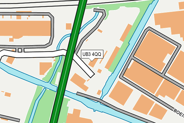
UB3 4QQ is located in the Pinkwell electoral ward, within the London borough of Hillingdon and the English Parliamentary constituency of Hayes and Harlington. The Sub Integrated Care Board (ICB) Location is NHS North West London ICB - W2U3Z and the police force is Metropolitan Police. This postcode has been in use since June 1999.


GetTheData
Source: OS OpenMap – Local (Ordnance Survey)
Source: OS VectorMap District (Ordnance Survey)
Licence: Open Government Licence (requires attribution)
| Easting | 510667 |
| Northing | 179216 |
| Latitude | 51.501058 |
| Longitude | -0.407003 |
GetTheData
Source: Open Postcode Geo
Licence: Open Government Licence
| Country | England |
| Postcode District | UB3 |
| ➜ UB3 open data dashboard ➜ See where UB3 is on a map ➜ Where is Southall? | |
GetTheData
Source: Land Registry Price Paid Data
Licence: Open Government Licence
Elevation or altitude of UB3 4QQ as distance above sea level:
| Metres | Feet | |
|---|---|---|
| Elevation | 30m | 98ft |
Elevation is measured from the approximate centre of the postcode, to the nearest point on an OS contour line from OS Terrain 50, which has contour spacing of ten vertical metres.
➜ How high above sea level am I? Find the elevation of your current position using your device's GPS.
GetTheData
Source: Open Postcode Elevation
Licence: Open Government Licence
| Ward | Pinkwell |
| Constituency | Hayes And Harlington |
GetTheData
Source: ONS Postcode Database
Licence: Open Government Licence
| June 2022 | Theft from the person | On or near Bulls Bridge Road | 118m |
| June 2022 | Shoplifting | On or near Bulls Bridge Road | 118m |
| June 2022 | Other theft | On or near Boeing Way | 235m |
| ➜ Get more crime data in our Crime section | |||
GetTheData
Source: data.police.uk
Licence: Open Government Licence
| Bulls Bridge Tesco | Cranford | 279m |
| Hayes Road Tesco | Cranford | 345m |
| Hayes Road Tesco | Cranford | 426m |
| Roseville Road | Cranford Park | 534m |
| North Hyde Road Hayes Town | Hayes Town | 557m |
| Hayes & Harlington Station | 1km |
| Southall Station | 2km |
| Heathrow Airport Central Bus Stn (Rail-Air) | 4.6km |
GetTheData
Source: NaPTAN
Licence: Open Government Licence
| Percentage of properties with Next Generation Access | 100.0% |
| Percentage of properties with Superfast Broadband | 100.0% |
| Percentage of properties with Ultrafast Broadband | 0.0% |
| Percentage of properties with Full Fibre Broadband | 0.0% |
Superfast Broadband is between 30Mbps and 300Mbps
Ultrafast Broadband is > 300Mbps
| Percentage of properties unable to receive 2Mbps | 0.0% |
| Percentage of properties unable to receive 5Mbps | 0.0% |
| Percentage of properties unable to receive 10Mbps | 0.0% |
| Percentage of properties unable to receive 30Mbps | 0.0% |
GetTheData
Source: Ofcom
Licence: Ofcom Terms of Use (requires attribution)
GetTheData
Source: ONS Postcode Database
Licence: Open Government Licence


➜ Get more ratings from the Food Standards Agency
GetTheData
Source: Food Standards Agency
Licence: FSA terms & conditions
| Last Collection | |||
|---|---|---|---|
| Location | Mon-Fri | Sat | Distance |
| Tesco | 18:30 | 12:45 | 260m |
| Brent Road Industrial Estate | 18:45 | 532m | |
| Derley Road | 17:15 | 12:15 | 639m |
GetTheData
Source: Dracos
Licence: Creative Commons Attribution-ShareAlike
| Facility | Distance |
|---|---|
| Olympian Fitness Pump Lane, Hayes Health and Fitness Gym, Studio | 759m |
| Jack Hi Indoor Bowls Club Silverdale Road, Hayes Indoor Bowls | 776m |
| London Airlinks Golf Course Southall Lane, Hounslow Golf | 909m |
GetTheData
Source: Active Places
Licence: Open Government Licence
| School | Phase of Education | Distance |
|---|---|---|
| Featherstone Primary and Nursery School Western Road, Southall, UB2 5JT | Primary | 862m |
| Guru Nanak Sikh Academy Springfield Road, Hayes, UB4 0LT | All-through | 1km |
| Nanaksar Primary School Springfield Road, Hillingdon, Hayes, UB4 0LT | Primary | 1km |
GetTheData
Source: Edubase
Licence: Open Government Licence
The below table lists the International Territorial Level (ITL) codes (formerly Nomenclature of Territorial Units for Statistics (NUTS) codes) and Local Administrative Units (LAU) codes for UB3 4QQ:
| ITL 1 Code | Name |
|---|---|
| TLI | London |
| ITL 2 Code | Name |
| TLI7 | Outer London - West and North West |
| ITL 3 Code | Name |
| TLI74 | Harrow and Hillingdon |
| LAU 1 Code | Name |
| E09000017 | Hillingdon |
GetTheData
Source: ONS Postcode Directory
Licence: Open Government Licence
The below table lists the Census Output Area (OA), Lower Layer Super Output Area (LSOA), and Middle Layer Super Output Area (MSOA) for UB3 4QQ:
| Code | Name | |
|---|---|---|
| OA | E00012477 | |
| LSOA | E01002507 | Hillingdon 027F |
| MSOA | E02000520 | Hillingdon 027 |
GetTheData
Source: ONS Postcode Directory
Licence: Open Government Licence
| UB3 3NT | Peter James Business Centre | 444m |
| UB3 4QR | North Hyde Gardens | 481m |
| UB3 4QS | Water Splash Lane | 510m |
| UB2 5LD | Brent Road | 514m |
| UB3 4QG | Nestles Avenue | 517m |
| UB3 4PN | Sutherland Avenue | 526m |
| UB2 5XD | Western International Market | 539m |
| UB3 3NW | Chesterfield Way | 540m |
| UB3 3NB | Pump Lane | 553m |
| UB2 5LA | Brent Road | 554m |
GetTheData
Source: Open Postcode Geo; Land Registry Price Paid Data
Licence: Open Government Licence