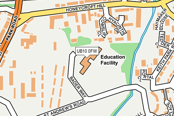
UB10 0FW is located in the Hillingdon West electoral ward, within the London borough of Hillingdon and the English Parliamentary constituency of Uxbridge and South Ruislip. The Sub Integrated Care Board (ICB) Location is NHS North West London ICB - W2U3Z and the police force is Metropolitan Police. This postcode has been in use since September 2014.


GetTheData
Source: OS OpenMap – Local (Ordnance Survey)
Source: OS VectorMap District (Ordnance Survey)
Licence: Open Government Licence (requires attribution)
| Easting | 506338 |
| Northing | 184149 |
| Latitude | 51.546226 |
| Longitude | -0.467879 |
GetTheData
Source: Open Postcode Geo
Licence: Open Government Licence
| Country | England |
| Postcode District | UB10 |
| ➜ UB10 open data dashboard ➜ See where UB10 is on a map ➜ Where is London? | |
GetTheData
Source: Land Registry Price Paid Data
Licence: Open Government Licence
Elevation or altitude of UB10 0FW as distance above sea level:
| Metres | Feet | |
|---|---|---|
| Elevation | 40m | 131ft |
Elevation is measured from the approximate centre of the postcode, to the nearest point on an OS contour line from OS Terrain 50, which has contour spacing of ten vertical metres.
➜ How high above sea level am I? Find the elevation of your current position using your device's GPS.
GetTheData
Source: Open Postcode Elevation
Licence: Open Government Licence
| Ward | Hillingdon West |
| Constituency | Uxbridge And South Ruislip |
GetTheData
Source: ONS Postcode Database
Licence: Open Government Licence
| January 2024 | Other theft | On or near Further/Higher Educational Building | 423m |
| January 2024 | Other theft | On or near Further/Higher Educational Building | 423m |
| December 2023 | Anti-social behaviour | On or near Further/Higher Educational Building | 423m |
| ➜ Get more crime data in our Crime section | |||
GetTheData
Source: data.police.uk
Licence: Open Government Licence
| Hillingdon T A Centre (Honeycroft Hill) | Uxbridge | 169m |
| Hillingdon T A Centre | Uxbridge | 220m |
| Honey Hill | Uxbridge | 276m |
| Uxbridge College (Park Road) | Uxbridge | 329m |
| Uxbridge College (Park Road) | Uxbridge | 379m |
| Uxbridge Underground Station | Uxbridge | 699m |
| Hillingdon Underground Station | North Hillingdon | 1,504m |
| West Ruislip Station | 3.3km |
| West Drayton Station | 4km |
| Denham Station | 4.2km |
GetTheData
Source: NaPTAN
Licence: Open Government Licence
| Percentage of properties with Next Generation Access | 0.0% |
| Percentage of properties with Superfast Broadband | 0.0% |
| Percentage of properties with Ultrafast Broadband | 0.0% |
| Percentage of properties with Full Fibre Broadband | 0.0% |
Superfast Broadband is between 30Mbps and 300Mbps
Ultrafast Broadband is > 300Mbps
| Percentage of properties unable to receive 2Mbps | 0.0% |
| Percentage of properties unable to receive 5Mbps | 0.0% |
| Percentage of properties unable to receive 10Mbps | 0.0% |
| Percentage of properties unable to receive 30Mbps | 0.0% |
GetTheData
Source: Ofcom
Licence: Ofcom Terms of Use (requires attribution)
GetTheData
Source: ONS Postcode Database
Licence: Open Government Licence


➜ Get more ratings from the Food Standards Agency
GetTheData
Source: Food Standards Agency
Licence: FSA terms & conditions
| Last Collection | |||
|---|---|---|---|
| Location | Mon-Fri | Sat | Distance |
| Uxbridge Common Post Office | 18:30 | 12:00 | 299m |
| Belmont Road | 18:30 | 12:45 | 555m |
| Manor Waye | 18:15 | 12:45 | 678m |
GetTheData
Source: Dracos
Licence: Creative Commons Attribution-ShareAlike
| Facility | Distance |
|---|---|
| Uxbridge College Park Road, Uxbridge Health and Fitness Gym, Sports Hall, Artificial Grass Pitch, Outdoor Tennis Courts | 423m |
| Active4less (Uxbridge) High Street, Uxbridge Health and Fitness Gym, Studio | 486m |
| Hermitage Primary School Belmont Road, Uxbridge Grass Pitches | 554m |
GetTheData
Source: Active Places
Licence: Open Government Licence
| School | Phase of Education | Distance |
|---|---|---|
| HRUC (Harrow, Richmond & Uxbridge Colleges) Park Road, Uxbridge, UB8 1NQ | 16 plus | 424m |
| Hermitage Primary School Belmont Road, Uxbridge, UB8 1RB | Primary | 554m |
| John Locke Academy Bader Way, Uxbridge, UB10 0FW | Primary | 559m |
GetTheData
Source: Edubase
Licence: Open Government Licence
The below table lists the International Territorial Level (ITL) codes (formerly Nomenclature of Territorial Units for Statistics (NUTS) codes) and Local Administrative Units (LAU) codes for UB10 0FW:
| ITL 1 Code | Name |
|---|---|
| TLI | London |
| ITL 2 Code | Name |
| TLI7 | Outer London - West and North West |
| ITL 3 Code | Name |
| TLI74 | Harrow and Hillingdon |
| LAU 1 Code | Name |
| E09000017 | Hillingdon |
GetTheData
Source: ONS Postcode Directory
Licence: Open Government Licence
The below table lists the Census Output Area (OA), Lower Layer Super Output Area (LSOA), and Middle Layer Super Output Area (MSOA) for UB10 0FW:
| Code | Name | |
|---|---|---|
| OA | E00012520 | |
| LSOA | E01002515 | Hillingdon 015D |
| MSOA | E02000508 | Hillingdon 015 |
GetTheData
Source: ONS Postcode Directory
Licence: Open Government Licence
| UB10 9QN | Cowslip Close | 112m |
| UB10 9NH | Honeycroft Hill | 141m |
| UB10 9QW | Hyacinth Drive | 173m |
| UB10 0FE | Portal Close | 194m |
| UB10 9NQ | Honeycroft Hill | 195m |
| UB10 0FG | Keith Park Road | 229m |
| UB10 9NG | North Way | 274m |
| UB10 0QL | Giles Crescent | 282m |
| UB10 0RQ | Keith Park Road | 288m |
| UB10 0FA | Newall Close | 296m |
GetTheData
Source: Open Postcode Geo; Land Registry Price Paid Data
Licence: Open Government Licence