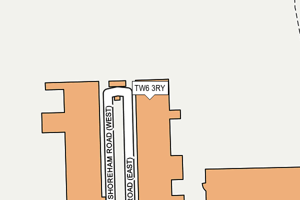
TW6 3RY is located in the Heathrow Villages electoral ward, within the London borough of Hillingdon and the English Parliamentary constituency of Hayes and Harlington. The Sub Integrated Care Board (ICB) Location is NHS North West London ICB - W2U3Z and the police force is Metropolitan Police. This postcode has been in use since January 1992.


GetTheData
Source: OS OpenMap – Local (Ordnance Survey)
Source: OS VectorMap District (Ordnance Survey)
Licence: Open Government Licence (requires attribution)
| Easting | 506477 |
| Northing | 174829 |
| Latitude | 51.462429 |
| Longitude | -0.468686 |
GetTheData
Source: Open Postcode Geo
Licence: Open Government Licence
| Country | England |
| Postcode District | TW6 |
| ➜ TW6 open data dashboard ➜ See where TW6 is on a map ➜ Where is London? | |
GetTheData
Source: Land Registry Price Paid Data
Licence: Open Government Licence
Elevation or altitude of TW6 3RY as distance above sea level:
| Metres | Feet | |
|---|---|---|
| Elevation | 20m | 66ft |
Elevation is measured from the approximate centre of the postcode, to the nearest point on an OS contour line from OS Terrain 50, which has contour spacing of ten vertical metres.
➜ How high above sea level am I? Find the elevation of your current position using your device's GPS.
GetTheData
Source: Open Postcode Elevation
Licence: Open Government Licence
| Ward | Heathrow Villages |
| Constituency | Hayes And Harlington |
GetTheData
Source: ONS Postcode Database
Licence: Open Government Licence
| June 2022 | Other theft | On or near Shoreham Road (East) | 176m |
| February 2022 | Other theft | On or near Shoreham Road (East) | 176m |
| February 2022 | Other theft | On or near Shoreham Road (East) | 176m |
| ➜ Get more crime data in our Crime section | |||
GetTheData
Source: data.police.uk
Licence: Open Government Licence
| Heathrow Cargo Area (Stirling Road) | Heathrow Airport | 409m |
| Bedfont Road (Clare Road) | Stanwell | 531m |
| Riverside Road (Bedfont Road) | Stanwell | 548m |
| Bedfont Road (Clare Road) | Stanwell | 563m |
| Riverside Road (Bedfont Road) | Stanwell | 571m |
| Heathrow Terminals 1-2-3 Underground Station | Heathrow Airport Terminals 1-3 | 1,503m |
| Heathrow Terminals 1-3 Station | 1.4km |
| Heathrow Airport Central Bus Stn (Rail-Air) | 1.4km |
| Heathrow Terminal 4 (Rail-Air) | 1.5km |
GetTheData
Source: NaPTAN
Licence: Open Government Licence
GetTheData
Source: ONS Postcode Database
Licence: Open Government Licence


➜ Get more ratings from the Food Standards Agency
GetTheData
Source: Food Standards Agency
Licence: FSA terms & conditions
| Last Collection | |||
|---|---|---|---|
| Location | Mon-Fri | Sat | Distance |
| Northumberland Close | 18:30 | 588m | |
| Kingsway | 17:30 | 11:30 | 1,200m |
| Post Office, Terminal 2 | 18:30 | 11:45 | 1,469m |
GetTheData
Source: Dracos
Licence: Creative Commons Attribution-ShareAlike
| Facility | Distance |
|---|---|
| Stanwell Recreation Ground Lindsay Close, Stanwell, Staines-upon-thames Outdoor Tennis Courts | 723m |
| Stanwell Fields Ce Primary School Clare Road, Stanwell, Staines-upon-thames Grass Pitches | 890m |
| Long Lane Recreation Ground Cambria Gardens, Staines Grass Pitches, Outdoor Tennis Courts | 1.1km |
GetTheData
Source: Active Places
Licence: Open Government Licence
| School | Phase of Education | Distance |
|---|---|---|
| Stanwell Fields CofE Primary School Clare Road, Stanwell, Staines-upon-Thames, TW19 7DB | Primary | 909m |
| Town Farm Primary School & Nursery St Mary's Crescent, Stanwell, Staines, TW19 7HU | Primary | 1.3km |
| Green Corridor Main Road Nurseries, Stanwell Moor Road, London, TW19 6BS | Not applicable | 1.9km |
GetTheData
Source: Edubase
Licence: Open Government Licence
The below table lists the International Territorial Level (ITL) codes (formerly Nomenclature of Territorial Units for Statistics (NUTS) codes) and Local Administrative Units (LAU) codes for TW6 3RY:
| ITL 1 Code | Name |
|---|---|
| TLI | London |
| ITL 2 Code | Name |
| TLI7 | Outer London - West and North West |
| ITL 3 Code | Name |
| TLI74 | Harrow and Hillingdon |
| LAU 1 Code | Name |
| E09000017 | Hillingdon |
GetTheData
Source: ONS Postcode Directory
Licence: Open Government Licence
The below table lists the Census Output Area (OA), Lower Layer Super Output Area (LSOA), and Middle Layer Super Output Area (MSOA) for TW6 3RY:
| Code | Name | |
|---|---|---|
| OA | E00012179 | |
| LSOA | E01002444 | Hillingdon 031A |
| MSOA | E02000524 | Hillingdon 031 |
GetTheData
Source: ONS Postcode Directory
Licence: Open Government Licence
| TW19 7LX | Cleveland Park | 546m |
| TW19 7LT | Bedfont Road | 555m |
| TW19 7LA | Riverside Road | 575m |
| TW19 7LR | Bedfont Road | 600m |
| TW19 7LP | Riverside Place | 605m |
| TW19 7LD | Callis Farm Close | 613m |
| TW19 7HA | Whitley Close | 613m |
| TW19 7LS | Deridene Close | 618m |
| TW19 7EQ | Clare Road | 619m |
| TW19 7NA | Westland Close | 626m |
GetTheData
Source: Open Postcode Geo; Land Registry Price Paid Data
Licence: Open Government Licence