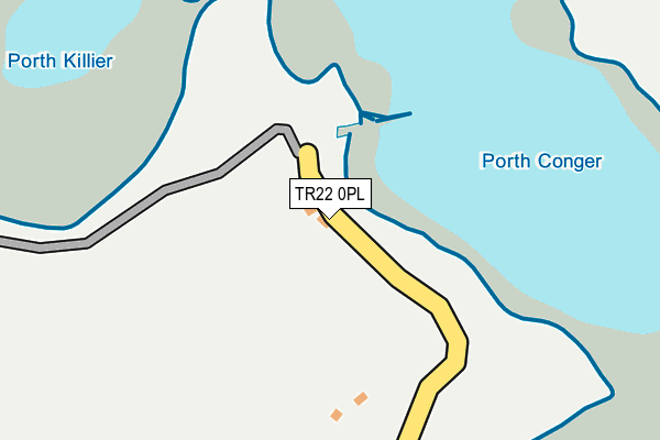
TR22 0PL is in St Agnes, Isles Of Scilly. TR22 0PL is located in the St Agnes electoral ward, within the unitary authority of Isles of Scilly and the English Parliamentary constituency of St Ives. The Sub Integrated Care Board (ICB) Location is NHS Cornwall and the Isles of Scilly ICB - 11N and the police force is Devon & Cornwall. This postcode has been in use since January 1980.


GetTheData
Source: OS OpenMap – Local (Ordnance Survey)
Source: OS VectorMap District (Ordnance Survey)
Licence: Open Government Licence (requires attribution)
| Easting | 88364 |
| Northing | 8478 |
| Latitude | 49.895171 |
| Longitude | -6.340873 |
GetTheData
Source: Open Postcode Geo
Licence: Open Government Licence
| Locality | St Agnes |
| Town/City | Isles Of Scilly |
| Country | England |
| Postcode District | TR22 |
| ➜ TR22 open data dashboard ➜ See where TR22 is on a map | |
GetTheData
Source: Land Registry Price Paid Data
Licence: Open Government Licence
Elevation or altitude of TR22 0PL as distance above sea level:
| Metres | Feet | |
|---|---|---|
| Elevation | 10m | 33ft |
Elevation is measured from the approximate centre of the postcode, to the nearest point on an OS contour line from OS Terrain 50, which has contour spacing of ten vertical metres.
➜ How high above sea level am I? Find the elevation of your current position using your device's GPS.
GetTheData
Source: Open Postcode Elevation
Licence: Open Government Licence
| Ward | St Agnes |
| Constituency | St Ives |
GetTheData
Source: ONS Postcode Database
Licence: Open Government Licence
➜ Broadband speed and availability dashboard for TR22 0PL
| Percentage of properties with Next Generation Access | 100.0% |
| Percentage of properties with Superfast Broadband | 100.0% |
| Percentage of properties with Ultrafast Broadband | 0.0% |
| Percentage of properties with Full Fibre Broadband | 0.0% |
Superfast Broadband is between 30Mbps and 300Mbps
Ultrafast Broadband is > 300Mbps
| Median download speed | 38.8Mbps |
| Average download speed | 38.2Mbps |
| Maximum download speed | 78.64Mbps |
| Median upload speed | 7.5Mbps |
| Average upload speed | 8.4Mbps |
| Maximum upload speed | 20.00Mbps |
| Percentage of properties unable to receive 2Mbps | 0.0% |
| Percentage of properties unable to receive 5Mbps | 0.0% |
| Percentage of properties unable to receive 10Mbps | 0.0% |
| Percentage of properties unable to receive 30Mbps | 0.0% |
➜ Broadband speed and availability dashboard for TR22 0PL
GetTheData
Source: Ofcom
Licence: Ofcom Terms of Use (requires attribution)
Estimated total energy consumption in TR22 0PL by fuel type, 2015.
| Consumption (kWh) | 437,456 |
|---|---|
| Meter count | 38 |
| Mean (kWh/meter) | 11,512 |
| Median (kWh/meter) | 8,440 |
GetTheData
Source: Postcode level gas estimates: 2015 (experimental)
Source: Postcode level electricity estimates: 2015 (experimental)
Licence: Open Government Licence
GetTheData
Source: ONS Postcode Database
Licence: Open Government Licence


➜ Get more ratings from the Food Standards Agency
GetTheData
Source: Food Standards Agency
Licence: FSA terms & conditions
| Last Collection | |||
|---|---|---|---|
| Location | Mon-Fri | Sat | Distance |
| St Agnes Spso (I.o.s.) | 13:00 | 08:00 | 365m |
| The Quay (St Mary's) | 13:00 | 08:00 | 2,797m |
| Well Cross (St Mary's) | 13:00 | 08:00 | 2,985m |
GetTheData
Source: Dracos
Licence: Creative Commons Attribution-ShareAlike
| Facility | Distance |
|---|---|
| Garrison Field Garrison, St. Mary's, Isles Of Scilly Grass Pitches, Outdoor Tennis Courts | 2.4km |
| Isles Of Scilly Tennis Club Church Road, St. Mary's, Isles Of Scilly Squash Courts, Outdoor Tennis Courts | 3.1km |
| The Five Islands Academy Church Road, St. Mary's, Isles Of Scilly Grass Pitches, Outdoor Tennis Courts | 3.2km |
GetTheData
Source: Active Places
Licence: Open Government Licence
| School | Phase of Education | Distance |
|---|---|---|
| The Five Islands Academy Church Road, Old Town, St Mary's, TR21 0NA | All-through | 3.3km |
GetTheData
Source: Edubase
Licence: Open Government Licence
The below table lists the International Territorial Level (ITL) codes (formerly Nomenclature of Territorial Units for Statistics (NUTS) codes) and Local Administrative Units (LAU) codes for TR22 0PL:
| ITL 1 Code | Name |
|---|---|
| TLK | South West (England) |
| ITL 2 Code | Name |
| TLK3 | Cornwall and Isles of Scilly |
| ITL 3 Code | Name |
| TLK30 | Cornwall and Isles of Scilly |
| LAU 1 Code | Name |
| E06000053 | Isles of Scilly |
GetTheData
Source: ONS Postcode Directory
Licence: Open Government Licence
The below table lists the Census Output Area (OA), Lower Layer Super Output Area (LSOA), and Middle Layer Super Output Area (MSOA) for TR22 0PL:
| Code | Name | |
|---|---|---|
| OA | E00096400 | |
| LSOA | E01019077 | Isles of Scilly 001A |
| MSOA | E02006781 | Isles of Scilly 001 |
GetTheData
Source: ONS Postcode Directory
Licence: Open Government Licence
| TR21 0LS | 2609m | |
| TR21 0JE | 2669m | |
| TR21 0JJ | Parsons Field | 2716m |
| TR21 0JG | 2737m | |
| TR21 0JF | Garrison Lane | 2741m |
| TR21 0JD | Garrison Lane | 2751m |
| TR21 0JH | Jerusalem Terrace | 2763m |
| TR21 0HZ | Well Lane | 2772m |
| TR21 0PZ | Silver Street | 2793m |
| TR21 0LL | Hugh Street | 2796m |
GetTheData
Source: Open Postcode Geo; Land Registry Price Paid Data
Licence: Open Government Licence