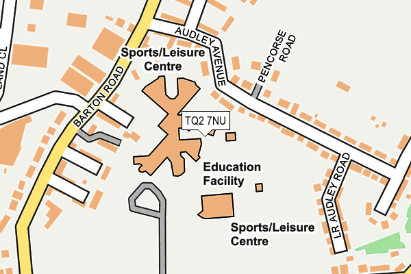
TQ2 7NU is located in the Tormohun electoral ward, within the unitary authority of Torbay and the English Parliamentary constituency of Torbay. The Sub Integrated Care Board (ICB) Location is NHS Devon ICB - 15N and the police force is Devon & Cornwall. This postcode has been in use since January 1980.


GetTheData
Source: OS OpenMap – Local (Ordnance Survey)
Source: OS VectorMap District (Ordnance Survey)
Licence: Open Government Licence (requires attribution)
| Easting | 290663 |
| Northing | 65640 |
| Latitude | 50.480346 |
| Longitude | -3.542379 |
GetTheData
Source: Open Postcode Geo
Licence: Open Government Licence
| Country | England |
| Postcode District | TQ2 |
| ➜ TQ2 open data dashboard ➜ See where TQ2 is on a map ➜ Where is Torquay? | |
GetTheData
Source: Land Registry Price Paid Data
Licence: Open Government Licence
Elevation or altitude of TQ2 7NU as distance above sea level:
| Metres | Feet | |
|---|---|---|
| Elevation | 70m | 230ft |
Elevation is measured from the approximate centre of the postcode, to the nearest point on an OS contour line from OS Terrain 50, which has contour spacing of ten vertical metres.
➜ How high above sea level am I? Find the elevation of your current position using your device's GPS.
GetTheData
Source: Open Postcode Elevation
Licence: Open Government Licence
| Ward | Tormohun |
| Constituency | Torbay |
GetTheData
Source: ONS Postcode Database
Licence: Open Government Licence
| June 2022 | Vehicle crime | On or near Sports/Recreation Area | 256m |
| June 2022 | Violence and sexual offences | On or near Sports/Recreation Area | 256m |
| June 2022 | Violence and sexual offences | On or near Penny'S Hill | 320m |
| ➜ Get more crime data in our Crime section | |||
GetTheData
Source: data.police.uk
Licence: Open Government Licence
| Torquay Academy (Barton Road) | Hele | 153m |
| Torquay Academy (Barton Road) | Hele | 169m |
| Torquay Academy (Cricket Filed Road) | Hele | 256m |
| Cricket Field Road (Torquay Community College) | Hele | 262m |
| Cemetery Lodge (Barton Road) | Hele | 293m |
| Torre Station | 0.8km |
| Torquay Station | 2.1km |
GetTheData
Source: NaPTAN
Licence: Open Government Licence
GetTheData
Source: ONS Postcode Database
Licence: Open Government Licence


➜ Get more ratings from the Food Standards Agency
GetTheData
Source: Food Standards Agency
Licence: FSA terms & conditions
| Last Collection | |||
|---|---|---|---|
| Location | Mon-Fri | Sat | Distance |
| Audley Avenue | 18:15 | 12:30 | 167m |
| Audley Park | 18:15 | 12:30 | 176m |
| Barton Road | 17:30 | 12:30 | 590m |
GetTheData
Source: Dracos
Licence: Creative Commons Attribution-ShareAlike
| Facility | Distance |
|---|---|
| Torquay Academy Cricketfield Road, Torquay Health and Fitness Gym, Grass Pitches, Sports Hall, Artificial Grass Pitch | 40m |
| Cricketfield Road Recreation Ground Cricketfield Road, Torquay Grass Pitches | 237m |
| Windmill Hill Playing Field Higher Audley Avenue, Torquay Grass Pitches | 289m |
GetTheData
Source: Active Places
Licence: Open Government Licence
| School | Phase of Education | Distance |
|---|---|---|
| Torquay Academy Cricketfield Road, Torquay, TQ2 7NU | Secondary | 47m |
| Torre Church of England Academy Barton Road, Torre C of E Academy, Barton Road, TORQUAY, TQ1 4DN | Primary | 463m |
| St Cuthbert Mayne School Trumlands Road, Torquay, TQ1 4RN | Secondary | 867m |
GetTheData
Source: Edubase
Licence: Open Government Licence
The below table lists the International Territorial Level (ITL) codes (formerly Nomenclature of Territorial Units for Statistics (NUTS) codes) and Local Administrative Units (LAU) codes for TQ2 7NU:
| ITL 1 Code | Name |
|---|---|
| TLK | South West (England) |
| ITL 2 Code | Name |
| TLK4 | Devon |
| ITL 3 Code | Name |
| TLK42 | Torbay |
| LAU 1 Code | Name |
| E06000027 | Torbay |
GetTheData
Source: ONS Postcode Directory
Licence: Open Government Licence
The below table lists the Census Output Area (OA), Lower Layer Super Output Area (LSOA), and Middle Layer Super Output Area (MSOA) for TQ2 7NU:
| Code | Name | |
|---|---|---|
| OA | E00077095 | |
| LSOA | E01015258 | Torbay 004B |
| MSOA | E02003157 | Torbay 004 |
GetTheData
Source: ONS Postcode Directory
Licence: Open Government Licence
| TQ2 7PB | Audley Avenue | 108m |
| TQ2 7PH | Lindfield Close | 138m |
| TQ2 7PE | Pencorse Road | 139m |
| TQ2 7NL | Charlotte Close | 145m |
| TQ2 7NJ | Kirkstead Close | 170m |
| TQ2 7NW | Cricketers Green | 180m |
| TQ2 7PD | Audley Avenue | 183m |
| TQ2 7PJ | Cricketers Green | 190m |
| TQ2 7NN | Cricketers Green | 223m |
| TQ2 7PQ | Lower Audley Road | 225m |
GetTheData
Source: Open Postcode Geo; Land Registry Price Paid Data
Licence: Open Government Licence