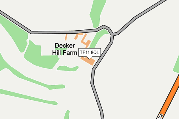
TF11 8QL is located in the Shifnal North electoral ward, within the unitary authority of Shropshire and the English Parliamentary constituency of The Wrekin. The Sub Integrated Care Board (ICB) Location is NHS Shropshire, Telford and Wrekin ICB - M2L0M and the police force is West Mercia. This postcode has been in use since January 1980.


GetTheData
Source: OS OpenMap – Local (Ordnance Survey)
Source: OS VectorMap District (Ordnance Survey)
Licence: Open Government Licence (requires attribution)
| Easting | 375119 |
| Northing | 309783 |
| Latitude | 52.685177 |
| Longitude | -2.369500 |
GetTheData
Source: Open Postcode Geo
Licence: Open Government Licence
| Country | England |
| Postcode District | TF11 |
| ➜ TF11 open data dashboard ➜ See where TF11 is on a map | |
GetTheData
Source: Land Registry Price Paid Data
Licence: Open Government Licence
Elevation or altitude of TF11 8QL as distance above sea level:
| Metres | Feet | |
|---|---|---|
| Elevation | 120m | 394ft |
Elevation is measured from the approximate centre of the postcode, to the nearest point on an OS contour line from OS Terrain 50, which has contour spacing of ten vertical metres.
➜ How high above sea level am I? Find the elevation of your current position using your device's GPS.
GetTheData
Source: Open Postcode Elevation
Licence: Open Government Licence
| Ward | Shifnal North |
| Constituency | The Wrekin |
GetTheData
Source: ONS Postcode Database
Licence: Open Government Licence
| June 2022 | Drugs | On or near B4379 | 468m |
| February 2021 | Anti-social behaviour | On or near B4379 | 468m |
| ➜ Get more crime data in our Crime section | |||
GetTheData
Source: data.police.uk
Licence: Open Government Licence
| Admirals Close Jct (Meadow Drive) | Shifnal | 1,000m |
| No. 8 (Admirals Close) | Shifnal | 1,097m |
| Beatty Close Jct (Balfour Road) | Shifnal | 1,138m |
| Drayton Road Jct (Newport Road) | Shifnal | 1,152m |
| Drayton Road Jct (Newport Road) | Shifnal | 1,174m |
| Shifnal Station | 2.1km |
| Telford Central Station | 4.9km |
| Cosford Station | 6.5km |
GetTheData
Source: NaPTAN
Licence: Open Government Licence
| Percentage of properties with Next Generation Access | 100.0% |
| Percentage of properties with Superfast Broadband | 0.0% |
| Percentage of properties with Ultrafast Broadband | 0.0% |
| Percentage of properties with Full Fibre Broadband | 0.0% |
Superfast Broadband is between 30Mbps and 300Mbps
Ultrafast Broadband is > 300Mbps
| Percentage of properties unable to receive 2Mbps | 0.0% |
| Percentage of properties unable to receive 5Mbps | 0.0% |
| Percentage of properties unable to receive 10Mbps | 0.0% |
| Percentage of properties unable to receive 30Mbps | 100.0% |
GetTheData
Source: Ofcom
Licence: Ofcom Terms of Use (requires attribution)
GetTheData
Source: ONS Postcode Database
Licence: Open Government Licence


➜ Get more ratings from the Food Standards Agency
GetTheData
Source: Food Standards Agency
Licence: FSA terms & conditions
| Last Collection | |||
|---|---|---|---|
| Location | Mon-Fri | Sat | Distance |
| Cheapside | 17:30 | 11:30 | 2,038m |
| Stafford Park 4 Meter Box | 18:15 | 3,769m | |
| Stafford Park 4 | 18:15 | 11:30 | 3,775m |
GetTheData
Source: Dracos
Licence: Creative Commons Attribution-ShareAlike
| Facility | Distance |
|---|---|
| Shifnal Golf Club Decker Hill, Shifnal Golf | 91m |
| Idsall Sports Centre Coppice Green Lane, Shifnal Sports Hall, Health and Fitness Gym, Grass Pitches, Outdoor Tennis Courts | 1.4km |
| Wheatfield Drive Recreation Ground Wheatfield Drive, Shifnal Grass Pitches | 1.4km |
GetTheData
Source: Active Places
Licence: Open Government Licence
| School | Phase of Education | Distance |
|---|---|---|
| Idsall School Coppice Green Lane, Shifnal, TF11 8PD | Secondary | 1.5km |
| Shifnal Primary School Curriers Lane, Shifnal, TF11 8EJ | Primary | 1.6km |
| Amberleigh Therapeutic School The Oaks, Redhill, Telford, TF2 9NZ | Not applicable | 2km |
GetTheData
Source: Edubase
Licence: Open Government Licence
The below table lists the International Territorial Level (ITL) codes (formerly Nomenclature of Territorial Units for Statistics (NUTS) codes) and Local Administrative Units (LAU) codes for TF11 8QL:
| ITL 1 Code | Name |
|---|---|
| TLG | West Midlands (England) |
| ITL 2 Code | Name |
| TLG2 | Shropshire and Staffordshire |
| ITL 3 Code | Name |
| TLG22 | Shropshire |
| LAU 1 Code | Name |
| E06000051 | Shropshire |
GetTheData
Source: ONS Postcode Directory
Licence: Open Government Licence
The below table lists the Census Output Area (OA), Lower Layer Super Output Area (LSOA), and Middle Layer Super Output Area (MSOA) for TF11 8QL:
| Code | Name | |
|---|---|---|
| OA | E00146973 | |
| LSOA | E01028857 | Shropshire 025E |
| MSOA | E02006008 | Shropshire 025 |
GetTheData
Source: ONS Postcode Directory
Licence: Open Government Licence
| TF11 8QN | 514m | |
| TF11 8BY | Meadow Drive | 995m |
| TF11 8TU | Mountbatten Close | 1025m |
| TF11 8BZ | Meadow Drive | 1048m |
| TF11 8TX | Collingwood Court | 1064m |
| TF11 8BU | Admirals Close | 1066m |
| TF11 8DA | Coppice Road | 1071m |
| TF11 8BX | Admirals Close | 1072m |
| TF11 8TT | Nelson Court | 1095m |
| TF11 8DB | Weston Close | 1117m |
GetTheData
Source: Open Postcode Geo; Land Registry Price Paid Data
Licence: Open Government Licence