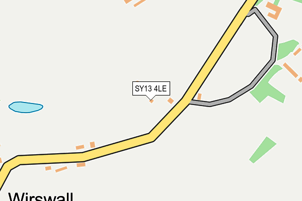
SY13 4LE is in Wirswall, Whitchurch. SY13 4LE is located in the Wrenbury electoral ward, within the unitary authority of Cheshire East and the English Parliamentary constituency of Eddisbury. The Sub Integrated Care Board (ICB) Location is NHS Cheshire and Merseyside ICB - 27D and the police force is Cheshire. This postcode has been in use since January 1980.


GetTheData
Source: OS OpenMap – Local (Ordnance Survey)
Source: OS VectorMap District (Ordnance Survey)
Licence: Open Government Licence (requires attribution)
| Easting | 354822 |
| Northing | 344209 |
| Latitude | 52.993294 |
| Longitude | -2.674518 |
GetTheData
Source: Open Postcode Geo
Licence: Open Government Licence
| Locality | Wirswall |
| Town/City | Whitchurch |
| Country | England |
| Postcode District | SY13 |
➜ See where SY13 is on a map ➜ Where is Wirswall? | |
GetTheData
Source: Land Registry Price Paid Data
Licence: Open Government Licence
Elevation or altitude of SY13 4LE as distance above sea level:
| Metres | Feet | |
|---|---|---|
| Elevation | 160m | 525ft |
Elevation is measured from the approximate centre of the postcode, to the nearest point on an OS contour line from OS Terrain 50, which has contour spacing of ten vertical metres.
➜ How high above sea level am I? Find the elevation of your current position using your device's GPS.
GetTheData
Source: Open Postcode Elevation
Licence: Open Government Licence
| Ward | Wrenbury |
| Constituency | Eddisbury |
GetTheData
Source: ONS Postcode Database
Licence: Open Government Licence
| Wirswall Hall (Wirswall Road) | Wirswall | 365m |
| Bradeley Green Lane (Whitchurch Road) | Bradeley Green | 1,378m |
| Whitchurch (Shrops) Station | 2.8km |
GetTheData
Source: NaPTAN
Licence: Open Government Licence
| Percentage of properties with Next Generation Access | 100.0% |
| Percentage of properties with Superfast Broadband | 0.0% |
| Percentage of properties with Ultrafast Broadband | 0.0% |
| Percentage of properties with Full Fibre Broadband | 0.0% |
Superfast Broadband is between 30Mbps and 300Mbps
Ultrafast Broadband is > 300Mbps
| Median download speed | 3.3Mbps |
| Average download speed | 3.2Mbps |
| Maximum download speed | 5.26Mbps |
| Median upload speed | 0.5Mbps |
| Average upload speed | 0.6Mbps |
| Maximum upload speed | 1.02Mbps |
| Percentage of properties unable to receive 2Mbps | 0.0% |
| Percentage of properties unable to receive 5Mbps | 61.5% |
| Percentage of properties unable to receive 10Mbps | 100.0% |
| Percentage of properties unable to receive 30Mbps | 100.0% |
GetTheData
Source: Ofcom
Licence: Ofcom Terms of Use (requires attribution)
GetTheData
Source: ONS Postcode Database
Licence: Open Government Licence

➜ Get more ratings from the Food Standards Agency
GetTheData
Source: Food Standards Agency
Licence: FSA terms & conditions
| Last Collection | |||
|---|---|---|---|
| Location | Mon-Fri | Sat | Distance |
| Brownlow Road | 17:30 | 11:15 | 2,514m |
| Fountain | 17:30 | 11:30 | 2,656m |
| High Street | 17:45 | 11:30 | 2,681m |
GetTheData
Source: Dracos
Licence: Creative Commons Attribution-ShareAlike
The below table lists the International Territorial Level (ITL) codes (formerly Nomenclature of Territorial Units for Statistics (NUTS) codes) and Local Administrative Units (LAU) codes for SY13 4LE:
| ITL 1 Code | Name |
|---|---|
| TLD | North West (England) |
| ITL 2 Code | Name |
| TLD6 | Cheshire |
| ITL 3 Code | Name |
| TLD62 | Cheshire East |
| LAU 1 Code | Name |
| E06000049 | Cheshire East |
GetTheData
Source: ONS Postcode Directory
Licence: Open Government Licence
The below table lists the Census Output Area (OA), Lower Layer Super Output Area (LSOA), and Middle Layer Super Output Area (MSOA) for SY13 4LE:
| Code | Name | |
|---|---|---|
| OA | E00093421 | |
| LSOA | E01018514 | Cheshire East 051E |
| MSOA | E02003840 | Cheshire East 051 |
GetTheData
Source: ONS Postcode Directory
Licence: Open Government Licence
| SY13 4LB | 340m | |
| SY13 4LF | 736m | |
| SY13 4LA | 739m | |
| SY13 4HE | Bradeley Green Lane | 937m |
| SY13 4HD | Bradeley Green Lane | 1264m |
| SY13 4NB | Heath Lane | 1475m |
| SY13 4HB | 1533m | |
| SY13 4JZ | 1552m | |
| SY13 4LP | 1606m | |
| SY13 4JY | 1616m |
GetTheData
Source: Open Postcode Geo; Land Registry Price Paid Data
Licence: Open Government Licence