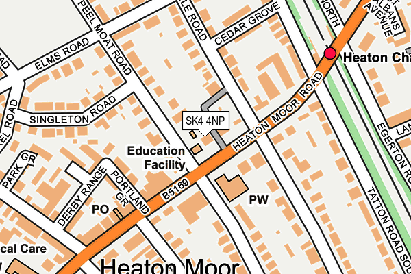
SK4 4NP is located in the Heatons North electoral ward, within the metropolitan district of Stockport and the English Parliamentary constituency of Stockport. The Sub Integrated Care Board (ICB) Location is NHS Greater Manchester ICB - 01W and the police force is Greater Manchester. This postcode has been in use since June 1998.


GetTheData
Source: OS OpenMap – Local (Ordnance Survey)
Source: OS VectorMap District (Ordnance Survey)
Licence: Open Government Licence (requires attribution)
| Easting | 388035 |
| Northing | 391964 |
| Latitude | 53.424332 |
| Longitude | -2.181519 |
GetTheData
Source: Open Postcode Geo
Licence: Open Government Licence
| Country | England |
| Postcode District | SK4 |
| ➜ SK4 open data dashboard ➜ See where SK4 is on a map ➜ Where is Stockport? | |
GetTheData
Source: Land Registry Price Paid Data
Licence: Open Government Licence
Elevation or altitude of SK4 4NP as distance above sea level:
| Metres | Feet | |
|---|---|---|
| Elevation | 70m | 230ft |
Elevation is measured from the approximate centre of the postcode, to the nearest point on an OS contour line from OS Terrain 50, which has contour spacing of ten vertical metres.
➜ How high above sea level am I? Find the elevation of your current position using your device's GPS.
GetTheData
Source: Open Postcode Elevation
Licence: Open Government Licence
| Ward | Heatons North |
| Constituency | Stockport |
GetTheData
Source: ONS Postcode Database
Licence: Open Government Licence
| Heaton Moor Rd/Heaton Chapel Stn (Heaton Moor Rd) | Heaton Chapel | 133m |
| Heaton Moor Rd/Shaw Rd (Heaton Moor Rd) | Heaton Moor | 200m |
| Heaton Moor Rd/Heaton Chapel Stn (Heaton Moor Rd) | Heaton Chapel | 216m |
| Heaton Moor Rd/Shaw Rd (Heaton Moor Rd) | Heaton Moor | 301m |
| Parsonage Rd/Heaton Moor Rd (Parsonage Rd) | Heaton Moor | 357m |
| Heaton Chapel Station | 0.2km |
| Reddish South Station | 2km |
| Mauldeth Road Station | 2.1km |
GetTheData
Source: NaPTAN
Licence: Open Government Licence
GetTheData
Source: ONS Postcode Database
Licence: Open Government Licence


➜ Get more ratings from the Food Standards Agency
GetTheData
Source: Food Standards Agency
Licence: FSA terms & conditions
| Last Collection | |||
|---|---|---|---|
| Location | Mon-Fri | Sat | Distance |
| Heaton Chapel Station | 17:30 | 11:30 | 183m |
| Parsonage Road | 17:30 | 11:30 | 417m |
| Buckingham Road | 17:30 | 11:30 | 460m |
GetTheData
Source: Dracos
Licence: Creative Commons Attribution-ShareAlike
| Facility | Distance |
|---|---|
| Heaton School St. James Road, Stockport Grass Pitches, Sports Hall | 474m |
| Peel Moat Sports And Target Fitness Centre (Closed) Buckingham Road, Stockport Sports Hall, Health and Fitness Gym, Artificial Grass Pitch, Grass Pitches, Squash Courts | 534m |
| Heaton Moor Rugby Football Club Green Lane, Stockport Grass Pitches, Outdoor Tennis Courts | 768m |
GetTheData
Source: Active Places
Licence: Open Government Licence
| School | Phase of Education | Distance |
|---|---|---|
| Covenant Christian School 48 Heaton Moor Road, Heaton Moor, Stockport, SK4 4NX | Not applicable | 24m |
| Heaton School St James Road, Heaton Moor, Stockport, SK4 4RE | Not applicable | 474m |
| St Thomas' Church of England Primary School Heaton Chapel Wellington Road North, Heaton Chapel, Stockport, SK4 4QG | Primary | 545m |
GetTheData
Source: Edubase
Licence: Open Government Licence
The below table lists the International Territorial Level (ITL) codes (formerly Nomenclature of Territorial Units for Statistics (NUTS) codes) and Local Administrative Units (LAU) codes for SK4 4NP:
| ITL 1 Code | Name |
|---|---|
| TLD | North West (England) |
| ITL 2 Code | Name |
| TLD3 | Greater Manchester |
| ITL 3 Code | Name |
| TLD35 | Greater Manchester South East |
| LAU 1 Code | Name |
| E08000007 | Stockport |
GetTheData
Source: ONS Postcode Directory
Licence: Open Government Licence
The below table lists the Census Output Area (OA), Lower Layer Super Output Area (LSOA), and Middle Layer Super Output Area (MSOA) for SK4 4NP:
| Code | Name | |
|---|---|---|
| OA | E00029689 | |
| LSOA | E01005866 | Stockport 006C |
| MSOA | E02001192 | Stockport 006 |
GetTheData
Source: ONS Postcode Directory
Licence: Open Government Licence
| SK4 4NU | Heaton Moor Road | 25m |
| SK4 4NX | Heaton Moor Road | 92m |
| SK4 4LT | Heaton Moor Road | 104m |
| SK4 4PB | Heaton Moor Road | 105m |
| SK4 4PL | Peel Moat Road | 116m |
| SK4 4AA | Portland Grove | 122m |
| SK4 4PE | Brownsville Road | 131m |
| SK4 4NZ | Heaton Moor Road | 143m |
| SK4 4RL | Stoneleigh Mews | 189m |
| SK4 4AB | Derby Range | 191m |
GetTheData
Source: Open Postcode Geo; Land Registry Price Paid Data
Licence: Open Government Licence