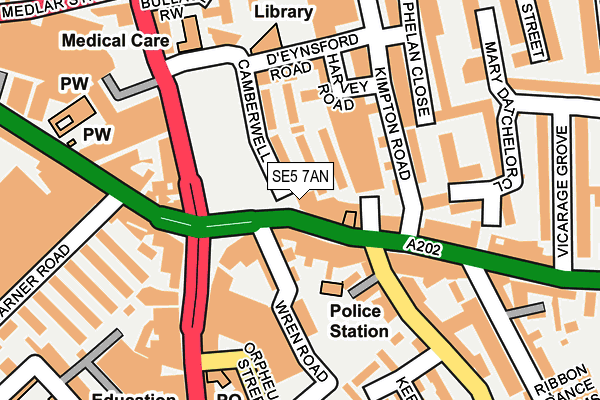
SE5 7AN is located in the St Giles electoral ward, within the London borough of Southwark and the English Parliamentary constituency of Camberwell and Peckham. The Sub Integrated Care Board (ICB) Location is NHS South East London ICB - 72Q and the police force is Metropolitan Police. This postcode has been in use since January 1980.


GetTheData
Source: OS OpenMap – Local (Ordnance Survey)
Source: OS VectorMap District (Ordnance Survey)
Licence: Open Government Licence (requires attribution)
| Easting | 532640 |
| Northing | 176764 |
| Latitude | 51.474298 |
| Longitude | -0.091554 |
GetTheData
Source: Open Postcode Geo
Licence: Open Government Licence
| Country | England |
| Postcode District | SE5 |
| ➜ SE5 open data dashboard ➜ See where SE5 is on a map ➜ Where is Camberwell? | |
GetTheData
Source: Land Registry Price Paid Data
Licence: Open Government Licence
Elevation or altitude of SE5 7AN as distance above sea level:
| Metres | Feet | |
|---|---|---|
| Elevation | 10m | 33ft |
Elevation is measured from the approximate centre of the postcode, to the nearest point on an OS contour line from OS Terrain 50, which has contour spacing of ten vertical metres.
➜ How high above sea level am I? Find the elevation of your current position using your device's GPS.
GetTheData
Source: Open Postcode Elevation
Licence: Open Government Licence
| Ward | St Giles |
| Constituency | Camberwell And Peckham |
GetTheData
Source: ONS Postcode Database
Licence: Open Government Licence
| January 2024 | Anti-social behaviour | On or near Wren Road | 95m |
| January 2024 | Anti-social behaviour | On or near Wren Road | 95m |
| January 2024 | Other theft | On or near Wren Road | 95m |
| ➜ Get more crime data in our Crime section | |||
GetTheData
Source: data.police.uk
Licence: Open Government Licence
| Camberwell Church St Camberwell Grn (Camberwell Church Street) | Camberwell | 12m |
| Camberwell Church St Camberwell Grn (Camberwell Church Street) | Camberwell | 30m |
| Camberwell Green | Camberwell | 124m |
| Denmark Hill Camberwell Green (Denmark Hill) | Camberwell | 125m |
| Camberwell Green | Camberwell | 142m |
| Oval Underground Station | Oval | 1,676m |
| Denmark Hill Station | 0.7km |
| Loughborough Junction Station | 1.2km |
| Peckham Rye Station | 1.6km |
GetTheData
Source: NaPTAN
Licence: Open Government Licence
GetTheData
Source: ONS Postcode Database
Licence: Open Government Licence


➜ Get more ratings from the Food Standards Agency
GetTheData
Source: Food Standards Agency
Licence: FSA terms & conditions
| Last Collection | |||
|---|---|---|---|
| Location | Mon-Fri | Sat | Distance |
| 304 Camberwell Road | 17:30 | 12:00 | 200m |
| Post Office | 17:30 | 12:00 | 200m |
| Camberwell Grove | 17:30 | 12:00 | 220m |
GetTheData
Source: Dracos
Licence: Creative Commons Attribution-ShareAlike
| Facility | Distance |
|---|---|
| Camberwell Leisure Centre Artichoke Place, London Sports Hall, Swimming Pool, Health and Fitness Gym, Studio | 97m |
| Puregym (London Camberwell New Road) Camberwell New Road, Camberwell New Road, London Health and Fitness Gym | 178m |
| Easygym (Camberwell) Denmark Hill, Denmark Hill, London Health and Fitness Gym | 225m |
GetTheData
Source: Active Places
Licence: Open Government Licence
| School | Phase of Education | Distance |
|---|---|---|
| Arco Academy Camberwell Leisure Centre, Artichoke Place, Camberwell, London, SE5 8TS | Not applicable | 97m |
| Crawford Primary School Crawford Road, London, SE5 9NF | Primary | 376m |
| Sacred Heart Catholic School Camberwell New Road, London, SE5 0RP | Secondary | 410m |
GetTheData
Source: Edubase
Licence: Open Government Licence
The below table lists the International Territorial Level (ITL) codes (formerly Nomenclature of Territorial Units for Statistics (NUTS) codes) and Local Administrative Units (LAU) codes for SE5 7AN:
| ITL 1 Code | Name |
|---|---|
| TLI | London |
| ITL 2 Code | Name |
| TLI4 | Inner London - East |
| ITL 3 Code | Name |
| TLI44 | Lewisham and Southwark |
| LAU 1 Code | Name |
| E09000028 | Southwark |
GetTheData
Source: ONS Postcode Directory
Licence: Open Government Licence
The below table lists the Census Output Area (OA), Lower Layer Super Output Area (LSOA), and Middle Layer Super Output Area (MSOA) for SE5 7AN:
| Code | Name | |
|---|---|---|
| OA | E00019742 | |
| LSOA | E01003921 | Southwark 021C |
| MSOA | E02000827 | Southwark 021 |
GetTheData
Source: ONS Postcode Directory
Licence: Open Government Licence
| SE5 7BG | Peabody Estate | 11m |
| SE5 7BJ | Peabody Estate | 26m |
| SE5 7BE | Peabody Estate | 31m |
| SE5 7BH | Peabody Estate | 33m |
| SE5 7BW | Peabody Estate | 47m |
| SE5 7BQ | Peabody Estate | 49m |
| SE5 7BN | Peabody Estate | 50m |
| SE5 7BD | Peabody Estate | 52m |
| SE5 8QU | Camberwell Church Street | 57m |
| SE5 7BL | Peabody Estate | 61m |
GetTheData
Source: Open Postcode Geo; Land Registry Price Paid Data
Licence: Open Government Licence