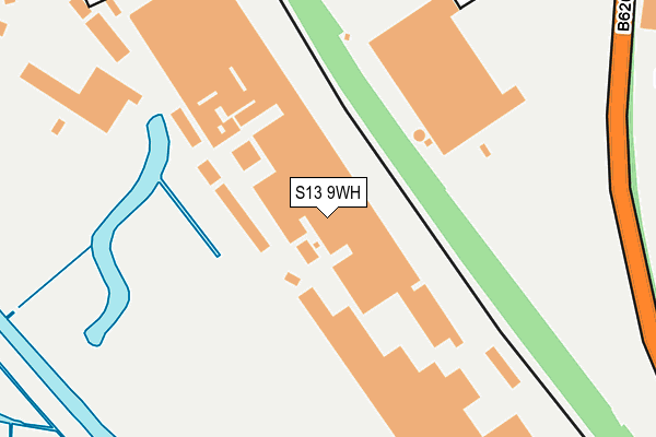
S13 9WH is located in the Aughton & Swallownest electoral ward, within the metropolitan district of Rotherham and the English Parliamentary constituency of Rother Valley. The Sub Integrated Care Board (ICB) Location is NHS South Yorkshire ICB - 03L and the police force is South Yorkshire. This postcode has been in use since December 1995.


GetTheData
Source: OS OpenMap – Local (Ordnance Survey)
Source: OS VectorMap District (Ordnance Survey)
Licence: Open Government Licence (requires attribution)
| Easting | 443734 |
| Northing | 385527 |
| Latitude | 53.364830 |
| Longitude | -1.344253 |
GetTheData
Source: Open Postcode Geo
Licence: Open Government Licence
| Country | England |
| Postcode District | S13 |
➜ See where S13 is on a map | |
GetTheData
Source: Land Registry Price Paid Data
Licence: Open Government Licence
Elevation or altitude of S13 9WH as distance above sea level:
| Metres | Feet | |
|---|---|---|
| Elevation | 40m | 131ft |
Elevation is measured from the approximate centre of the postcode, to the nearest point on an OS contour line from OS Terrain 50, which has contour spacing of ten vertical metres.
➜ How high above sea level am I? Find the elevation of your current position using your device's GPS.
GetTheData
Source: Open Postcode Elevation
Licence: Open Government Licence
| Ward | Aughton & Swallownest |
| Constituency | Rother Valley |
GetTheData
Source: ONS Postcode Database
Licence: Open Government Licence
| Falconer Lane (Sheffield Road) | Fence | 353m |
| Falconer Road (Sheffield Road) | Fence | 385m |
| Princess Royal (Sheffield Road) | Woodhouse Mill | 393m |
| The Princess Royal (Retford Road) | Woodhouse Mill | 420m |
| Aston Fence School (Sheffield Road) | Fence | 444m |
| Woodhouse Station | 0.9km |
| Darnall Station | 5km |
GetTheData
Source: NaPTAN
Licence: Open Government Licence
GetTheData
Source: ONS Postcode Database
Licence: Open Government Licence


➜ Get more ratings from the Food Standards Agency
GetTheData
Source: Food Standards Agency
Licence: FSA terms & conditions
| Last Collection | |||
|---|---|---|---|
| Location | Mon-Fri | Sat | Distance |
| Woodhouse Mill Post Office | 17:30 | 12:00 | 578m |
| Junction Inn | 18:00 | 10:00 | 870m |
| Rotherwood Avenue | 17:30 | 09:30 | 955m |
GetTheData
Source: Dracos
Licence: Creative Commons Attribution-ShareAlike
The below table lists the International Territorial Level (ITL) codes (formerly Nomenclature of Territorial Units for Statistics (NUTS) codes) and Local Administrative Units (LAU) codes for S13 9WH:
| ITL 1 Code | Name |
|---|---|
| TLE | Yorkshire and The Humber |
| ITL 2 Code | Name |
| TLE3 | South Yorkshire |
| ITL 3 Code | Name |
| TLE31 | Barnsley, Doncaster and Rotherham |
| LAU 1 Code | Name |
| E08000018 | Rotherham |
GetTheData
Source: ONS Postcode Directory
Licence: Open Government Licence
The below table lists the Census Output Area (OA), Lower Layer Super Output Area (LSOA), and Middle Layer Super Output Area (MSOA) for S13 9WH:
| Code | Name | |
|---|---|---|
| OA | E00038854 | |
| LSOA | E01007665 | Rotherham 027A |
| MSOA | E02001604 | Rotherham 027 |
GetTheData
Source: ONS Postcode Directory
Licence: Open Government Licence
| S13 9ZE | Sheffield Road | 424m |
| S13 9ZD | Sheffield Road | 443m |
| S13 9UT | John Hibbard Avenue | 464m |
| S13 9ZL | Falconer Lane | 493m |
| S26 4SH | Kingfisher Grove | 502m |
| S13 9UU | John Hibbard Avenue | 508m |
| S13 9UY | John Hibbard Close | 513m |
| S26 4XB | Baxter Close | 514m |
| S13 9UZ | Ryan Drive | 542m |
| S13 9UX | John Hibbard Rise | 545m |
GetTheData
Source: Open Postcode Geo; Land Registry Price Paid Data
Licence: Open Government Licence