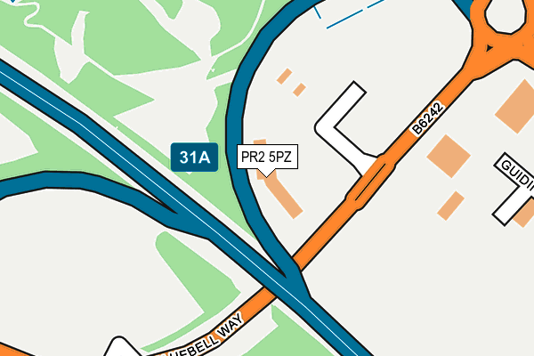
PR2 5PZ is located in the Ribbleton electoral ward, within the local authority district of Preston and the English Parliamentary constituency of Wyre and Preston North. The Sub Integrated Care Board (ICB) Location is NHS Lancashire and South Cumbria ICB - 01E and the police force is Lancashire. This postcode has been in use since December 2000.


GetTheData
Source: OS OpenMap – Local (Ordnance Survey)
Source: OS VectorMap District (Ordnance Survey)
Licence: Open Government Licence (requires attribution)
| Easting | 356710 |
| Northing | 432828 |
| Latitude | 53.789956 |
| Longitude | -2.658579 |
GetTheData
Source: Open Postcode Geo
Licence: Open Government Licence
| Country | England |
| Postcode District | PR2 |
| ➜ PR2 open data dashboard ➜ See where PR2 is on a map | |
GetTheData
Source: Land Registry Price Paid Data
Licence: Open Government Licence
Elevation or altitude of PR2 5PZ as distance above sea level:
| Metres | Feet | |
|---|---|---|
| Elevation | 50m | 164ft |
Elevation is measured from the approximate centre of the postcode, to the nearest point on an OS contour line from OS Terrain 50, which has contour spacing of ten vertical metres.
➜ How high above sea level am I? Find the elevation of your current position using your device's GPS.
GetTheData
Source: Open Postcode Elevation
Licence: Open Government Licence
| Ward | Ribbleton |
| Constituency | Wyre And Preston North |
GetTheData
Source: ONS Postcode Database
Licence: Open Government Licence
| September 2023 | Violence and sexual offences | On or near North Highfield | 459m |
| April 2023 | Anti-social behaviour | On or near North Highfield | 459m |
| June 2022 | Anti-social behaviour | On or near Sumners Barn | 417m |
| ➜ Get more crime data in our Crime section | |||
GetTheData
Source: data.police.uk
Licence: Open Government Licence
| Norman Jepson (Longsands Lane) | Longsands | 113m |
| Norman Jepson (Bluebell Way) | Longsands | 188m |
| James Hall Head Office (Bluebell Way) | Longsands | 389m |
| Bluebell Way | Red Scar | 565m |
| Bluebell Way | Red Scar | 581m |
| Preston Station | 4.9km |
GetTheData
Source: NaPTAN
Licence: Open Government Licence
GetTheData
Source: ONS Postcode Database
Licence: Open Government Licence


➜ Get more ratings from the Food Standards Agency
GetTheData
Source: Food Standards Agency
Licence: FSA terms & conditions
| Last Collection | |||
|---|---|---|---|
| Location | Mon-Fri | Sat | Distance |
| Blackpool Road Post Office | 17:30 | 11:30 | 908m |
| Preston Mail Centre | 19:30 | 12:30 | 1,916m |
| Village Drive | 17:15 | 11:30 | 1,993m |
GetTheData
Source: Dracos
Licence: Creative Commons Attribution-ShareAlike
| Facility | Distance |
|---|---|
| St Maria Goretti Primary School Gamull Lane, Ribbleton, Preston Grass Pitches | 674m |
| Brookfields Community Primary School Watling Street Road, Ribbleton, Preston Grass Pitches | 816m |
| Preston Grange Primary School Grange Avenue, Ribbleton, Preston Sports Hall, Artificial Grass Pitch, Grass Pitches | 1km |
GetTheData
Source: Active Places
Licence: Open Government Licence
| School | Phase of Education | Distance |
|---|---|---|
| Highfield Priory School Fulwood Row, Fulwood, Preston, PR2 5RW | Not applicable | 571m |
| St Maria Goretti Catholic Primary School, Preston Gamull Lane, Ribbleton, Preston, PR2 6SJ | Primary | 654m |
| Brookfield Community Primary School Watling Street Road, Preston, PR2 6TU | Primary | 811m |
GetTheData
Source: Edubase
Licence: Open Government Licence
The below table lists the International Territorial Level (ITL) codes (formerly Nomenclature of Territorial Units for Statistics (NUTS) codes) and Local Administrative Units (LAU) codes for PR2 5PZ:
| ITL 1 Code | Name |
|---|---|
| TLD | North West (England) |
| ITL 2 Code | Name |
| TLD4 | Lancashire |
| ITL 3 Code | Name |
| TLD45 | Mid Lancashire |
| LAU 1 Code | Name |
| E07000123 | Preston |
GetTheData
Source: ONS Postcode Directory
Licence: Open Government Licence
The below table lists the Census Output Area (OA), Lower Layer Super Output Area (LSOA), and Middle Layer Super Output Area (MSOA) for PR2 5PZ:
| Code | Name | |
|---|---|---|
| OA | E00128181 | |
| LSOA | E01025255 | Preston 004C |
| MSOA | E02005256 | Preston 004 |
GetTheData
Source: ONS Postcode Directory
Licence: Open Government Licence
| PR2 5QX | Sandybrook Close | 409m |
| PR2 5RU | Fulwood Row | 410m |
| PR2 5RY | The Close | 419m |
| PR2 6SH | Church Walk Gardens | 489m |
| PR2 9PD | Teil Green | 523m |
| PR2 9PE | Teil Green | 527m |
| PR2 9LW | Chingle Close | 534m |
| PR2 9AR | Heatherway | 542m |
| PR2 6SZ | Church Walk | 551m |
| PR2 5RW | Fulwood Row | 572m |
GetTheData
Source: Open Postcode Geo; Land Registry Price Paid Data
Licence: Open Government Licence