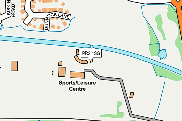
PR2 1SG is located in the Ingol & Cottam electoral ward, within the local authority district of Preston and the English Parliamentary constituency of Fylde. The Sub Integrated Care Board (ICB) Location is NHS Lancashire and South Cumbria ICB - 01E and the police force is Lancashire. This postcode has been in use since June 1999.


GetTheData
Source: OS OpenMap – Local (Ordnance Survey)
Source: OS VectorMap District (Ordnance Survey)
Licence: Open Government Licence (requires attribution)
| Easting | 350291 |
| Northing | 431481 |
| Latitude | 53.777276 |
| Longitude | -2.755786 |
GetTheData
Source: Open Postcode Geo
Licence: Open Government Licence
| Country | England |
| Postcode District | PR2 |
| ➜ PR2 open data dashboard ➜ See where PR2 is on a map ➜ Where is Preston? | |
GetTheData
Source: Land Registry Price Paid Data
Licence: Open Government Licence
Elevation or altitude of PR2 1SG as distance above sea level:
| Metres | Feet | |
|---|---|---|
| Elevation | 20m | 66ft |
Elevation is measured from the approximate centre of the postcode, to the nearest point on an OS contour line from OS Terrain 50, which has contour spacing of ten vertical metres.
➜ How high above sea level am I? Find the elevation of your current position using your device's GPS.
GetTheData
Source: Open Postcode Elevation
Licence: Open Government Licence
| Ward | Ingol & Cottam |
| Constituency | Fylde |
GetTheData
Source: ONS Postcode Database
Licence: Open Government Licence
| June 2022 | Anti-social behaviour | On or near Alder Coppice | 262m |
| June 2022 | Anti-social behaviour | On or near Finch Lane | 264m |
| June 2022 | Violence and sexual offences | On or near Finch Lane | 264m |
| ➜ Get more crime data in our Crime section | |||
GetTheData
Source: data.police.uk
Licence: Open Government Licence
| Valentine Meadow (Cottam Way) | Cottam | 286m |
| Turning Circle (Savick Way) | Savick | 372m |
| Cottam Way | Cottam | 461m |
| Keats Way (Cottam Way) | Cottam | 473m |
| Keats Way (Cottam Way) | Cottam | 477m |
| Preston Station | 3.9km |
| Salwick Station | 4.1km |
GetTheData
Source: NaPTAN
Licence: Open Government Licence
| Percentage of properties with Next Generation Access | 100.0% |
| Percentage of properties with Superfast Broadband | 100.0% |
| Percentage of properties with Ultrafast Broadband | 0.0% |
| Percentage of properties with Full Fibre Broadband | 0.0% |
Superfast Broadband is between 30Mbps and 300Mbps
Ultrafast Broadband is > 300Mbps
| Percentage of properties unable to receive 2Mbps | 0.0% |
| Percentage of properties unable to receive 5Mbps | 0.0% |
| Percentage of properties unable to receive 10Mbps | 0.0% |
| Percentage of properties unable to receive 30Mbps | 0.0% |
GetTheData
Source: Ofcom
Licence: Ofcom Terms of Use (requires attribution)
GetTheData
Source: ONS Postcode Database
Licence: Open Government Licence

➜ Get more ratings from the Food Standards Agency
GetTheData
Source: Food Standards Agency
Licence: FSA terms & conditions
| Last Collection | |||
|---|---|---|---|
| Location | Mon-Fri | Sat | Distance |
| Ingol Post Office | 17:30 | 11:30 | 1,276m |
| Lea School | 16:00 | 08:00 | 1,384m |
| Nog Tow | 16:00 | 10:30 | 1,605m |
GetTheData
Source: Dracos
Licence: Creative Commons Attribution-ShareAlike
| Facility | Distance |
|---|---|
| Uclan Sports Arena Tom Benson Way, Ashton-on-ribble, Preston Athletics, Health and Fitness Gym, Artificial Grass Pitch, Sports Hall, Grass Pitches, Outdoor Tennis Courts, Cycling | 66m |
| Cottam Primary School Haydocks Lane, Cottam, Preston Grass Pitches | 658m |
| Ingol Community Primary School Whitby Avenue, Ingol, Preston Grass Pitches | 757m |
GetTheData
Source: Active Places
Licence: Open Government Licence
| School | Phase of Education | Distance |
|---|---|---|
| Cottam Primary School Haydocks Lane, Cottam, Preston, PR4 0NY | Primary | 651m |
| Ashton Primary School Ainsdale Drive, Ashton-on-Ribble, Preston, PR2 1TU | Primary | 669m |
| Ingol Community Primary School Whitby Avenue, Ingol, Ingol Cp School, 39 Whitby Avenue, PRESTON, PR2 3YP | Primary | 745m |
GetTheData
Source: Edubase
Licence: Open Government Licence
The below table lists the International Territorial Level (ITL) codes (formerly Nomenclature of Territorial Units for Statistics (NUTS) codes) and Local Administrative Units (LAU) codes for PR2 1SG:
| ITL 1 Code | Name |
|---|---|
| TLD | North West (England) |
| ITL 2 Code | Name |
| TLD4 | Lancashire |
| ITL 3 Code | Name |
| TLD45 | Mid Lancashire |
| LAU 1 Code | Name |
| E07000123 | Preston |
GetTheData
Source: ONS Postcode Directory
Licence: Open Government Licence
The below table lists the Census Output Area (OA), Lower Layer Super Output Area (LSOA), and Middle Layer Super Output Area (MSOA) for PR2 1SG:
| Code | Name | |
|---|---|---|
| OA | E00128262 | |
| LSOA | E01025272 | Preston 010B |
| MSOA | E02005262 | Preston 010 |
GetTheData
Source: ONS Postcode Directory
Licence: Open Government Licence
| PR4 0NX | Dunnock Lane | 237m |
| PR2 1YG | Alder Coppice | 239m |
| PR2 1XW | Willow Coppice | 276m |
| PR2 1XG | Hazel Coppice | 309m |
| PR4 0AZ | Millersgate | 331m |
| PR2 1XB | Miller Field | 343m |
| PR2 1YX | West Meadow | 358m |
| PR4 0PD | Canberra Lane | 369m |
| PR4 0PE | Siskin Road | 375m |
| PR2 1SD | Savick Way | 405m |
GetTheData
Source: Open Postcode Geo; Land Registry Price Paid Data
Licence: Open Government Licence