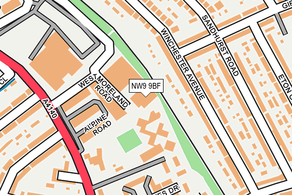
NW9 9BF is located in the Queensbury electoral ward, within the London borough of Brent and the English Parliamentary constituency of Brent North. The Sub Integrated Care Board (ICB) Location is NHS North West London ICB - W2U3Z and the police force is Metropolitan Police. This postcode has been in use since March 2013.


GetTheData
Source: OS OpenMap – Local (Ordnance Survey)
Source: OS VectorMap District (Ordnance Survey)
Licence: Open Government Licence (requires attribution)
| Easting | 519113 |
| Northing | 189442 |
| Latitude | 51.591247 |
| Longitude | -0.281941 |
GetTheData
Source: Open Postcode Geo
Licence: Open Government Licence
| Country | England |
| Postcode District | NW9 |
| ➜ NW9 open data dashboard ➜ See where NW9 is on a map ➜ Where is London? | |
GetTheData
Source: Land Registry Price Paid Data
Licence: Open Government Licence
Elevation or altitude of NW9 9BF as distance above sea level:
| Metres | Feet | |
|---|---|---|
| Elevation | 50m | 164ft |
Elevation is measured from the approximate centre of the postcode, to the nearest point on an OS contour line from OS Terrain 50, which has contour spacing of ten vertical metres.
➜ How high above sea level am I? Find the elevation of your current position using your device's GPS.
GetTheData
Source: Open Postcode Elevation
Licence: Open Government Licence
| Ward | Queensbury |
| Constituency | Brent North |
GetTheData
Source: ONS Postcode Database
Licence: Open Government Licence
| January 2024 | Vehicle crime | On or near Queensbury Station Parade | 409m |
| January 2024 | Other theft | On or near Queensbury Station Parade | 409m |
| January 2024 | Anti-social behaviour | On or near Queensbury Station Parade | 409m |
| ➜ Get more crime data in our Crime section | |||
GetTheData
Source: data.police.uk
Licence: Open Government Licence
| Queensbury Morrisons (Honeypot Lane) | Queensbury | 278m |
| Cowbridge Road (Honeypot Lane) | Queensbury | 293m |
| Queensbury Morrisons | Queensbury | 325m |
| Princes Avenue (Nw9) (Honeypot Lane) | Queensbury | 355m |
| Queensbury (Station Parade) | Queensbury | 432m |
| Queensbury Underground Station | Queensbury | 441m |
| Kingsbury Underground Station | Kingsbury | 745m |
| Burnt Oak Underground Station | Burnt Oak | 1,783m |
| Kenton Station | 2.6km |
| South Kenton Station | 3km |
| Hendon Station | 3.2km |
GetTheData
Source: NaPTAN
Licence: Open Government Licence
GetTheData
Source: ONS Postcode Database
Licence: Open Government Licence


➜ Get more ratings from the Food Standards Agency
GetTheData
Source: Food Standards Agency
Licence: FSA terms & conditions
| Last Collection | |||
|---|---|---|---|
| Location | Mon-Fri | Sat | Distance |
| Girton Avenue | 17:30 | 12:00 | 314m |
| Princes Avenue | 17:30 | 12:00 | 340m |
| Honeypot Lane | 17:30 | 12:15 | 389m |
GetTheData
Source: Dracos
Licence: Creative Commons Attribution-ShareAlike
| Facility | Distance |
|---|---|
| Eton Grove Park Eton Grove, London Grass Pitches, Outdoor Tennis Courts | 413m |
| Queensbury Park Clifton Road, Kenton Grass Pitches, Outdoor Tennis Courts | 481m |
| Kingsbury High School (Upper Site) Princes Avenue, London Sports Hall, Health and Fitness Gym, Grass Pitches | 526m |
GetTheData
Source: Active Places
Licence: Open Government Licence
| School | Phase of Education | Distance |
|---|---|---|
| Kingsbury High School Princes Avenue, Kingsbury, London, NW9 9JR | Secondary | 529m |
| St Bernadette's Catholic Primary School Clifton Road, Kenton, Harrow, HA3 9NS | Primary | 633m |
| Roe Green Junior School Princes Avenue, Kingsbury, London, NW9 9JL | Primary | 683m |
GetTheData
Source: Edubase
Licence: Open Government Licence
The below table lists the International Territorial Level (ITL) codes (formerly Nomenclature of Territorial Units for Statistics (NUTS) codes) and Local Administrative Units (LAU) codes for NW9 9BF:
| ITL 1 Code | Name |
|---|---|
| TLI | London |
| ITL 2 Code | Name |
| TLI7 | Outer London - West and North West |
| ITL 3 Code | Name |
| TLI72 | Brent |
| LAU 1 Code | Name |
| E09000005 | Brent |
GetTheData
Source: ONS Postcode Directory
Licence: Open Government Licence
The below table lists the Census Output Area (OA), Lower Layer Super Output Area (LSOA), and Middle Layer Super Output Area (MSOA) for NW9 9BF:
| Code | Name | |
|---|---|---|
| OA | E00174696 | |
| LSOA | E01000589 | Brent 001B |
| MSOA | E02000093 | Brent 001 |
GetTheData
Source: ONS Postcode Directory
Licence: Open Government Licence
| NW9 9BT | Alpine Road | 84m |
| NW9 9TA | Winchester Avenue | 139m |
| NW9 9SX | Girton Avenue | 142m |
| NW9 9BQ | Alpine Road | 147m |
| NW9 9TG | Girton Avenue | 157m |
| NW9 9BS | Alpine Road | 163m |
| NW9 9SY | Winchester Avenue | 170m |
| NW9 9QZ | Rose Bates Drive | 173m |
| NW9 9TB | Winchester Avenue | 196m |
| NW9 9LP | Sandhurst Road | 209m |
GetTheData
Source: Open Postcode Geo; Land Registry Price Paid Data
Licence: Open Government Licence