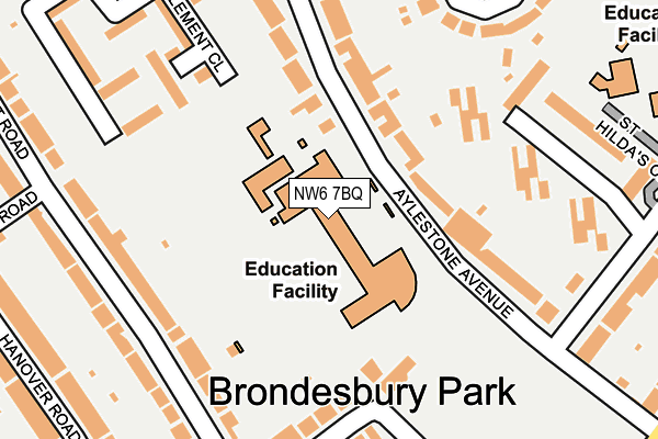
NW6 7BQ is located in the Brondesbury Park electoral ward, within the London borough of Brent and the English Parliamentary constituency of Hampstead and Kilburn. The Sub Integrated Care Board (ICB) Location is NHS North West London ICB - W2U3Z and the police force is Metropolitan Police. This postcode has been in use since June 1999.


GetTheData
Source: OS OpenMap – Local (Ordnance Survey)
Source: OS VectorMap District (Ordnance Survey)
Licence: Open Government Licence (requires attribution)
| Easting | 523638 |
| Northing | 183904 |
| Latitude | 51.540505 |
| Longitude | -0.218575 |
GetTheData
Source: Open Postcode Geo
Licence: Open Government Licence
| Country | England |
| Postcode District | NW6 |
| ➜ NW6 open data dashboard ➜ See where NW6 is on a map ➜ Where is London? | |
GetTheData
Source: Land Registry Price Paid Data
Licence: Open Government Licence
Elevation or altitude of NW6 7BQ as distance above sea level:
| Metres | Feet | |
|---|---|---|
| Elevation | 60m | 197ft |
Elevation is measured from the approximate centre of the postcode, to the nearest point on an OS contour line from OS Terrain 50, which has contour spacing of ten vertical metres.
➜ How high above sea level am I? Find the elevation of your current position using your device's GPS.
GetTheData
Source: Open Postcode Elevation
Licence: Open Government Licence
| Ward | Brondesbury Park |
| Constituency | Hampstead And Kilburn |
GetTheData
Source: ONS Postcode Database
Licence: Open Government Licence
| January 2024 | Vehicle crime | On or near Crediton Road | 409m |
| August 2023 | Vehicle crime | On or near Crediton Road | 409m |
| July 2023 | Vehicle crime | On or near Crediton Road | 409m |
| ➜ Get more crime data in our Crime section | |||
GetTheData
Source: data.police.uk
Licence: Open Government Licence
| Okehampton Road (Chamberlayne Road) | Kensal Rise | 410m |
| Okehampton Road (Chamberlayne Road) | Kensal Rise | 416m |
| All Souls Avenue | Willesden Green | 453m |
| Manor House Drive (Nw6) (Brondesbury Park) | Brondesbury Park | 467m |
| Manor House Drive (Nw6) (Brondesbury Park) | Brondesbury Park | 474m |
| Willesden Green Underground Station | Willesden Green | 983m |
| Kensal Green Underground Station | Kensal Green | 1,195m |
| Queen's Park Underground Station | Queen's Park | 1,202m |
| Kilburn Underground Station | Brondesbury | 1,225m |
| Dollis Hill Underground Station | Dudden Hill | 1,907m |
| Brondesbury Park Station | 0.6km |
| Kensal Rise Station | 0.7km |
| Queens Park (London) Station | 1.2km |
GetTheData
Source: NaPTAN
Licence: Open Government Licence
GetTheData
Source: ONS Postcode Database
Licence: Open Government Licence


➜ Get more ratings from the Food Standards Agency
GetTheData
Source: Food Standards Agency
Licence: FSA terms & conditions
| Last Collection | |||
|---|---|---|---|
| Location | Mon-Fri | Sat | Distance |
| Aylestone Avenue | 17:30 | 12:00 | 257m |
| Mount Pleasant Road | 17:30 | 12:00 | 262m |
| Wrentham Avenue | 17:30 | 12:00 | 340m |
GetTheData
Source: Dracos
Licence: Creative Commons Attribution-ShareAlike
| Facility | Distance |
|---|---|
| Queens Park Community School Aylestone Avenue, London Grass Pitches, Sports Hall | 0m |
| Tiverton Playing Field (Closed) Aylestone Avenue, London Grass Pitches | 241m |
| South Hampstead Cricket Club Milverton Road, London Grass Pitches | 368m |
GetTheData
Source: Active Places
Licence: Open Government Licence
| School | Phase of Education | Distance |
|---|---|---|
| The Avenue School Christchurch Avenue, London, NW6 7BH | Not applicable | 0m |
| Queens Park Community School Aylestone Avenue, London, NW6 7BQ | Secondary | 7m |
| Malorees Junior School Christchurch Avenue, London, NW6 7PB | Primary | 301m |
GetTheData
Source: Edubase
Licence: Open Government Licence
The below table lists the International Territorial Level (ITL) codes (formerly Nomenclature of Territorial Units for Statistics (NUTS) codes) and Local Administrative Units (LAU) codes for NW6 7BQ:
| ITL 1 Code | Name |
|---|---|
| TLI | London |
| ITL 2 Code | Name |
| TLI7 | Outer London - West and North West |
| ITL 3 Code | Name |
| TLI72 | Brent |
| LAU 1 Code | Name |
| E09000005 | Brent |
GetTheData
Source: ONS Postcode Directory
Licence: Open Government Licence
The below table lists the Census Output Area (OA), Lower Layer Super Output Area (LSOA), and Middle Layer Super Output Area (MSOA) for NW6 7BQ:
| Code | Name | |
|---|---|---|
| OA | E00002395 | |
| LSOA | E01000489 | Brent 030A |
| MSOA | E02000122 | Brent 030 |
GetTheData
Source: ONS Postcode Directory
Licence: Open Government Licence
| NW6 7AB | Aylestone Avenue | 101m |
| NW6 7AD | Aylestone Avenue | 160m |
| NW10 3EL | Mount Pleasant Road | 179m |
| NW6 7NU | Christchurch Avenue | 183m |
| NW6 7AL | Clement Close | 207m |
| NW10 3EN | Okehampton Road | 210m |
| NW6 7NT | Christchurch Avenue | 217m |
| NW10 3EG | Mount Pleasant Road | 221m |
| NW10 3EP | Okehampton Road | 226m |
| NW6 7NY | St Hildas Close | 236m |
GetTheData
Source: Open Postcode Geo; Land Registry Price Paid Data
Licence: Open Government Licence