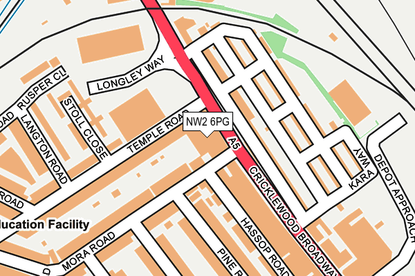
NW2 6PG is located in the Cricklewood & Mapesbury electoral ward, within the London borough of Brent and the English Parliamentary constituency of Brent Central. The Sub Integrated Care Board (ICB) Location is NHS North West London ICB - W2U3Z and the police force is Metropolitan Police. This postcode has been in use since January 1980.


GetTheData
Source: OS OpenMap – Local (Ordnance Survey)
Source: OS VectorMap District (Ordnance Survey)
Licence: Open Government Licence (requires attribution)
| Easting | 523515 |
| Northing | 186065 |
| Latitude | 51.559951 |
| Longitude | -0.219615 |
GetTheData
Source: Open Postcode Geo
Licence: Open Government Licence
| Country | England |
| Postcode District | NW2 |
| ➜ NW2 open data dashboard ➜ See where NW2 is on a map ➜ Where is London? | |
GetTheData
Source: Land Registry Price Paid Data
Licence: Open Government Licence
Elevation or altitude of NW2 6PG as distance above sea level:
| Metres | Feet | |
|---|---|---|
| Elevation | 50m | 164ft |
Elevation is measured from the approximate centre of the postcode, to the nearest point on an OS contour line from OS Terrain 50, which has contour spacing of ten vertical metres.
➜ How high above sea level am I? Find the elevation of your current position using your device's GPS.
GetTheData
Source: Open Postcode Elevation
Licence: Open Government Licence
| Ward | Cricklewood & Mapesbury |
| Constituency | Brent Central |
GetTheData
Source: ONS Postcode Database
Licence: Open Government Licence
| January 2024 | Anti-social behaviour | On or near Dairyman Close | 498m |
| January 2024 | Other theft | On or near Dairyman Close | 498m |
| January 2024 | Vehicle crime | On or near Dairyman Close | 498m |
| ➜ Get more crime data in our Crime section | |||
GetTheData
Source: data.police.uk
Licence: Open Government Licence
| Mora Road (Edgware Road) | Cricklewood | 41m |
| Mora Road (Edgware Road) | Cricklewood | 77m |
| Mora Road (Cricklewood Broadway) | Cricklewood | 94m |
| Longley Way (Edgware Road) | Dollis Hill | 189m |
| Cricklewood Bus Garage | Dollis Hill | 265m |
| Willesden Green Underground Station | Willesden Green | 1,209m |
| Dollis Hill Underground Station | Dudden Hill | 1,616m |
| Kilburn Underground Station | Brondesbury | 1,816m |
| Cricklewood Station | 0.5km |
| Brondesbury Station | 2km |
| Brondesbury Park Station | 2.2km |
GetTheData
Source: NaPTAN
Licence: Open Government Licence
GetTheData
Source: ONS Postcode Database
Licence: Open Government Licence


➜ Get more ratings from the Food Standards Agency
GetTheData
Source: Food Standards Agency
Licence: FSA terms & conditions
| Last Collection | |||
|---|---|---|---|
| Location | Mon-Fri | Sat | Distance |
| 30 Gratton Terrace | 17:30 | 12:00 | 69m |
| 38 Mora Road | 17:30 | 12:00 | 126m |
| 26 Temple Road | 17:30 | 12:00 | 290m |
GetTheData
Source: Dracos
Licence: Creative Commons Attribution-ShareAlike
| Facility | Distance |
|---|---|
| Manor Health & Leisure Club (Cricklewood) Cricklewood Broadway, London Swimming Pool, Health and Fitness Gym, Studio | 25m |
| Fitness Planet Gym Cricklewood Broadway, London Health and Fitness Gym | 196m |
| David Lloyd (Cricklewood Lane) Cricklewood Lane, London Swimming Pool, Health and Fitness Gym, Studio | 679m |
GetTheData
Source: Active Places
Licence: Open Government Licence
| School | Phase of Education | Distance |
|---|---|---|
| Mora Primary School Mora Road, Cricklewood, London, NW2 6TD | Primary | 393m |
| Our Lady of Grace RC Infant and Nursery School Dollis Hill Avenue, London, NW2 6EU | Primary | 578m |
| St Agnes' Catholic Primary School Thorverton Road, Cricklewood, London, NW2 1RG | Primary | 613m |
GetTheData
Source: Edubase
Licence: Open Government Licence
The below table lists the International Territorial Level (ITL) codes (formerly Nomenclature of Territorial Units for Statistics (NUTS) codes) and Local Administrative Units (LAU) codes for NW2 6PG:
| ITL 1 Code | Name |
|---|---|
| TLI | London |
| ITL 2 Code | Name |
| TLI7 | Outer London - West and North West |
| ITL 3 Code | Name |
| TLI72 | Brent |
| LAU 1 Code | Name |
| E09000005 | Brent |
GetTheData
Source: ONS Postcode Directory
Licence: Open Government Licence
The below table lists the Census Output Area (OA), Lower Layer Super Output Area (LSOA), and Middle Layer Super Output Area (MSOA) for NW2 6PG:
| Code | Name | |
|---|---|---|
| OA | E00002731 | |
| LSOA | E01000553 | Brent 015A |
| MSOA | E02000107 | Brent 015 |
GetTheData
Source: ONS Postcode Directory
Licence: Open Government Licence
| NW2 6QE | Gratton Terrace | 70m |
| NW2 6NX | Cricklewood Broadway | 83m |
| NW2 6PJ | Temple Road | 92m |
| NW2 6QH | Midland Terrace | 105m |
| NW2 6TG | Mora Road | 108m |
| NW2 6SA | Pine Road | 127m |
| NW2 6QJ | Johnston Terrace | 130m |
| NW2 6SD | Mora Road | 132m |
| NW2 6QL | Needham Terrace | 146m |
| NW2 6PF | Gratton Terrace | 154m |
GetTheData
Source: Open Postcode Geo; Land Registry Price Paid Data
Licence: Open Government Licence