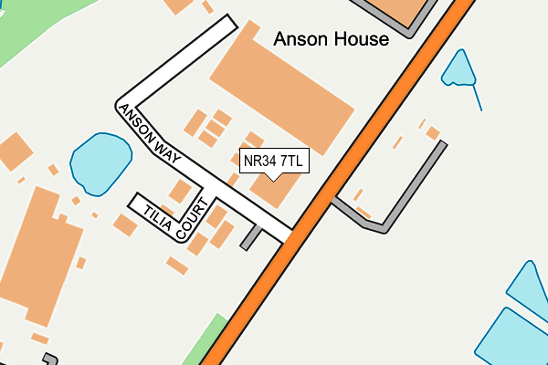
NR34 7TL is located in the Beccles & Worlingham electoral ward, within the local authority district of East Suffolk and the English Parliamentary constituency of Waveney. The Sub Integrated Care Board (ICB) Location is NHS Norfolk and Waveney ICB - 26A and the police force is Suffolk. This postcode has been in use since August 1993.


GetTheData
Source: OS OpenMap – Local (Ordnance Survey)
Source: OS VectorMap District (Ordnance Survey)
Licence: Open Government Licence (requires attribution)
| Easting | 645231 |
| Northing | 288440 |
| Latitude | 52.438864 |
| Longitude | 1.606625 |
GetTheData
Source: Open Postcode Geo
Licence: Open Government Licence
| Country | England |
| Postcode District | NR34 |
| ➜ NR34 open data dashboard ➜ See where NR34 is on a map | |
GetTheData
Source: Land Registry Price Paid Data
Licence: Open Government Licence
Elevation or altitude of NR34 7TL as distance above sea level:
| Metres | Feet | |
|---|---|---|
| Elevation | 20m | 66ft |
Elevation is measured from the approximate centre of the postcode, to the nearest point on an OS contour line from OS Terrain 50, which has contour spacing of ten vertical metres.
➜ How high above sea level am I? Find the elevation of your current position using your device's GPS.
GetTheData
Source: Open Postcode Elevation
Licence: Open Government Licence
| Ward | Beccles & Worlingham |
| Constituency | Waveney |
GetTheData
Source: ONS Postcode Database
Licence: Open Government Licence
| November 2021 | Violence and sexual offences | On or near Airport/Airfield | 235m |
| September 2021 | Other crime | On or near Copland Way | 246m |
| February 2021 | Violence and sexual offences | On or near Anson Way | 100m |
| ➜ Get more crime data in our Crime section | |||
GetTheData
Source: data.police.uk
Licence: Open Government Licence
| Industrial Estate (Benacre Road) | Ellough | 646m |
| Industrial Estate (Benacre Road) | Ellough | 650m |
| Heliport (Benacre Road) | Ellough | 1,006m |
| Heliport (Benacre Road) | Ellough | 1,014m |
| Ashtree Close (Rectory Lane) | Worlingham | 1,138m |
| Beccles Station | 3.3km |
GetTheData
Source: NaPTAN
Licence: Open Government Licence
GetTheData
Source: ONS Postcode Database
Licence: Open Government Licence

➜ Get more ratings from the Food Standards Agency
GetTheData
Source: Food Standards Agency
Licence: FSA terms & conditions
| Last Collection | |||
|---|---|---|---|
| Location | Mon-Fri | Sat | Distance |
| Townlands Drive | 17:30 | 12:00 | 1,708m |
| The Street Post Office | 16:00 | 08:30 | 1,945m |
| Clerks Piece | 17:30 | 12:00 | 2,250m |
GetTheData
Source: Dracos
Licence: Creative Commons Attribution-ShareAlike
| Facility | Distance |
|---|---|
| Worlingham C Of E Vc Primary School Garden Lane, Worlingham, Beccles Sports Hall, Grass Pitches | 1.4km |
| Beccles Primary Academy Ellough Road, Ellough Road, Beccles Grass Pitches, Sports Hall | 2.3km |
| Set Beccles School Castle Hill, Beccles Grass Pitches, Sports Hall | 2.6km |
GetTheData
Source: Active Places
Licence: Open Government Licence
| School | Phase of Education | Distance |
|---|---|---|
| Worlingham Church of England Voluntary Controlled Primary School Garden Lane, Worlingham, Beccles, NR34 7SB | Primary | 1.4km |
| Beccles Primary Academy Ellough Road, Beccles, NR34 7AB | Primary | 2.3km |
| Barnby and North Cove Community Primary School The Street, Barnby, Beccles, NR34 7QB | Primary | 2.3km |
GetTheData
Source: Edubase
Licence: Open Government Licence
The below table lists the International Territorial Level (ITL) codes (formerly Nomenclature of Territorial Units for Statistics (NUTS) codes) and Local Administrative Units (LAU) codes for NR34 7TL:
| ITL 1 Code | Name |
|---|---|
| TLH | East |
| ITL 2 Code | Name |
| TLH1 | East Anglia |
| ITL 3 Code | Name |
| TLH14 | Suffolk CC |
| LAU 1 Code | Name |
| E07000244 | East Suffolk |
GetTheData
Source: ONS Postcode Directory
Licence: Open Government Licence
The below table lists the Census Output Area (OA), Lower Layer Super Output Area (LSOA), and Middle Layer Super Output Area (MSOA) for NR34 7TL:
| Code | Name | |
|---|---|---|
| OA | E00173907 | |
| LSOA | E01030293 | Waveney 011D |
| MSOA | E02006312 | Waveney 011 |
GetTheData
Source: ONS Postcode Directory
Licence: Open Government Licence
| NR34 7TJ | Anson Way | 91m |
| NR34 7XE | Warrens Lane | 1021m |
| NR34 7RP | Rectory Lane | 1097m |
| NR34 7PD | Lowestoft Road | 1112m |
| NR34 7RU | Ashtree Close | 1135m |
| NR34 7RX | Manor Close | 1140m |
| NR34 7RE | Rectory Lane | 1146m |
| NR34 7SA | College Lane | 1177m |
| NR34 7SL | Janet Hadenham Close | 1183m |
| NR34 7TN | Church Road | 1204m |
GetTheData
Source: Open Postcode Geo; Land Registry Price Paid Data
Licence: Open Government Licence