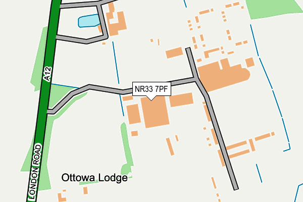
NR33 7PF is located in the Carlton Colville electoral ward, within the local authority district of East Suffolk and the English Parliamentary constituency of Waveney. The Sub Integrated Care Board (ICB) Location is NHS Norfolk and Waveney ICB - 26A and the police force is Suffolk. This postcode has been in use since May 2009.


GetTheData
Source: OS OpenMap – Local (Ordnance Survey)
Source: OS VectorMap District (Ordnance Survey)
Licence: Open Government Licence (requires attribution)
| Easting | 653308 |
| Northing | 288796 |
| Latitude | 52.438378 |
| Longitude | 1.725463 |
GetTheData
Source: Open Postcode Geo
Licence: Open Government Licence
| Country | England |
| Postcode District | NR33 |
| ➜ NR33 open data dashboard ➜ See where NR33 is on a map | |
GetTheData
Source: Land Registry Price Paid Data
Licence: Open Government Licence
Elevation or altitude of NR33 7PF as distance above sea level:
| Metres | Feet | |
|---|---|---|
| Elevation | 20m | 66ft |
Elevation is measured from the approximate centre of the postcode, to the nearest point on an OS contour line from OS Terrain 50, which has contour spacing of ten vertical metres.
➜ How high above sea level am I? Find the elevation of your current position using your device's GPS.
GetTheData
Source: Open Postcode Elevation
Licence: Open Government Licence
| Ward | Carlton Colville |
| Constituency | Waveney |
GetTheData
Source: ONS Postcode Database
Licence: Open Government Licence
| April 2022 | Violence and sexual offences | On or near London Road | 338m |
| April 2022 | Violence and sexual offences | On or near London Road | 338m |
| April 2022 | Violence and sexual offences | On or near London Road | 338m |
| ➜ Get more crime data in our Crime section | |||
GetTheData
Source: data.police.uk
Licence: Open Government Licence
| Holiday Village (London Road) | Pakefield | 218m |
| Holiday Village (London Road) | Pakefield | 219m |
| Ethel Cottages (London Road) | Pakefield | 388m |
| Ethel Cottages (London Road) | Pakefield | 390m |
| Morrisons (Tower Road) | Pakefield | 531m |
| Oulton Broad South Station | 3.7km |
| Lowestoft Station | 4.3km |
| Oulton Broad North Station | 4.4km |
GetTheData
Source: NaPTAN
Licence: Open Government Licence
GetTheData
Source: ONS Postcode Database
Licence: Open Government Licence


➜ Get more ratings from the Food Standards Agency
GetTheData
Source: Food Standards Agency
Licence: FSA terms & conditions
| Last Collection | |||
|---|---|---|---|
| Location | Mon-Fri | Sat | Distance |
| Safeways Tower Rd. Post Office | 16:00 | 11:45 | 531m |
| Tower Road | 16:00 | 10:30 | 929m |
| Lansdowne Road | 17:00 | 12:00 | 1,487m |
GetTheData
Source: Dracos
Licence: Creative Commons Attribution-ShareAlike
| Facility | Distance |
|---|---|
| Pontins Pakefield Holiday Centre London Road Pakefield, Lowestoft Swimming Pool, Grass Pitches, Outdoor Tennis Courts | 0m |
| The Gym Group (Lowestoft) Gateway Retail Park, Tower Road, Gisleham Health and Fitness Gym | 817m |
| Nr Health And Fitness (Lowestoft) Pinbush Road, Lowestoft Health and Fitness Gym, Swimming Pool, Studio | 1.1km |
GetTheData
Source: Active Places
Licence: Open Government Licence
| School | Phase of Education | Distance |
|---|---|---|
| Pakefield High School London Road Pakefield, Pakefield, Lowestoft, NR33 7AQ | Secondary | 1.2km |
| Pakefield Primary School London Road, Pakefield, Lowestoft, NR33 7AQ | Primary | 1.4km |
| Kessingland Church of England Primary Academy Field Lane, Kessingland, Lowestoft, NR33 7QA | Primary | 2.1km |
GetTheData
Source: Edubase
Licence: Open Government Licence
The below table lists the International Territorial Level (ITL) codes (formerly Nomenclature of Territorial Units for Statistics (NUTS) codes) and Local Administrative Units (LAU) codes for NR33 7PF:
| ITL 1 Code | Name |
|---|---|
| TLH | East |
| ITL 2 Code | Name |
| TLH1 | East Anglia |
| ITL 3 Code | Name |
| TLH14 | Suffolk CC |
| LAU 1 Code | Name |
| E07000244 | East Suffolk |
GetTheData
Source: ONS Postcode Directory
Licence: Open Government Licence
The below table lists the Census Output Area (OA), Lower Layer Super Output Area (LSOA), and Middle Layer Super Output Area (MSOA) for NR33 7PF:
| Code | Name | |
|---|---|---|
| OA | E00154298 | |
| LSOA | E01030253 | Waveney 012D |
| MSOA | E02006313 | Waveney 012 |
GetTheData
Source: ONS Postcode Directory
Licence: Open Government Licence
| NR33 7PG | London Road | 337m |
| NR33 7QP | Barnard Terrace | 450m |
| NR33 7QR | Elizabeth Terrace | 503m |
| NR33 7QS | Catherine Terrace | 547m |
| NR33 7PQ | London Road | 715m |
| NR33 7NG | Tower Road | 732m |
| NR33 7BL | Jubilee Road | 892m |
| NR33 7NF | Hadenham Road | 941m |
| NR33 8DR | 962m | |
| NR33 7BJ | Willow Road | 984m |
GetTheData
Source: Open Postcode Geo; Land Registry Price Paid Data
Licence: Open Government Licence